Category:Serbian-language SVG maps showing history
Jump to navigation
Jump to search
Subcategories
This category has the following 2 subcategories, out of 2 total.
Media in category "Serbian-language SVG maps showing history"
The following 28 files are in this category, out of 28 total.
-
Andorra topographic map-sr.svg 1,625 × 1,300; 1.56 MB
-
Arhipelag Bu Tina.svg 744 × 850; 88 KB
-
August 2024 Kursk Oblast incursion.svg 1,318 × 930; 1.22 MB
-
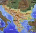
Balkan topo sr.svg 1,400 × 1,278; 466 KB
-
BundesligaGeografskiPolozajTimova2006-2007.svg 604 × 790; 50 KB
-
China administrative claimed included sr.svg 857 × 699; 116 KB
-
Churches in Medieval Bosnia Map-sr.svg 715 × 1,107; 534 KB
-
Dinaric Alps map sr.svg 1,857 × 1,503; 3.63 MB
-
Eastern Equatoria Administrative Map-sr.svg 1,117 × 730; 200 KB
-
Ethnic Groups of Southern Sudan-sr.svg 422 × 315; 28 KB
-
Gastrochilus sr.svg 623 × 617; 751 KB
-
Hudson bay large sr.svg 429 × 425; 122 KB
-
Ilemi Triangle Map-sr.svg 994 × 710; 164 KB
-
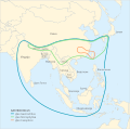
Indo-Pacific biogeographic region map-sr.svg 1,950 × 1,200; 1.48 MB
-
Jonglei Administrative Map-sr.svg 1,058 × 693; 259 KB
-
Kajkavsko-narečje.svg 1,841 × 1,151; 92 KB
-
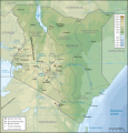
Kenya topographic map-sr.svg 1,181 × 1,231; 3.26 MB
-
Mongolija.svg 2,315 × 1,379; 171 KB
-
Mozart in Italy sr.svg 2,279 × 2,811; 328 KB
-
North Sentinel Island Map-sr.svg 2,121 × 2,177; 154 KB
-
Northern Bahr el Ghazal Administrative Map-sr.svg 1,058 × 810; 180 KB
-
Religious map of Montenegro by municipality.svg 1,063 × 1,285; 233 KB
-
Serbia Mineral Deposits and Energetics Map-sr.svg 1,073 × 1,553; 754 KB
-
Serbian Railways Map-sr.svg 1,272 × 1,922; 523 KB
-
Serbian vehicle license plate codes by region-sr.svg 727 × 1,041; 336 KB
-
UEFA Euro 2008 Venues serbian.svg 1,000 × 540; 990 KB
-
Uk-map-sr.svg 1,021 × 2,255; 150 KB
-
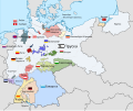
Weimar Republic states map-sr.svg 976 × 818; 950 KB


