Category:Sense
Jump to navigation
Jump to search
river in Switzerland | |||||
| Upload media | |||||
| Instance of | |||||
|---|---|---|---|---|---|
| Location |
| ||||
| Length |
| ||||
| Elevation above sea level |
| ||||
| Mouth of the watercourse | |||||
| Drainage basin | |||||
| Tributary | |||||
 | |||||
Subcategories
This category has the following 3 subcategories, out of 3 total.
Media in category "Sense"
The following 43 files are in this category, out of 43 total.
-
2012-04-26 Sense-Sarino (Foto Dietrich Michael Weidmann) 107.JPG 3,872 × 2,592; 4.76 MB
-
2012-04-26 Sense-Sarino (Foto Dietrich Michael Weidmann) 108.JPG 3,872 × 2,592; 4.86 MB
-
2012-04-26 Sense-Sarino (Foto Dietrich Michael Weidmann) 109.JPG 3,872 × 2,592; 4.8 MB
-
Auengebiet Kalte Sense, Schwarzsee FR– Sangernboden BE 20211015-jag9889.jpg 4,608 × 2,880; 10.91 MB
-
Auengebiet Rotenbach, Sangernboden BE 20211015-jag9889.jpg 4,608 × 3,456; 10.81 MB
-
Bridge and fence (6850876771).jpg 6,000 × 4,000; 3.88 MB
-
ETH-BIB-Alte Sense-Läufe, nach Bärtschi und Büchi-Dia 247-Z-00392.tif 3,623 × 3,014; 31.4 MB
-
ETH-BIB-Interglaciale Sense-Läufe (Profile)-Dia 247-Z-00361.tif 3,654 × 2,949; 30.95 MB
-
ETH-BIB-Sense - abwärts vom Steg unter Ruine Grasburg-Dia 247-12715.tif 3,593 × 2,833; 29.26 MB
-
ETH-BIB-Sense - aufwärts von der Grasburg-Dia 247-12714.tif 3,611 × 2,792; 28.97 MB
-
ETH-BIB-Sense - Tal, abwärts von Grasburg-Dia 247-12713.tif 3,063 × 3,411; 30.01 MB
-
ETH-BIB-Sense abwärts von der Guggerbachbrücke-Dia 247-13397.tif 3,636 × 2,787; 29.13 MB
-
ETH-BIB-Sense Saane, Kiesauskübelung, Ost-Dia 247-13990.tif 3,624 × 2,806; 29.23 MB
-
ETH-BIB-Sense Saane, Kiesauskübelung, West-Dia 247-13991.tif 3,648 × 2,783; 29.19 MB
-
ETH-BIB-Sense zur Saane bei Laupen, Ost-Dia 247-13988.tif 3,708 × 2,709; 28.88 MB
-
ETH-BIB-Sense zur Saane bei Laupen, West-Dia 247-13989.tif 3,624 × 2,756; 28.72 MB
-
ETH-BIB-Sense-aufwärts Sodbach bei Schwarzenburg-Dia 247-13392.tif 3,640 × 2,747; 28.72 MB
-
Floodplain Auenlandschaft Sense Sodbach 1.jpg 4,224 × 3,168; 5.26 MB
-
Floodplain Auenlandschaft Sense Sodbach 2.jpg 4,224 × 3,168; 5.56 MB
-
Floodplain Auenlandschaft Sense Sodbach 23.jpg 4,224 × 3,168; 5.25 MB
-
Flusslandschaft sense kantonbern schweiz.jpg 2,272 × 1,704; 1.39 MB
-
Kalte Sense en Sangernboden(Foto Dietrich Michael Weidmann).jpg 1,200 × 1,600; 455 KB
-
Kalte Sense en Sangernboden(Foto Dietrich Michael Weidmann)148.jpg 1,200 × 1,600; 359 KB
-
Kalte Sense.jpg 4,032 × 6,048; 11.48 MB
-
Naturpark Gantrisch 25.jpg 4,896 × 3,264; 6.74 MB
-
Naturpark Gantrisch 26.jpg 4,896 × 3,264; 7.06 MB
-
Naturpark Gantrisch 27.jpg 4,896 × 3,264; 7.52 MB
-
Naturpark Gantrisch 28.jpg 4,896 × 3,264; 7.07 MB
-
Naturpark Gantrisch 29.jpg 4,896 × 3,264; 7.26 MB
-
River Sense - panoramio.jpg 2,816 × 2,112; 2.03 MB
-
River Sense, with Schwarzwasser bridge - panoramio.jpg 2,816 × 2,112; 2.1 MB
-
Schwarzseetal FR.jpg 2,048 × 1,536; 669 KB
-
Sense (3).JPG 2,112 × 2,816; 2.44 MB
-
Sense bei Laupen.JPG 3,072 × 2,304; 4.31 MB
-
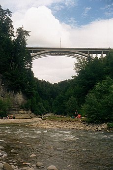
Sense mit Schwarzwasser-Hochbrücke.JPG 2,816 × 2,112; 1.85 MB
-
Sense und Schwarzwasser.jpg 1,024 × 1,536; 226 KB
-
Sense1 20150821.jpg 2,592 × 1,936; 1,014 KB
-
Sense2 20150823.jpg 1,936 × 2,592; 1.59 MB
-
Sense3 20150827.jpg 1,936 × 2,592; 1.63 MB
-
Sense4 20150831.jpg 1,936 × 2,592; 1.43 MB
-
Sense5 20150831.jpg 1,936 × 2,592; 1.41 MB
-
Sense6 20150901.jpg 1,936 × 2,592; 1.44 MB
-
Singine.png 351 × 523; 249 KB


