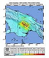
Category:Seismological maps of Papua New Guinea
Jump to navigation
Jump to search
Subcategories
This category has only the following subcategory.
Media in category "Seismological maps of Papua New Guinea"
The following 6 files are in this category, out of 6 total.
-
2018 October PNG New Britain Earthquake - Shakemap.jpg 612 × 718; 83 KB
-
6,3 Papua New Guinea.jpg 612 × 707; 103 KB
-
Intensity1.jpg 612 × 713; 106 KB
-
M 7.5 - 89km SSW of Porgera, Papua New Guinea - intensity.jpg 612 × 717; 114 KB
-
PapuaNewGuineaQuake4.21.07.jpg 515 × 455; 39 KB
-
PNG2018ShakeMapv4.jpg 612 × 717; 114 KB


