Category:Second Military Mapping Survey of Austrian Empire
Jump to navigation
Jump to search
Internationalization
Deutsch: Franziszeische Landesaufnahme
English: 2nd Military Mapping Survey of Austria
Magyar: II. katonai felmérés
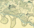
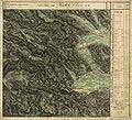
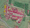
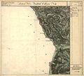
Maps were created between 1806 and 1869 and the elder ones rectified after 1840. Scale 1:28 800. They are much more precise than maps of the first survey. The Cadastral maps of Austrian Empire do not belong to any Mapping Survey. Works on the Cadastral maps startet 1817 concerning taxes on land and buildings, not landscape and scenery.
- See:
- Category:First Military Mapping Survey of Austrian Empire (1764 – 1806)
- Category:Second Military Mapping Survey of Austrian Empire (1806 – 1869)
- Category:3rd Military Mapping Survey of Austria-Hungary (1868 – 1880)
- Category:Cadastral maps of Austrian Empire (1817 – 1861)
| Upload media | |||||
| Instance of | |||||
|---|---|---|---|---|---|
| Location |
| ||||
| Start time |
| ||||
| End time |
| ||||
| Follows | |||||
| Followed by | |||||
| |||||
Subcategories
This category has the following 2 subcategories, out of 2 total.
Media in category "Second Military Mapping Survey of Austrian Empire"
The following 66 files are in this category, out of 66 total.
-
Bergamo (Second military survey of the Habsburg Empire, 1818-1829).jpg 1,426 × 713; 240 KB
-
Braunau am Inn Stadt Plan.png 608 × 628; 791 KB
-
Clusone (Second military survey of the Habsburg Empire, 1818-1829).jpg 700 × 455; 110 KB
-
Drávaszentmárton franciskánus térképe.png 1,136 × 951; 774 KB
-
Dürngrün historische Karte01.jpg 1,293 × 863; 507 KB
-
Eferding Stadt Plan.png 451 × 572; 581 KB
-
Fichtenbach, 2nd Military Survey.jpg 1,103 × 743; 254 KB
-
Franziszeische Landesaufnahme - Berchtesgadener Alpen.jpg 13,981 × 17,321; 63.97 MB
-
Franziszeische Landesaufnahme 01.png 561 × 411; 515 KB
-
Franziszeische Landesaufnahme 02.png 524 × 651; 693 KB
-
Franziszeische Landesaufnahme 03.png 519 × 685; 706 KB
-
Franziszeische Landesaufnahme 04.png 544 × 475; 547 KB
-
Franziszeische Landesaufnahme 05.png 752 × 559; 987 KB
-
Franziszeische Landesaufnahme 06.png 317 × 294; 172 KB
-
Franziszeische Landesaufnahme 07.png 850 × 773; 1.51 MB
-
Franziszeische Landesaufnahme 09.png 697 × 717; 1.11 MB
-
Franziszeische Landesaufnahme 10.png 551 × 527; 726 KB
-
Franziszeische Landesaufnahme Landsberg Osterwitz.jpg 7,632 × 6,962; 17.93 MB
-
Franziszeische Landesaufnahme Siebenbründl.jpg 1,095 × 652; 280 KB
-
Franziszeische Landesaufnahme Stainz bis Schwarzkogel.jpg 6,387 × 5,796; 16.61 MB
-
Franziszeische Landesaufnahme Weineben Glashütten.JPEG 7,680 × 6,983; 18.48 MB
-
FranzLA Preitenegg.jpg 7,696 × 7,044; 12.87 MB
-
Franzosenstein Enzengarn Nord.jpg 1,365 × 2,048; 3.2 MB
-
Franzosenstein Enzengarn Süd.jpg 1,365 × 2,048; 3.08 MB
-
Freistadt Stadt Plan.png 815 × 619; 1.05 MB
-
Gárdony-második-katonai-felmérés-térképe.jpg 863 × 706; 271 KB
-
Haslach an der Mühl Town Plan.png 552 × 516; 630 KB
-
Hebalm westl Rettenbach.JPEG 7,616 × 6,933; 18.27 MB
-
Iborfia-második-katonai-felmérés-térképe.jpg 691 × 692; 206 KB
-
Illyria (1829–1835) Second military survey.jpg 1,920 × 980; 833 KB
-
Innozenzidorf.png 603 × 569; 722 KB
-
Karolinthal na mapách druhého vojenského mapování.jpg 773 × 499; 108 KB
-
Krumau 1823 detail.jpg 4,785 × 2,411; 18.46 MB
-
Krumau 1823.jpg 8,333 × 8,151; 90.71 MB
-
Kápolnásnyék-második-katonai-felmérés-térképe.jpg 863 × 706; 254 KB
-
Leonfelden Town Plan.png 738 × 587; 982 KB
-
Mapa bgd 2 franckatastar.jpg 1,445 × 902; 501 KB
-
Nadap-második-katonai-felmérés-térképe.jpg 863 × 706; 311 KB
-
Nagysalló és környéke a XIX. század közepén.jpg 3,368 × 4,256; 6.19 MB
-
Nembro (Second military survey of the Habsburg Empire, 1818-1829).jpg 700 × 455; 101 KB
-
Nyírjes térkép (második katonai felmérés).jpg 1,311 × 767; 414 KB
-
Ottensheim Stadt Plan.png 547 × 521; 607 KB
-
Pusztaszabolcs-második-katonai felmérésének-térképe.jpg 863 × 706; 250 KB
-
Pákozd-második-katonai-felmérés-térképe.jpg 863 × 706; 278 KB
-
Pázmánd-második-katonai-felmérés-térképe.jpg 863 × 706; 293 KB
-
Sukoró-második-katonai-felmérés-térképe.jpg 863 × 706; 299 KB
-
Szabadegyháza-második-katonai-felmérés-térképe.jpg 863 × 706; 242 KB
-
Sárbogárd-második-katonai-felmérése.jpg 863 × 706; 257 KB
-
Sárosd-második-katonai-felmérés-térképe.jpg 863 × 706; 267 KB
-
Söréd-második-katonai-felmérés-térképe.jpg 863 × 706; 218 KB
-
Tiszaújlak térképe 1806-64.jpg 1,429 × 1,239; 2.58 MB
-
Treviglio (Second military survey of the Habsburg Empire, 1818-1829).jpg 800 × 511; 124 KB
-
Trieste 1821-1824.jpg 1,306 × 714; 203 KB
-
Velence-második-katonai-felmérés-térképe.jpg 863 × 706; 273 KB
-
Vereb-második-katonai-felmérés-térképe.jpg 863 × 706; 300 KB
-
Vermessungsstein Hochsalm Ost.jpg 1,365 × 2,048; 2.51 MB
-
Vermessungsstein Hochsalm West.jpg 1,365 × 2,048; 2.74 MB
-
Vermessungsstein Hochsalm.jpg 2,048 × 1,365; 2.9 MB
-
Zemianske Podhradie.jpg 883 × 423; 160 KB
-
Zichyújfalu-2.-katonai-felmérés-térképe.jpg 863 × 706; 242 KB
-
Zogno (Second military survey of the Habsburg Empire, 1818-1829).jpg 700 × 455; 119 KB
-
Čížkovice and Želechovice in 1840s.png 1,280 × 965; 2.8 MB


