
Category:Seascapes of the United Kingdom
Subcategories
This category has the following 6 subcategories, out of 6 total.
E
N
S
W
Media in category "Seascapes of the United Kingdom"
The following 107 files are in this category, out of 107 total.
-
 'The Landslip' by Arthur Hughes.jpg 2,250 × 1,415; 903 KB
-
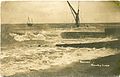
 1905-03-23 front Boats in a Storm Scarborough.jpg 3,272 × 2,120; 1.8 MB
-
-
 Achmelvich Sunset - geograph.org.uk - 50648.jpg 640 × 480; 73 KB
-
 Ailsa Craig - geograph.org.uk - 250513.jpg 640 × 479; 44 KB
-
 Bacon Breakfast - geograph.org.uk - 302853.jpg 426 × 640; 73 KB
-
 Barnstaple Bay - geograph.org.uk - 42694.jpg 640 × 427; 38 KB
-

-
 Borness Point, Galloway - geograph.org.uk - 343117.jpg 640 × 384; 104 KB
-
 Brighton Pier - geograph.org.uk - 362657.jpg 640 × 480; 96 KB
-
 Cliffs, mountains and sea RMG BHC1316.tiff 3,800 × 3,000; 32.62 MB
-

-
 Distant Morecambe and Heysham - geograph.org.uk - 271927.jpg 640 × 466; 59 KB
-
 Frank Short - Sea and sky at Seaford.jpg 2,250 × 1,633; 657 KB
-
 Fred C Palmer grounded barge Herne Bay.jpg 3,264 × 2,087; 5.48 MB
-
 Fred C Palmer rough sea and pier Herne Bay.jpg 3,160 × 1,920; 3.75 MB
-
 Groynes, Studd Hill - geograph.org.uk - 1457701.jpg 640 × 430; 112 KB
-
 Gulf of Corryvreckan - geograph.org.uk - 22292.jpg 640 × 480; 58 KB
-
 Hampton Pier - geograph.org.uk - 23183.jpg 640 × 480; 41 KB
-
 Hampton-on-Sea by Geograph 016.jpg 4,320 × 3,240; 3.75 MB
-
 Hampton-on-Sea by Geograph 017.jpg 1,280 × 960; 620 KB
-
 Hampton-on-Sea by Geograph 018.jpg 1,280 × 960; 630 KB
-
 Herne Bay Kings Hall 004.jpg 640 × 480; 99 KB
-
 Lane End Rocks, Bexhill, Sussex - geograph.org.uk - 37153.jpg 640 × 480; 72 KB
-
 Morte Point - geograph.org.uk - 58906.jpg 640 × 480; 150 KB
-

-
 Promenade, Herne Bay - geograph.org.uk - 858136.jpg 640 × 480; 83 KB
-
 Rocks Below Dunnottar Castle - geograph.org.uk - 220312.jpg 640 × 481; 121 KB
-
 Slipway, Hampton - geograph.org.uk - 1457715.jpg 640 × 430; 123 KB
-
 South South-West - geograph.org.uk - 287611.jpg 640 × 419; 55 KB
-
 SunriseLymeBay.jpg 4,592 × 3,056; 1.17 MB
-
 T S Triumph - geograph.org.uk - 1440553.jpg 640 × 480; 62 KB
-
 The beach at Herne Bay, Kent. - geograph.org.uk - 1522020.jpg 640 × 432; 69 KB
-
 The sea RMG BHC1311.tiff 3,800 × 3,000; 32.62 MB
-
 The sea RMG BHC1312.tiff 3,800 × 3,000; 32.62 MB
-
 The sea RMG BHC1314.tiff 3,800 × 3,000; 32.62 MB
-
 The sea RMG BHC1315.tiff 3,800 × 3,000; 32.62 MB
-

-
 Trafalgar 200 - geograph.org.uk - 22869.jpg 640 × 480; 121 KB
-
-
 West North West - geograph.org.uk - 287602.jpg 640 × 479; 56 KB
-
 A rough looking Menai Straits - geograph.org.uk - 288987.jpg 640 × 480; 57 KB
-

-
 Arran viewed from above Carrick Point - geograph.org.uk - 352043.jpg 576 × 300; 39 KB
-
 Ballygown Bay - geograph.org.uk - 82647.jpg 640 × 480; 137 KB
-
 Beaulieu River - geograph.org.uk - 226287.jpg 427 × 640; 62 KB
-
 Becalmed off Carradale Point - geograph.org.uk - 38281.jpg 640 × 480; 75 KB
-
 Bell Stane - geograph.org.uk - 320090.jpg 640 × 480; 104 KB
-
 Bell Stane - geograph.org.uk - 320103.jpg 640 × 480; 74 KB
-
 Breaking waves near Cheswick Beach - geograph.org.uk - 138779.jpg 640 × 480; 82 KB
-
 Brither Rocks - geograph.org.uk - 374851.jpg 640 × 477; 57 KB
-
-

-
 Dive^ dive^ dive^ - geograph.org.uk - 76440.jpg 640 × 455; 49 KB
-
 Easter seas at Walcott - geograph.org.uk - 154791.jpg 640 × 480; 78 KB
-
 Entrance to Acairseid Mhor on Rona - geograph.org.uk - 41869.jpg 640 × 480; 92 KB
-
 Entrance to Poldoran - geograph.org.uk - 107908.jpg 640 × 480; 22 KB
-
 Escaping the cliffs at Beachy Head - geograph.org.uk - 35445.jpg 640 × 409; 101 KB
-
 Extreme Geographing (midsummers day) - geograph.org.uk - 193861.jpg 640 × 480; 46 KB
-
 Filey Brigg - geograph.org.uk - 202158.jpg 640 × 480; 65 KB
-
 Freshwater Bay and Albion Hotel. - geograph.org.uk - 308659.jpg 640 × 480; 116 KB
-
-
 Greshornish point - geograph.org.uk - 88078.jpg 640 × 480; 84 KB
-
 Gulf stream influence at Immachar - geograph.org.uk - 77305.jpg 640 × 480; 103 KB
-
 Irish Sea - geograph.org.uk - 256003.jpg 640 × 480; 42 KB
-
 Leaving Scalasaig Harbour - geograph.org.uk - 22301.jpg 640 × 480; 88 KB
-
 Lepe Beach - geograph.org.uk - 229023.jpg 640 × 480; 74 KB
-
 Lynn of Lorn - geograph.org.uk - 63311.jpg 640 × 480; 122 KB
-
 Minard Point - geograph.org.uk - 128996.jpg 640 × 480; 114 KB
-
 Mouth of the Deben River - geograph.org.uk - 39037.jpg 640 × 480; 250 KB
-
 North Bay, Scarborough - geograph.org.uk - 355788.jpg 600 × 400; 87 KB
-
 North Dunoon and Kirn - geograph.org.uk - 289627.jpg 640 × 480; 73 KB
-
 North Sea and Rocks - geograph.org.uk - 126976.jpg 640 × 475; 63 KB
-
 North Sea off Eyemouth - geograph.org.uk - 18084.jpg 640 × 480; 137 KB
-
 October seas at Swanage - geograph.org.uk - 314963.jpg 640 × 446; 76 KB
-

-
 Port Aoineadh an Tighein - geograph.org.uk - 192186.jpg 640 × 480; 67 KB
-
 Porth Dinllaen - geograph.org.uk - 270429.jpg 640 × 480; 60 KB
-
 Promenade and beach, Southwold - geograph.org.uk - 126227.jpg 640 × 480; 63 KB
-
 Redness Point from Whitehaven - geograph.org.uk - 105385.jpg 640 × 480; 40 KB
-
 Rocks - geograph.org.uk - 269180.jpg 640 × 480; 72 KB
-
 Rocks at Sanna Beach - geograph.org.uk - 107296.jpg 640 × 480; 57 KB
-
 Rocks at West end of Camas Mor - geograph.org.uk - 79980.jpg 640 × 480; 101 KB
-
 Sailing Barge at Southwold - geograph.org.uk - 41787.jpg 640 × 464; 44 KB
-
 Seascape off Rubha na Codha, Mull - geograph.org.uk - 162610.jpg 640 × 480; 98 KB
-
 Seaview off Belgrano - geograph.org.uk - 34460.jpg 640 × 480; 41 KB
-
 Sound of Islay - geograph.org.uk - 114213.jpg 640 × 415; 41 KB
-
 South East Corner of Rona - geograph.org.uk - 41867.jpg 640 × 480; 81 KB
-
 South East Point, Walney Island - geograph.org.uk - 148763.jpg 640 × 480; 160 KB
-
 Southern tip of Inchmarnock. - geograph.org.uk - 348852.jpg 640 × 480; 119 KB
-
 Southport Pier end - geograph.org.uk - 146.jpg 640 × 480; 30 KB
-
-

-

-
 The Sand Island - geograph.org.uk - 287633.jpg 640 × 479; 169 KB
-

-

-
 Tidal drying green - geograph.org.uk - 365831.jpg 640 × 480; 97 KB
-
 Torr an Ogha - geograph.org.uk - 82671.jpg 640 × 480; 112 KB
-
 Traigh Bhan - geograph.org.uk - 27505.jpg 640 × 426; 140 KB
-
 View from Coastal Road - geograph.org.uk - 358932.jpg 640 × 465; 114 KB
-

-
 View from South Parade Pier - geograph.org.uk - 334795.jpg 640 × 480; 79 KB
-

-
 View of Kirby Creek - geograph.org.uk - 349989.jpg 640 × 480; 90 KB
-

-


_-_geograph.org.uk_-_193861.jpg)


