Category:Sea level maps of Europe
Jump to navigation
Jump to search
| NO WIKIDATA ID FOUND! Search for Sea level maps of Europe on Wikidata | |
| Upload media |
Temperate regions: North America · South America · Africa · Europe · Asia · Oceania – Polar regions: – Other regions:
Media in category "Sea level maps of Europe"
The following 12 files are in this category, out of 12 total.
-
ETH-BIB-Europa, 200 m gehoben-Dia 247-Z-00160.tif 3,624 × 2,944; 30.66 MB
-
ETH-BIB-Europa, 200m gesenkt-Dia 247-Z-00161.tif 3,636 × 2,950; 30.85 MB
-
Hamburg, Germany Population Density and Low Elevation Coastal Zones (5457913434).jpg 3,295 × 2,478; 1.14 MB
-
London, Great Britain Population Density and Low Elevation Coastal Zones (5457306673).jpg 3,289 × 2,472; 1.08 MB
-
Netherlands Population Density and Low Elevation Coastal Zones (5457306871).jpg 3,255 × 2,472; 1.06 MB
-
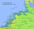
Nordsee plus 1m.png 1,500 × 1,283; 567 KB
-
North Sea Sea Level RisksFr.png 1,064 × 1,050; 536 KB
-
The Netherlands below sealevel and protected from floods.png 962 × 1,003; 591 KB
-
The Netherlands compared to sealevel.png 962 × 1,003; 25 KB
-
Urban-Rural Population and Land Area Estimates, v2, 2010 Netherlands (13874139234).jpg 3,150 × 2,417; 1.04 MB
-
Urban-Rural Population and Land Area Estimates, v2, 2010 Northeast Italy (13873744025).jpg 3,200 × 2,417; 1.07 MB


