Category:Schuylkill Canal
Jump to navigation
Jump to search
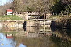
English: The Schuylkill Canal, or Schuylkill Navigation, was a system of interconnected canals and slack-water pools along the Schuylkill River in the U.S. state of Pennsylvania, built as a commercial waterway in the early 19th-century. The Schuylkill was in operation until 1931 and was almost completely filled in the 1950s. Some remaining watered reaches are now used for recreation.
historic canal along the Schuylkill River in Pennsylvania | |||||
| Upload media | |||||
| Instance of | |||||
|---|---|---|---|---|---|
| Named after | |||||
| Location | Pennsylvania | ||||
| Architect |
| ||||
| Has part(s) |
| ||||
| Heritage designation | |||||
| Inception |
| ||||
| Date of official closure |
| ||||
 | |||||
Subcategories
This category has the following 2 subcategories, out of 2 total.
F
S
- Schuylkill Canal Lock 60 (5 F)
Media in category "Schuylkill Canal"
The following 48 files are in this category, out of 48 total.
-
Biking towpath.jpg 6,016 × 4,000; 6.06 MB
-
Black Rock Dam freshet.jpg 3,872 × 2,592; 3.64 MB
-
Fairmount Waterworks 1835 (cropped).jpg 933 × 703; 155 KB
-
Fairmount, c1871. (4700131539).jpg 2,000 × 1,520; 535 KB
-
Leesport Lock House 1 BerksCo PA.JPG 4,320 × 3,240; 5.84 MB
-
Lock Tender's House 2008-06-29.jpg 3,872 × 2,592; 4.15 MB
-
Lock60 20070421.jpg 2,560 × 1,920; 2.55 MB
-
Luminares on Schuylkill Canal - 8280814141.jpg 4,272 × 2,848; 4.6 MB
-
Luminares on Schuylkill Canal.jpg 4,272 × 2,848; 4.81 MB
-
Manayunk Canal 2009.jpg 3,872 × 2,592; 3.4 MB
-
New Towpath Bridge.jpg 4,000 × 3,000; 4.12 MB
-
Pennsylvania canals.png 759 × 414; 133 KB
-
Philadelphia and its environs (1876) (14770773962).jpg 3,136 × 2,119; 1.47 MB
-
Port Carbon Public Library, Schuylkill Co PA 02.JPG 3,456 × 4,608; 3.49 MB
-
Rental Boats.jpg 4,272 × 2,848; 2.39 MB
-
Runner Towpath II.jpg 6,016 × 4,000; 6.48 MB
-
Runner Towpath.jpg 6,016 × 4,000; 6.52 MB
-
Schuylkill Canal aka Schuylkill Navigation.jpg 4,608 × 2,592; 5.51 MB
-
Schuylkill Canal from Manayunk Bridge looking north, Aug 2022.jpg 3,573 × 2,630; 1.91 MB
-
Schuylkill Canal from Manayunk Bridge looking south, Aug 2022.jpg 3,538 × 2,666; 1.58 MB
-
Schuylkill Canal II.jpg 6,016 × 4,000; 5.13 MB
-
Schuylkill Canal Oaks Viaduct, January 2008.jpg 3,872 × 2,592; 4.67 MB
-
Schuylkill Canal Ribbon Cutting.jpg 4,446 × 3,335; 4.58 MB
-
Schuylkill canal.jpg 3,040 × 2,280; 3.03 MB
-
Schuylkill Navigation Company 1870.jpg 8,291 × 5,336; 5.19 MB
-
Schuylkill Navigation Lock 70.jpg 3,872 × 2,592; 4.1 MB
-
Schuylkill Suspension Bridge (9101176849).jpg 2,326 × 1,200; 473 KB
-
SRT Canal Ribbon II.jpg 4,272 × 2,848; 6.75 MB
-
SRT Tow Path Event VII.jpg 6,016 × 4,000; 6.32 MB
-
SRT Tow Path Event XXXVI.jpg 6,016 × 4,000; 6.32 MB
-
Towpath bikers.jpg 4,272 × 2,848; 6.87 MB
-
Winter along the Schuylkill Canal.jpg 3,027 × 2,338; 2.45 MB
-
Locks, from Robert N. Dennis collection of stereoscopic views.jpg 2,737 × 1,407; 1.51 MB
-
Suspension bridge, Philadelphia, by Kilburn Brothers 3.jpg 2,717 × 1,378; 1.39 MB
-
View of a bridge, by Cremer, James, 1821-1893.jpg 2,737 × 1,614; 1.39 MB
-
Wire bridge, Fairmount, by Newell, R., d. 1897.jpg 2,737 × 1,380; 1.48 MB
Categories:
- Canals in Pennsylvania
- Structures on the National Register of Historic Places in Pennsylvania
- National Register of Historic Places in Montgomery County, Pennsylvania
- Historic districts on the National Register of Historic Places in Pennsylvania
- Ruins in Pennsylvania
- Schuylkill River
- Transport in Montgomery County, Pennsylvania
- Structures in Montgomery County, Pennsylvania
- Canals on the National Register of Historic Places


