Category:Scheduled monuments in England with known IDs
Jump to navigation
Jump to search
Subcategories
This category has the following 200 subcategories, out of 308 total.
(previous page) (next page)- Mordiford bridge (17 F)
- Pembridge Castle (14 F)
- Southwick Brewhouse (5 F)
- Wigmore Castle (127 F)
- Black Barn, Warblington (4 F)
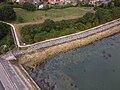
- Fort Southwick (23 F)
- Twyford Waterworks (28 F)
- Vulcan Block (32 F)
- Eastney Fort West (6 F)
- Bastion 1, Gosport (8 F)
- Hilsea lines (78 F)
- St Denys Priory (11 F)
- Netley Castle (13 F)
- Quilter's Vault (3 F)
- St Peter's Church, Lainston (3 F)
- Warblington Castle (9 F)
- Cutthorn (6 F)
- God's House Tower and Gate (26 F)
- Westgate, Southampton (26 F)
- Water Gate, Southampton (15 F)
- Canute's Palace, Southampton (25 F)
- Kingsgate, Winchester (42 F)
- St John's House, Warnford (37 F)
- Almory Gate (4 F)
- Bourne Mill, Colchester (27 F)
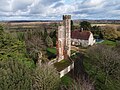
- St. Osyth's Abbey (24 F)
- Robertsbridge Abbey (5 F)
- St Mary's Chapel, Bulverhythe (12 F)
- Landgate, Rye (34 F)
- Stanhope Bridge (6 F)
- Postbridge Clapper Bridge (81 F)
- The Conduit, Sherborne, Dorset (31 F)
- Wyke Farm (10 F)
- Bourn Windmill (8 F)
- Warden Abbey (7 F)
- Castle Bridge, Warwick (12 F)
- Clarendon Palace (15 F)
- Wycoller Hall (36 F)
- St Benet's Abbey (87 F)
- Erpingham Gate, Norwich (36 F)
- Town pump, Little Walsingham (15 F)
- St Mary's Friary, Walsingham (6 F)
- Yeolm Bridge (3 F)
- Breamore Mizmaze (8 F)
- Manor Farm, Rockbourne (16 F)
- Salters Bridge (1 F)
- St Mary in Arden (6 F)
- Greyfriars Tower, King's Lynn (24 F)
- St Michael's church, Bowthorpe (10 F)
- Starston windpump (4 F)
- Berney Arms Windmill (44 F)
- Melford Bridge, Thetford (2 F)
- Thetford Grammar School (6 F)
- Watergate, Norwich (28 F)
- St Ethelbert Gate (30 F)
- Malton Priory (27 F)
- Boscathnoe Cross (4 F)
- Lesingey Round (9 F)
- Boswarthen Cross (6 F)
- South Gate, Launceston (10 F)
- Elstow Moot Hall (8 F)
- Ravenstonedale Priory (5 F)
- Mên-an-Tol (55 F)
- Goldherring (7 F)
- Dunstable Priory (111 F)
- Lamel Hill, York (8 F)
- Kexby Bridge (8 F)
- Williams Hill, Middleham (4 F)
- Storeton Hall (3 F)
- Winery Lane (3 F)
- Wycoller packhorse bridge (30 F)
- The Hall Bridge, Wycoller (8 F)
- Bank House Bridge, Wycoller (10 F)
- Canterbury Castle (66 F)
- Wressle Castle (21 F)
- All Saints church, Segenhoe (11 F)
- Wye Bridge, Hereford (39 F)
- Polesworth Abbey (23 F)
- Chesterton Windmill (59 F)
- Tilford West Bridge (8 F)
- Tilford East Bridge (12 F)
- Somerset Bridge on River Wey (9 F)
- Saxtead Green Windmill (62 F)
- Creswell Church Ruin (2 F)
- Radcot Bridge (17 F)
- Newstead Abbey Church (14 F)
- Chysauster Ancient Village (38 F)
- Madron Well, Cornwall (32 F)
- Mulfra Quoit (16 F)
- Lanyon Quoit (80 F)
- Town Wall, Hartlepool (9 F)
- Great Gransden windmill (7 F)
- Over Windmill (6 F)
- Lanercost Old Bridge (16 F)
- Arnside Tower (14 F)
- Holmcultram Abbey (39 F)
- Calder Abbey (8 F)
- Eamont Bridge, Eamont Bridge (8 F)
- Chûn Castle (18 F)
- Mayburgh Henge (20 F)
- Bisham Abbey (21 F)
- Meare Fish House (15 F)
- Willy Howe (10 F)
- Trembath Cross (3 F)
- Bardney Abbey (25 F)
- Eyam cross (14 F)
- St Andrew's Castle, Hamble (3 F)
- Odiham Castle (96 F)
- Buckland Rings (17 F)
- Kendal Castle (28 F)
- Ambleside Roman Fort (49 F)
- St. Catherine's Oratory (30 F)
- Eaton Socon Castle (4 F)
- Market Cross, Castle Rising (4 F)
- Black Friars Monastery, Hereford (15 F)
- Tremethick Stone Cross (2 F)
- Castle Folds, Cumbria (2 F)
- Maxstoke Priory (14 F)
- Skipsea Castle (22 F)
Media in category "Scheduled monuments in England with known IDs"
The following 115 files are in this category, out of 115 total.
-
 Southwick Brewhouse - Steam Plant - geograph.org.uk - 458846.jpg 640 × 427; 87 KB
-
 The Southwick Brewhouse at the back of The Golden Lion, Southwick.jpg 5,184 × 3,456; 4.67 MB
-
 Site of Former Pickett Hamilton fort, Hilsea 1.jpg 4,000 × 3,000; 4.98 MB
-
 Black Barn, Warblington 2.jpg 4,000 × 3,000; 5.18 MB
-
 Fort Southwick 10.jpg 4,000 × 3,000; 5.12 MB
-
 Fort Southwick 2b.jpg 4,000 × 3,000; 5.54 MB
-
 Fort Southwick 3.jpg 4,000 × 3,000; 5.18 MB
-
 Fort Southwick 7b.jpg 4,000 × 3,000; 5.07 MB
-
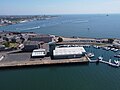
 Haslar Marine Technology Park 3.jpg 4,000 × 2,250; 7.07 MB
-
 Former Haslar Royal Naval Hospital 1.jpg 4,000 × 3,000; 5.82 MB
-
 Former Haslar Royal Naval Hospital 2.jpg 4,000 × 3,000; 5.91 MB
-
 Haslar Marine Technology Park 10.jpg 4,000 × 3,000; 6.31 MB
-
 Haslar Marine Technology Park 11.jpg 4,000 × 3,000; 5.11 MB
-
 Haslar Marine Technology Park 4 - 53731809439.jpg 4,000 × 3,000; 5.34 MB
-
 Haslar Marine Technology Park 6 - 53731809444.jpg 4,000 × 3,000; 6.27 MB
-
 Eastney Barracks Forts, Portsmouth.jpg 4,000 × 3,000; 5.21 MB
-
 Eastney Fort West, Portsmouth.jpg 4,000 × 3,000; 6.23 MB
-
 Holy Trinity Vicarage, Bastion Number 1 - 53731809754.jpg 4,000 × 3,000; 5.35 MB
-
 Forton, Gosport Oil Fuel Depot.jpg 4,000 × 3,000; 5.09 MB
-
 Fort Widley 2.jpg 4,000 × 3,000; 5.32 MB
-
 Fort Widley 3.jpg 4,000 × 3,000; 4.96 MB
-
 Gate to Fort Widley.jpg 3,456 × 4,608; 6.65 MB
-
 Fort Blockhouse 1.jpg 4,000 × 3,000; 5.79 MB
-
 Fort Blockhouse 2.jpg 4,000 × 3,000; 6.34 MB
-
 Fort Blockhouse, Gosport.jpg 4,000 × 3,000; 5.5 MB
-
 Weigh House.JPG 3,648 × 2,736; 2.96 MB
-
 Ruins of Southwick Priory.jpg 5,184 × 3,456; 7.07 MB
-
 Warblington Castle 1.jpg 4,000 × 3,000; 5.38 MB
-
 Warblington Castle 3.jpg 4,000 × 3,000; 5.22 MB
-
 Friary Reredorter on town wall.JPG 3,648 × 2,432; 3.15 MB
-
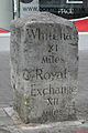 Milestone on Sutton High Street.jpg 2,887 × 4,330; 5.36 MB
-
 Milestone on Cheam Road, Sutton, London.jpg 3,750 × 5,625; 8.15 MB
-
 Milestone on Brighton Road, Sutton, London.jpg 3,750 × 5,625; 8.22 MB
-
 Entrance Archway Facing Outwards, Fort Stamford, Plymouth.jpg 2,378 × 3,567; 6.47 MB
-
 Eashing Bridge, Lower Eashing.jpg 4,608 × 3,456; 8.43 MB
-
 KingsLynnWhitefriars.JPG 3,168 × 4,224; 4.34 MB
-
 Ruins of Church of St Mary, Pluckley Road, Little Chart.jpg 2,736 × 3,648; 8.1 MB
-
 'Mound' on Round Hill - geograph.org.uk - 1013674.jpg 640 × 480; 164 KB
-

-
 St Catherine's Tower.JPG 2,376 × 4,224; 4.45 MB
-
 Willy Howe - geograph.org.uk - 1099.jpg 640 × 418; 45 KB
-
 Willy Howe Barrow.JPG 3,648 × 2,736; 3.63 MB
-
 Willy Howe Neolithic round barrow (2) (geograph 5741606).jpg 1,024 × 760; 592 KB
-
 Willy Howe Neolithic round barrow (geograph 5741604).jpg 1,024 × 754; 569 KB
-
 Willy Howe Neolithic round barrow (geograph 6467509).jpg 800 × 600; 126 KB
-
 Willy Howe Neolithic round barrow (geograph 6467510).jpg 800 × 500; 126 KB
-
 Willy Howe viewed looking south - geograph.org.uk - 69231.jpg 640 × 480; 77 KB
-
 Willy Howe.jpg 640 × 480; 84 KB
-
 Castle Hill (1) - geograph.org.uk - 651401.jpg 640 × 424; 68 KB
-
 Castle Hill, Swine (2) - geograph.org.uk - 651580.jpg 640 × 480; 67 KB
-
 Shillito Cross.jpg 3,010 × 4,838; 8.73 MB
-
 Bell Barrow, Horsell Common, Woking.jpg 3,287 × 1,627; 2.65 MB
-
 Clam Bridge over Bar Brook - geograph.org.uk - 1737422.jpg 3,296 × 2,472; 1.08 MB
-
 St Arthur's Stone, Dorstone.jpg 3,648 × 2,736; 3.96 MB
-
 Earthwork Defences at Priddy's Hard.jpg 4,819 × 3,739; 4.41 MB
-
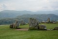 St John's Castlerigg and Wythburn - Castlerigg stone circle - 20230817073712.jpg 5,065 × 3,378; 8.28 MB
-
 St John's Castlerigg and Wythburn - Castlerigg stone circle - 20230817074129.jpg 5,999 × 4,000; 9.86 MB
-
 St John's Castlerigg and Wythburn - Castlerigg stone circle - 20230817074238.jpg 4,911 × 3,277; 8.36 MB
-
 CallevaAtrebatum SouthGate.jpg 5,184 × 3,456; 9.95 MB
-
 Moat in Whomerley Wood, Stevenage (8679487075).jpg 4,288 × 3,216; 4.61 MB
-
 The Killingwoldgraves Cross - geograph.org.uk - 481050.jpg 640 × 465; 118 KB
-
 Old Wayside Cross (geograph 6501746).jpg 960 × 576; 166 KB
-
 St John of Beverley Sanctuary Stone.jpg 681 × 511; 152 KB
-
 Walkington Sanctuary Stone (geograph 6360798).jpg 800 × 600; 233 KB
-
 Site of Carisbrooke Roman Villa looking south, after clearance works, May 2008.jpg 1,536 × 1,152; 324 KB
-
 Camp Down, Looking Towards Bedhampton.jpg 4,000 × 3,000; 5.34 MB
-
 View from Beacon Hill showing long barrow mounds in distance.jpg 5,616 × 3,744; 13.84 MB
-
 Ancient churchyard cross - geograph.org.uk - 111423.jpg 427 × 640; 122 KB
-
 Avebury pure gold.jpg 6,144 × 4,096; 10.52 MB
-
 Bourton Cross.JPG 2,000 × 3,008; 2.47 MB
-
 Portchester Castle 12.jpg 4,000 × 3,000; 5.47 MB
-
 Portchester Castle 14.jpg 4,000 × 3,000; 5.09 MB
-
 Portchester Castle 16.jpg 4,000 × 3,000; 5.08 MB
-
 Portchester Castle 18.jpg 4,000 × 3,000; 12.05 MB
-
 Portchester Castle 19.jpg 4,000 × 3,000; 5.53 MB
-
 Portchester Castle 9.jpg 4,000 × 3,000; 5.7 MB
-
 Ruined spiral stairs at Portchester Castle.jpg 3,456 × 5,184; 7.66 MB
-
 Preceptory near Stydd Hall-geograph.org.uk-4148932.jpg 3,681 × 2,530; 2.54 MB
-
 Martello Tower 6 - geograph.org.uk - 360196.jpg 640 × 480; 128 KB
-
 Martello Tower No. 6.jpg 5,184 × 3,456; 7.23 MB
-
 Haresfield Mount moat.JPG 4,288 × 3,216; 3.33 MB
-
 Haresfield Mount panorama.jpg 3,708 × 1,232; 3.73 MB
-
 The Roman bath-house, Lancaster - geograph.org.uk - 651985.jpg 640 × 473; 131 KB
-
 Linton Falls Hydroelectric Power Station (2).jpg 4,032 × 3,024; 2.74 MB
-
 Linton Falls Hydroelectric Power Station (3).jpg 4,032 × 3,024; 3.16 MB
-
 Linton Falls Hydroelectric Power Station.jpg 4,032 × 3,024; 3.06 MB
-
 2022-02-12 - World War II anti-aircraft gun platform near Cheshunt.jpg 4,032 × 3,024; 2.91 MB
-
 Observation Post 7 - geograph.org.uk - 3476336.jpg 1,600 × 1,067; 348 KB
-
 WWII Home Guard spigot mortar position at Farnham Park.jpg 4,032 × 3,024; 5.32 MB
-
 Abandoned Ship in Tipner Lake.jpg 4,000 × 3,000; 5.47 MB
-
 Horsea Island D-Day Landing Craft Maintenance Site 2.jpg 4,000 × 3,000; 5.9 MB
-
 Ship Undergoing Refurbishment.jpg 4,000 × 3,000; 5.71 MB
-
 Bowl Barrow, Culford, Suffolk.jpg 5,120 × 3,840; 7.46 MB
-
 Bronze Age bowl barrows on Petersfield Heath 01.jpg 4,128 × 3,096; 3.88 MB
-
 Bronze Age bowl barrows on Petersfield Heath 02.jpg 4,128 × 3,096; 5.71 MB
-
 Bronze Age bowl barrows on Petersfield Heath 03.jpg 4,128 × 3,096; 5.44 MB
-
 Bronze Age bowl barrows on Petersfield Heath 04.jpg 4,128 × 3,096; 4.92 MB
-
 Caen Hill Locks, Wiltshire.jpg 1,687 × 1,414; 2.9 MB
-
 Conduit House of St. Augustine's Abbey, Canterbury 01.jpg 5,152 × 3,864; 4.47 MB
-
 Conduit House of St. Augustine's Abbey, Canterbury 02.jpg 5,152 × 3,864; 4.39 MB
-
 Entrance Archway, Fort Stamford, Plymouth.jpg 2,461 × 3,691; 8.46 MB
-
 Group of four World War II fighter pens at the former airfield of RAF Kenley.jpg 4,032 × 2,268; 5.47 MB
-

-
 London, Midland and Scottish railway (LMS) swing bridge.1.jpg 4,320 × 3,240; 3.76 MB
-
 London, Midland and Scottish railway (LMS) swing bridge.2.jpg 4,320 × 3,240; 3.91 MB
-
 London, Midland and Scottish railway (LMS) swing bridge.3.jpg 4,320 × 3,240; 4.09 MB
-
 London, Midland and Scottish railway (LMS) swing bridge.4.jpg 4,320 × 3,240; 4.14 MB
-
 London, Midland and Scottish railway (LMS) swing bridge.5.jpg 4,320 × 3,240; 4.65 MB
-
 Medieval cross, Rolleston (geograph 3862527).jpg 1,280 × 960; 468 KB
-
 River Wey aqueduct, Headley Park.jpg 4,128 × 3,096; 8.82 MB
-
 St Helen's Chapel.jpg 5,626 × 3,751; 7.34 MB
-
 Stone alignments of the Great Western Reave on Longash Common.jpg 3,546 × 5,319; 5.82 MB
-
 View of old bridge across the Avon 3.jpg 2,538 × 2,356; 785 KB
-
 Waverley abbey panorama.jpg 850 × 339; 403 KB
-
 White Horse Stone 01.jpg 5,152 × 3,864; 4.35 MB


_(geograph_5741606).jpg)
.jpg)
.jpg)
.jpg)


_-_geograph.org.uk_-_651401.jpg)
_-_geograph.org.uk_-_651580.jpg)


.jpg)

.jpg)

.jpg)


.jpg)
.jpg)


_swing_bridge.1.jpg)
_swing_bridge.2.jpg)
_swing_bridge.3.jpg)
_swing_bridge.4.jpg)
_swing_bridge.5.jpg)
.jpg)


