Category:Scheduled Ancient Monuments in Wales with known IDs
Jump to navigation
Jump to search
Subcategories
This category has the following 16 subcategories, out of 16 total.
- Glyn Pits (3 F)
- Sirhowy Ironworks (3 F)
- Pont-y-Cafnau (8 F)
- Cwmbyrgwm colliery chimney (2 F)
- Penydarren tramway (4 F)
- Morlais Castle (5 F)
- Dyne Steel Incline (4 F)
- Twmbarlwm (31 F)
- Cefn Car (2 F)
- Trefil Quarries (6 F)
- Cefn Golau cholera cemetery (6 F)
Media in category "Scheduled Ancient Monuments in Wales with known IDs"
The following 21 files are in this category, out of 21 total.
-
 Llawddog, Eglwys Sant Llawddog Church, Cenarth, Carmarthenshire, Cymru Wales 01.jpg 2,084 × 3,682; 7.24 MB
-
 Llawddog, Eglwys Sant Llawddog Church, Cenarth, Carmarthenshire, Cymru Wales 14.jpg 3,672 × 4,896; 6.55 MB
-
 Llawddog, Eglwys Sant Llawddog Church, Cenarth, Carmarthenshire, Cymru Wales 15.jpg 3,672 × 4,896; 6.79 MB
-
 Llawddog, Eglwys Sant Llawddog Church, Cenarth, Carmarthenshire, Cymru Wales 16.jpg 3,672 × 4,896; 8.28 MB
-
 Llawddog, Eglwys Sant Llawddog Church, Cenarth, Carmarthenshire, Cymru Wales 18.jpg 4,896 × 3,672; 7.54 MB
-
 Admirality arch Holyhead.jpg 1,200 × 900; 213 KB
-
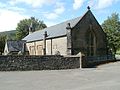 St Cadoc's Church, Glynneath-geograph.org.uk-2585919.jpg 640 × 480; 161 KB
-
 Disused mine building - geograph.org.uk - 558135.jpg 640 × 482; 87 KB
-
 Castell Coch, Penmorfa.jpg 3,108 × 2,073; 3.58 MB
-
 Cae Burdydd motte near Vaynor (geograph 3718583).jpg 640 × 480; 103 KB
-
 Carn y Defaid - geograph.org.uk - 368514.jpg 640 × 480; 129 KB
-
 Churchyard cross, St. Dingat's - geograph.org.uk - 1172013.jpg 480 × 640; 164 KB
-
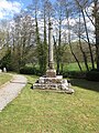 Old preaching cross - geograph.org.uk - 1243144.jpg 480 × 640; 171 KB
-
 Preaching Cross, Corwen - geograph.org.uk - 712407.jpg 480 × 640; 106 KB
-
 Trelawnyd Cross.jpg 420 × 609; 146 KB
-
 Llantarnam Preaching Cross - geograph.org.uk - 822372.jpg 480 × 640; 118 KB
-
 Holy Cross, Kilgwrrwg, Churchyard cross - geograph - 3294519.jpg 640 × 480; 124 KB
-
 Coast Defence Radar Station - geograph.org.uk - 715191.jpg 640 × 428; 81 KB
-
 Margam Chain Home Low Radar Station.jpg 960 × 720; 198 KB
-
 Track of Roman road, Gelligaer Common (geograph 1968870).jpg 3,296 × 2,472; 1.91 MB
-
 Abersychan Limestone Railway, Abersychan.JPG 2,976 × 3,968; 3.13 MB


.jpg)


.jpg)
