Category:Schönbielhütte
Jump to navigation
Jump to search
| Object location | | View all coordinates using: OpenStreetMap |
|---|

mountain hut  | |||||
| Upload media | |||||
| Instance of | |||||
|---|---|---|---|---|---|
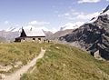
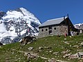
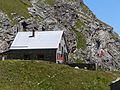
| Location | Valais, Switzerland | ||||
| Owned by | |||||
| Operator | |||||
| Inception |
| ||||
| Mountain range | |||||
| Elevation above sea level |
| ||||
| official website | |||||
 | |||||
![]() Switzerland
Switzerland ![]() Valais - 2.694 m ü. M.
Valais - 2.694 m ü. M.
Deutsch: SAC-Hütte im hinteren Zmutttal.
Media in category "Schönbielhütte"
The following 34 files are in this category, out of 34 total.
-
 13-Schönbiel-NW.jpg 4,240 × 2,832; 7.52 MB
-
 20090807 Dent d'Hérens.jpg 1,366 × 1,024; 1,001 KB
-
 CH-NB Photoglob-Wehrli EAD-WEHR-10762-B.tif 7,494 × 5,584, 2 pages; 79.88 MB
-
 Matterhorn Spiegelung Fenster Schönbielhütte.jpg 4,000 × 3,000; 4.7 MB
-
 Matterhorn through the window.jpg 1,280 × 853; 697 KB
-
 Morning at Schonbielhutte (5659836745).jpg 2,560 × 565; 262 KB
-
 Panorama Schönbielhütte.jpg 19,968 × 2,807; 13.89 MB
-
 Panoramic view near the Schönbielhütte (22269055104).jpg 16,011 × 3,923; 46.64 MB
-
 Panoramic view near the Schönbielhütte (22275776814).jpg 15,798 × 3,988; 47.87 MB
-
 Panoramic view near the Schönbielhütte (22519608407).jpg 18,090 × 3,746; 58.84 MB
-
 Panoramic view near the Schönbielhütte (22526721679).jpg 21,943 × 3,768; 69.37 MB
-
 Panoramic view near the Schönbielhütte (22842021246).jpg 15,625 × 4,031; 54.15 MB
-
 Panoramic view near the Schönbielhütte (22934591791).jpg 21,595 × 3,964; 78.37 MB
-
 Schönbiel.jpg 1,280 × 853; 473 KB
-
 Schönbielhütte (22481475952).jpg 5,184 × 3,456; 7.72 MB
-
 Schönbielhütte (22512208485).jpg 5,184 × 3,456; 6.04 MB
-
 Schönbielhütte 1943 Dia 350-096.jpg 5,396 × 3,486; 3.34 MB
-
 Schönbielhütte 2006.jpg 2,158 × 1,575; 1.87 MB
-
 Schönbielhütte 2015.jpg 4,000 × 3,000; 4.9 MB
-
 Schönbielhütte 2016 a.jpg 4,000 × 3,000; 4.59 MB
-
 Schönbielhütte Dent d’Hérens.jpg 4,000 × 3,000; 4.83 MB
-
 Schönbielhütte Gastraum.jpg 4,000 × 3,000; 4.72 MB
-
 Schönbielhütte Hüttenschild.jpg 4,000 × 3,000; 4.68 MB
-
 Schönbielhütte Matterhorn.jpg 4,000 × 3,000; 4.59 MB
-
 Schönbielhütte mit Terasse 2016.jpg 4,000 × 3,000; 4.67 MB
-
 Schönbielhütte mit Zmutt-Tal.jpg 4,000 × 3,000; 4.46 MB
-
 Schönbielhütte mit Zugangsweg.jpg 4,000 × 3,000; 4.73 MB
-
 Schönbielhütte Terrasse.jpg 4,000 × 3,000; 4.73 MB
-
 Schönbielhütte Zmuttgletscher.jpg 4,000 × 3,000; 4.55 MB
-
 Schönbielhütte über Zmutttal.jpg 4,000 × 3,000; 4.72 MB
-
 Schönbielhütte.JPG 2,816 × 2,112; 2.32 MB
-
 Tête Blanche (Swisstopo Landeskarte 50000 Blatt 283, 1968.tiff 1,510 × 1,221; 5.3 MB
-
 Zmuttgletscher Seitenmoräne Schönbielhütte.jpg 3,000 × 4,000; 4.7 MB
-
 Zmuttgletscher.jpg 12,103 × 2,587; 10.79 MB


.jpg)
.jpg)


.jpg)
.jpg)
.jpg)
.jpg)
.jpg)
.jpg)
.jpg)