Category:Scapa Flow
Jump to navigation
Jump to search
body of water in the Orkney Islands, Scotland, UK | |||||
| Upload media | |||||
| Instance of | |||||
|---|---|---|---|---|---|
| Location | Orkney Islands, Scotland | ||||
 | |||||
Subcategories
This category has the following 12 subcategories, out of 12 total.
B
- Barrel of Butter (2 F)
C
E
- Echna Loch (10 F)
G
- Grutter Sound (2 F)
R
- Rysa Sound (1 F)
S
W
- Water Sound (4 F)
- Scapa Flow in World War I (24 F)
Media in category "Scapa Flow"
The following 107 files are in this category, out of 107 total.
-
2018 07 12 Schottland (36).jpg 4,000 × 3,000; 4.6 MB
-
Admiralty Chart No 2180b Southern portion of the Orkney Islands, Scotland, Published 1886.jpg 11,787 × 8,260; 11.67 MB
-
Admiralty Chart No 2581 Long Hope and Widewall Harbour, Published 1858.jpg 10,100 × 6,644; 21.85 MB
-
Admiralty Chart No 2581 Scapa Flow and Approaches Southern Sheet, Published 1909.jpg 10,038 × 6,685; 26.32 MB
-
Admiralty Chart No 35 Scapa Flow Northern Part, Published 1944.jpg 16,338 × 11,204; 39.87 MB
-
Admiralty Chart No 3729 Scapa Flow and Approaches Northern Sheet, Published 1909.jpg 10,228 × 6,560; 28.92 MB
-
Alien arrival, edge of daylight - geograph.org.uk - 4752349.jpg 3,716 × 2,973; 4.96 MB
-
Blockship 'Inverlane' between Graemsay and Hoy - geograph.org.uk - 6446442.jpg 1,799 × 1,199; 386 KB
-
Blockship 'Inverlane' between Graemsay and Hoy - geograph.org.uk - 6446444.jpg 1,799 × 1,199; 398 KB
-
Calf of Cava - geograph.org.uk - 5815867.jpg 640 × 382; 215 KB
-
Cantick Head Lighthouse from the Orkney Ferry - geograph.org.uk - 5317332.jpg 2,000 × 1,333; 611 KB
-
Churchill Barriers (26259000377).jpg 2,789 × 2,014; 1.01 MB
-
Coastal fence - geograph.org.uk - 1299285.jpg 640 × 417; 107 KB
-
Coastal grassland by The Bu - geograph.org.uk - 3701141.jpg 3,872 × 2,592; 1.45 MB
-
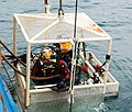
Commercial Divers - geograph.org.uk - 1490679.jpg 640 × 430; 88 KB
-
Concrete trough - geograph.org.uk - 1299327.jpg 640 × 420; 100 KB
-
Cutting equipment - geograph.org.uk - 1490707.jpg 640 × 533; 126 KB
-
Diver underwater - geograph.org.uk - 1490958.jpg 640 × 425; 45 KB
-
Diving control room - geograph.org.uk - 1491069.jpg 640 × 426; 80 KB
-
Emblem of HMS Royal Oak at a monument at Scapa Flow, 11.08.15.jpg 5,184 × 3,456; 14.07 MB
-
End of a long day creeling. - geograph.org.uk - 1710707.jpg 800 × 451; 191 KB
-
Entrance to Scapa Flow, from Cantick Head - geograph.org.uk - 3195307.jpg 1,600 × 1,066; 320 KB
-
Ferry traffic on the barrier - geograph.org.uk - 1710633.jpg 800 × 537; 224 KB
-
Final preparations - geograph.org.uk - 1490807.jpg 640 × 445; 88 KB
-
Flotta oil terminal across Scapa Flow - geograph.org.uk - 931811.jpg 640 × 480; 40 KB
-
German High Seas Fleet (16386011577).jpg 1,092 × 689; 365 KB
-
Geschützstand Stromness.jpg 618 × 450; 59 KB
-
Gill Bay and Lowertown - geograph.org.uk - 3483645.jpg 640 × 480; 46 KB
-
Going down - geograph.org.uk - 1490876.jpg 640 × 425; 63 KB
-
Gravel beach and east side of Outer Holm - geograph.org.uk - 1203159.jpg 640 × 427; 122 KB
-
Grey Atlantic seal on SPM No. 1, Scapa Flow, Orkney - geograph.org.uk - 4186980.jpg 3,000 × 2,250; 4.4 MB
-
Hitting the water - geograph.org.uk - 1490893.jpg 426 × 640; 73 KB
-
HMS Royal Oak Wreck Buoy - geograph.org.uk - 1491044.jpg 640 × 409; 61 KB
-
Houton Ferry to Hoy - panoramio.jpg 2,001 × 1,251; 2.05 MB
-
Hoxa Head, Scapa Flow defences - geograph.org.uk - 2474456.jpg 1,600 × 1,200; 470 KB
-
Illuminated Salmon breeding cages - geograph.org.uk - 2291199.jpg 2,816 × 2,112; 3.65 MB
-
Infiltración del U 47 en Scapa Flow.png 2,000 × 1,724; 290 KB
-
Inner Holmes from the Hamnavoe - geograph.org.uk - 359456.jpg 640 × 480; 92 KB
-
Kartskiss över Scapa flow.png 375 × 327; 15 KB
-
Kirby Morgan Superlite - geograph.org.uk - 1490773.jpg 640 × 425; 74 KB
-
Kitting up - geograph.org.uk - 1490799.jpg 640 × 425; 77 KB
-
Lane to Dyke-end - geograph.org.uk - 1077404.jpg 640 × 426; 50 KB
-
Looking across Scapa Bay - geograph.org.uk - 1265825.jpg 640 × 425; 95 KB
-
Mast of the block ship 'Emerald Wings' - geograph.org.uk - 4010048.jpg 480 × 640; 121 KB
-
Mid Taing, Scapa Bay - geograph.org.uk - 1267113.jpg 640 × 400; 122 KB
-
Ministry of Defence Salvage - geograph.org.uk - 1491098.jpg 439 × 640; 57 KB
-
Moorland near the Burn of Swartabeck - geograph.org.uk - 1247620.jpg 640 × 473; 110 KB
-
Ness Battery, Stromness, Orkney. Battery Observation Post.jpg 960 × 638; 144 KB
-
Northlink ferry in Scapa Flow - geograph.org.uk - 195810.jpg 640 × 480; 43 KB
-
Oil boom and barges - geograph.org.uk - 1490553.jpg 640 × 409; 67 KB
-
Ordnance Survey One-Inch Sheet 6 Orkney (Kirkwall), Published 1959.jpg 8,275 × 9,882; 8.34 MB
-
Ordnance Survey One-Inch Sheet 6 Orkney Islands (Mainland), Published 1948.jpg 13,958 × 10,689; 12.65 MB
-
Orkney Islands.jpg 859 × 996; 552 KB
-
Over the wreck - geograph.org.uk - 1490940.jpg 459 × 640; 63 KB
-
Pasture and tankers - geograph.org.uk - 1127375.jpg 640 × 425; 97 KB
-
Raft and blockship in Weddell Sound. - geograph.org.uk - 1510783.jpg 640 × 480; 126 KB
-
Rain shower over Scapa Flow - geograph.org.uk - 3699447.jpg 3,872 × 2,592; 1.01 MB
-
Raising the divers - geograph.org.uk - 1490611.jpg 640 × 543; 124 KB
-
Rock pool at Mid Taing - geograph.org.uk - 1242081.jpg 640 × 412; 90 KB
-
Royal Oak scapa.jpg 480 × 640; 148 KB
-
Royaloak.JPG 632 × 460; 73 KB
-
Scapa Flow - Churchill Barrier 1 - kingsley - 29-JUN-09.JPG 2,560 × 1,920; 1.07 MB
-
Scapa Flow - geograph.org.uk - 931817.jpg 640 × 480; 46 KB
-
Scapa Flow location.png 972 × 773; 690 KB
-
Scapa Flow RLH half size.png 512 × 329; 187 KB
-
Scapa Flow vessels - geograph.org.uk - 2884257.jpg 4,320 × 3,240; 4.9 MB
-
Scapa Flow(RLH).png 3,506 × 2,251; 2.52 MB
-
Scapa Flow, British pottery shard (RLH).JPG 1,712 × 2,288; 1.91 MB
-
Scapa Flow, German pottery shard (RLH).JPG 1,832 × 1,636; 1.71 MB
-
Scapa Flow.jpg 1,024 × 799; 139 KB
-
Scapa Flow.svg 711 × 622; 346 KB
-
Scapaflow.JPG 620 × 443; 38 KB
-
German battlecruisers steaming to Scapa (cropped).jpg 5,520 × 2,250; 1.69 MB
-
German battlecruisers steaming to Scapa.jpg 5,528 × 4,232; 2.44 MB
-
Seydlitz steams to Scapa (cropped).jpg 5,630 × 2,360; 2.31 MB
-
Seydlitz steams to Scapa.jpg 5,732 × 4,106; 3.64 MB
-
Skalpaflói.svg 878 × 910; 87 KB
-
SPM No. 1 and Grey Atlantic seal, Scapa Flow, Orkney - geograph.org.uk - 4186958.jpg 3,264 × 2,176; 4.4 MB
-
SPM No. 1, Scapa Flow, Orkney - geograph.org.uk - 4186941.jpg 3,264 × 2,176; 4.93 MB
-
Sub-Lieutenant H V Bartlett (6279267487).jpg 558 × 800; 49 KB
-
Sunset over The Empire Seaman - geograph.org.uk - 1710725.jpg 800 × 532; 217 KB
-
Sunset, towards Hoy - geograph.org.uk - 854659.jpg 640 × 426; 50 KB
-
Tankers in Scapa Flow - Mainland Orkney - kingsley - 29-JUN-09.JPG 2,560 × 1,920; 771 KB
-
The bay of Scapa Flow.jpg 5,184 × 3,456; 8.9 MB
-
The deck of the Cameron - geograph.org.uk - 1490749.jpg 425 × 640; 86 KB
-
The diving lift - geograph.org.uk - 1490629.jpg 415 × 640; 69 KB
-
The Josine - geograph.org.uk - 1490970.jpg 454 × 640; 76 KB
-
The Lash Skerry - geograph.org.uk - 2296196.jpg 4,000 × 3,000; 5.52 MB
-
The Pentalina - geograph.org.uk - 3264269.jpg 1,500 × 906; 961 KB
-
The Tongue of Gangsta - geograph.org.uk - 1127334.jpg 640 × 425; 108 KB
-
The wake of the Pentalina - geograph.org.uk - 4474622.jpg 640 × 480; 367 KB
-
The wake of the Pentalina - geograph.org.uk - 4475059.jpg 640 × 480; 356 KB
-
Torpedo net, Scapa Flow museum.jpg 3,000 × 4,000; 5.96 MB
-
Track to Lint Brae - geograph.org.uk - 1077363.jpg 640 × 426; 67 KB
-
U-47 raid.svg 725 × 625; 356 KB
-
View south-west from Hurtiso, Mainland, Orkney - geograph.org.uk - 3341443.jpg 1,600 × 1,066; 176 KB
-
What it's all about - geograph.org.uk - 1490926.jpg 640 × 425; 33 KB


