Category:Saxton’s Atlas of England and Wales
Jump to navigation
Jump to search
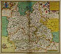
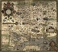
Images from editions of Christopher Saxton’s Atlas of England and Wales, completed in 1579.
Subcategories
This category has the following 2 subcategories, out of 2 total.
Media in category "Saxton’s Atlas of England and Wales"
The following 72 files are in this category, out of 72 total.
-
Cornwall - Christopher Saxton, 1579, 5 - BL.jpg 1,469 × 1,166; 939 KB
-
Anglia Atlas.jpg 8,614 × 6,888; 22.85 MB
-
Anglia Atlas.tif 8,614 × 6,888; 108.12 MB
-
Bodleian Libraries, Oxonia, Buckinghamia et Berceriae Comitatuum.jpg 1,000 × 675; 173 KB
-
Cantium southsexia surria meddlesexia Atlas.jpg 9,709 × 7,301; 25.19 MB
-
Cantium Southsexia Surria Meddlesexia Atlas.tif 9,709 × 7,301; 125.25 MB
-
Cestria Atlas.jpg 9,211 × 7,118; 21.19 MB
-
Cestria Atlas.tif 9,211 × 7,118; 105.91 MB
-
Derbia Atlas.jpg 8,908 × 7,175; 18.74 MB
-
Derbia Atlas.tif 8,908 × 7,175; 98.15 MB
-
Devon - Christopher Saxton, 1579, 10 - BL.jpg 906 × 712; 326 KB
-
Dunelmensis Atlas.jpg 8,829 × 6,810; 22.93 MB
-
Dunelmensis Atlas.tif 8,829 × 6,810; 106.76 MB
-
Eboracum Atlas.jpg 15,002 × 11,151; 49.82 MB
-
Eboracum Atlas.tif 15,002 × 11,151; 264.99 MB
-
Essexia Atlas.jpg 9,455 × 7,397; 24.88 MB
-
Essexia Atlas.tif 9,455 × 7,397; 122.92 MB
-
Glocestria Atlas.jpg 8,969 × 7,013; 18.95 MB
-
Glocestria Atlas.tif 8,969 × 7,013; 99.03 MB
-
Hardtfordia Atlas.jpg 9,386 × 7,217; 19.8 MB
-
Hardtfordia Atlas.tif 9,386 × 7,217; 104.44 MB
-
Herefordia Atlas.jpg 9,141 × 6,845; 19.54 MB
-
Herefordia Atlas.tif 9,141 × 6,845; 101.25 MB
-
Lancastria Atlas.jpg 8,729 × 7,218; 21.42 MB
-
Lancastria Atlas.tif 8,729 × 7,218; 104.54 MB
-
Lincolnia nottinghamia Atlas.jpg 9,603 × 7,334; 24.11 MB
-
Lincolnia Nottinghamia Atlas.tif 9,603 × 7,334; 117.47 MB
-
Monumetha Atlas.jpg 8,781 × 7,088; 19.74 MB
-
Monumetha Atlas.tif 8,781 × 7,088; 100.12 MB
-
Norfolcia Atlas.jpg 9,036 × 6,225; 19.26 MB
-
Norfolcia Atlas.tif 9,036 × 6,225; 94.78 MB
-
Northamptonia Bedfordia Cantabrigia Huntingdonia Rutlandia Atlas.jpg 9,466 × 7,180; 22.52 MB
-
Northamptonia Bedfordia Cantabrigia Huntingdonia Rutlandia Atlas.tif 9,466 × 7,180; 114.46 MB
-
Northumbria Atlas.jpg 8,511 × 7,044; 22.08 MB
-
Northumbria Atlas.tif 8,511 × 7,044; 107.48 MB
-
Oxonium Buckinghamia Berceria Atals.jpg 8,093 × 7,133; 19.78 MB
-
Oxonium Buckinghamia Berceria.tif 8,093 × 7,133; 99.48 MB
-
Penbrok Atlas.jpg 8,455 × 6,399; 20.57 MB
-
Penbrok Atlas.tif 8,455 × 6,399; 93.51 MB
-
Salopia Atlas.jpg 9,233 × 7,066; 21.01 MB
-
Salopia Atlas.tif 9,233 × 7,066; 106.09 MB
-
Saxton Anglesey.jpg 762 × 567; 161 KB
-
Saxton Anglia State II.jpg 1,000 × 772; 173 KB
-
Saxton Brecknock Cardigan Carmarthen Radnor.jpg 769 × 605; 174 KB
-
Saxton Denbigh and Flint.jpg 761 × 573; 117 KB
-
Saxton Glamorgan.jpg 783 × 533; 173 KB
-
Saxton Monmouth.jpg 763 × 609; 138 KB
-
Saxton Montgomery.jpg 769 × 582; 164 KB
-
Saxton Norfolk map Stage II 1583.jpg 4,125 × 2,880; 2.68 MB
-
Saxton pamberforest.jpg 488 × 266; 173 KB
-
Saxton Pembroke.jpg 771 × 584; 151 KB
-
Saxton Somerset uncoloured 1579.jpg 3,000 × 2,339; 1.34 MB
-
Saxton's Frontispiece.jpg 1,000 × 1,536; 605 KB
-
Saxton's Hampshire 1575.jpg 2,609 × 2,354; 1.69 MB
-
Saxton's map of Southamptonshire.jpg 1,536 × 1,140; 621 KB
-
Saxton's Map of Suffolk 1575.jpg 7,759 × 5,786; 9.85 MB
-
Saxton-Kip map of Essex 1607.jpg 2,000 × 1,591; 2.61 MB
-
Saxton’s Proof Map of Wales.jpg 4,830 × 5,895; 9.89 MB
-
Sc Saxton Wiltonia.jpg 8,394 × 7,399; 18.8 MB
-
Southamptonia Atlas.jpg 8,052 × 7,201; 20.6 MB
-
Staffordia Atlas.jpg 9,013 × 7,023; 17.99 MB
-
Suffolcia Atlas.jpg 8,840 × 6,187; 20.63 MB
-
Westmorlandia Cumberlandia Atlas.jpg 8,880 × 7,001; 23.35 MB
-
Westmorlandia Cumberlandia Atlas.tif 8,880 × 7,001; 110.45 MB
-
Wigornia Atlas.jpg 8,989 × 6,811; 18.03 MB
-
Wigornia Atlas.tif 8,989 × 6,811; 94.59 MB


