Category:Satellite pictures of thunderstorms
Jump to navigation
Jump to search
Subcategories
This category has the following 4 subcategories, out of 4 total.
A
I
- ISS thunderstorm pictures (47 F)
Media in category "Satellite pictures of thunderstorms"
The following 45 files are in this category, out of 45 total.
-
2010 wet season cloud over colombia.jpg 4,256 × 2,832; 703 KB
-
20203231600-20203240010-GOES16-ABI-MEX-13-1000x1000.gif 1,000 × 1,000; 14.81 MB
-
2022 Antananarivo floods 2022-1-19.png 788 × 684; 830 KB
-
40723Z IRsat.jpg 926 × 904; 137 KB
-
6 May 1989 infrared imagery.gif 720 × 540; 93 KB
-
Air Asia QZ8501 Flight Path and Satellite Imagery.jpg 960 × 660; 300 KB
-
April 14, 2011 tornado outbreak satellite.png 939 × 831; 947 KB
-
ATS-3 satellite images of Lubbock thunderstorm on 1970-05-11.png 958 × 240; 217 KB
-
Canadianderecho2022.jpg 2,760 × 2,760; 1.28 MB
-
Cloud Towers.jpg 1,800 × 1,400; 423 KB
-
Convection over Caribbean 2022-05-22 1510Z.png 298 × 461; 100 KB
-
Crepuscular Rays, India - NASA Earth Observatory.jpg 720 × 480; 81 KB
-
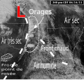
Dry line satellite description fr.svg 350 × 330; 166 KB
-
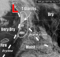
Dry line satellite description.png 350 × 330; 89 KB
-
Eastern US tornado outbreak Dec 23 2015 1415 UTC.jpg 2,048 × 1,152; 322 KB
-
GOESLightning130622.webm 5.0 s, 500 × 400; 757 KB
-
Imagemsatclima.gif 512 × 384; 1.19 MB
-
Large thunderstorms probably over the Central United States plains (2268-414).jpg 2,000 × 1,345; 297 KB
-
Maystorms.gif 500 × 333; 3.7 MB
-
Maystormsavn.gif 720 × 480; 3.56 MB
-
Maytstorms5m5a1132z-1715z.gif 500 × 382; 4.2 MB
-
NNVL - Tornado Outbreak AVHRR 2012-03-02.png 1,920 × 1,080; 1.74 MB
-
NNVL - Tornado Outbreak Visible 2012-03-02 1515z.png 1,920 × 1,080; 11.55 MB
-
NOAA MTSAT Indonesia 12282014 0032z Cropped.jpg 599 × 422; 91 KB
-
S65-18752 Clouds over Madagascar on Earth.jpg 1,950 × 1,799; 154 KB
-
Satellite Video Captures a Week of Severe Weather (8804162370).jpg 960 × 540; 45 KB
-
Satellite View of Moore, Oklahoma (8791126794).jpg 864 × 720; 95 KB
-
Scattered Thunderstorms over Hainan island 2012 5 21.jpg 2,037 × 2,267; 686 KB
-
September 21, 2009 southeast US floods & storms.jpg 2,000 × 1,288; 3.19 MB
-
Severe thunderstorms over the Midwest and Great Lakes on August 11, 2021.jpg 2,400 × 2,400; 4.45 MB
-
Southeast US severe weather outbreak 2020-04-12 2156z.jpg 2,464 × 1,804; 6.82 MB
-
SPC Mesoscale Discussion 0390.jpg 1,024 × 768; 229 KB
-
SPC Mesoscale Discussion 0392.jpg 1,024 × 768; 221 KB
-
Super Outbreak 1974-04-03 21GMT Analyse.PNG 1,119 × 839; 352 KB
-
Supercells associated with major storm system 2017-04-29 2330Z.jpg 680 × 644; 125 KB
-
Supercells in the February 28–March 1, 2017 tornado outbreak 2215Z.png 960 × 540; 358 KB
-
Thunderstorm cell near Caribbean coast of Panama - radar image by TerraSAR-X.jpg 709 × 2,461; 1.71 MB
-
Thunderstorms over Estonia on a Copernicus Sentinel-1 synthetic aperture radar image.jpg 8,565 × 6,244; 23.32 MB
-
Thunderstorms-Philippines.jpg 6,194 × 7,420; 7.14 MB
-
Wakelowimage zoom.png 409 × 442; 249 KB
-
Wakelowimage.JPG 670 × 734; 480 KB


