Category:Satellite pictures of the Río de la Plata
Jump to navigation
Jump to search
Media in category "Satellite pictures of the Río de la Plata"
The following 17 files are in this category, out of 17 total.
-
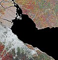
Earth from Space- Río de la Plata ESA25028060.jpg 6,471 × 6,642; 33.55 MB
-
Earth from Space- Río de la Plata ESA25028060.tiff 12,941 × 13,283; 491.82 MB
-
Inundaciones en Argentina Argentina.A2003128.1420.721.250m.jpg 4,000 × 5,200; 4.47 MB
-
Isla Martin Garcia NWW.png 1,024 × 768; 385 KB
-
ISS006-E-17940 - View of Uruguay.jpg 3,032 × 2,064; 730 KB
-
PlataRiver WFIAM1 20211027 037 021 L4 BAND4321.png 2,241 × 1,683; 8.22 MB
-
Rio de la Plata Cuenca.png 600 × 780; 1.09 MB
-
Rio de la Plata NASA image.jpg 2,852 × 2,192; 3.92 MB
-
Rio ibicui marcado con celeste.PNG 691 × 786; 1.07 MB
-
Río de la Plata (MODIS 2020-05-01).jpg 3,286 × 2,556; 1,013 KB
-
Sediment in the Río de la Plata (MODIS 2022-03-13).jpg 2,302 × 1,798; 574 KB
-
Sediment in the Río de La Plata - NASA Earth Observatory.jpg 720 × 480; 89 KB
-
Southern South America - November 13, 2013.jpg 7,200 × 9,400; 13.42 MB
-
Uruguay (4690803887).jpg 3,600 × 4,600; 2.44 MB
-
Uruguay T2.png 691 × 786; 1.18 MB
-
UruguayA200436614001km.jpg 1,100 × 850; 314 KB


