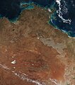
Category:Satellite pictures of the Northern Territory
Jump to navigation
Jump to search
States of Australia: New South Wales · Queensland · South Australia · Tasmania · Victoria · Western Australia
Internal territories of Australia: Northern Territory
External territories of Australia: Ashmore and Cartier Islands ·
Internal territories of Australia: Northern Territory
External territories of Australia: Ashmore and Cartier Islands ·
Subcategories
This category has the following 3 subcategories, out of 3 total.
Media in category "Satellite pictures of the Northern Territory"
The following 69 files are in this category, out of 69 total.
-
Amadeus Basin Australia.jpg 1,920 × 1,378; 1.11 MB
-
Australian Outback - 2.jpg 5,568 × 3,712; 4.46 MB
-
Australian outback - Australische Outback.jpg 5,568 × 3,712; 3.91 MB
-
Australian outback Australische Outback (45453075235).jpg 5,568 × 3,712; 4.23 MB
-
Australian Outback.jpg 5,568 × 3,712; 3.53 MB
-
Bickerton Island.jpg 3,032 × 2,008; 1.51 MB
-
ChannelCountryFloodingAfterNASA.jpg 5,722 × 5,696; 8.19 MB
-
ChannelCountryFloodingBeforeNASA.jpg 5,722 × 5,696; 7.12 MB
-
Clarence Strait (Australia).jpg 19,808 × 10,980; 20.16 MB
-
Clarence Strait, Australia ESA19709551.tiff 19,808 × 10,980; 622.27 MB
-
Darwin Australia.jpg 4,148 × 2,251; 4.18 MB
-
Earth from Space- Northern Territory, Australia ESA501645.jpg 2,080 × 1,426; 1.93 MB
-
Earth from Space- Northern Territory, Australia ESA501645.tiff 16,000 × 10,963; 474.4 MB
-
Fires in Australia's Northern Territory (MODIS 2020-05-31).jpg 3,286 × 2,537; 1.07 MB
-
Fires in Australia's Northern Territory (MODIS).jpg 4,724 × 3,450; 1.26 MB
-
Fires in Northern Territory, Australia.jpg 4,800 × 6,000; 5.78 MB
-
Folklore and Science Meet at Tiwi.jpeg 6,365 × 6,551; 5.35 MB
-
Gosses Bluff Crater, Australia.jpg 2,048 × 1,280; 1.01 MB
-
Gosses Bluff Northern Territory Australia.jpg 1,091 × 817; 603 KB
-
Goyder crater.jpg 799 × 607; 142 KB
-
Groote eylandt.jpg 3,899 × 3,907; 10.83 MB
-
GT-12 - EARTH SKY - WESTERN AUSTRALIA (s66-54928).jpg 4,290 × 4,272; 2.46 MB
-
Kata Tjuta, Northern Territory, Australia.JPG 4,256 × 2,824; 11.65 MB
-
LANDSAT New Year Island NT.png 502 × 248; 218 KB
-
Megan Makes Landfall in Northern Territory (MODIS 2024-03-19).jpg 6,331 × 4,898; 2.8 MB
-
NASA 2000-Elcho Island.jpg 972 × 583; 397 KB
-
Northern Territory (MODIS 2018-07-30).jpg 6,547 × 7,403; 3.67 MB
-
Northern Territory, Alice Springs 4992, Australia (2024-01-13-13-53-58 UMBRA-08).tiff 4,529 × 4,529, 5 pages; 30 MB
-
Northern Territory, MacDonnell Ranges (MODIS 2018-06-04).jpg 3,979 × 2,839; 1.31 MB
-
NT small bushfires July 2019.jpg 1,920 × 1,080; 1.45 MB
-
Sand Texture, Australia.jpg 2,048 × 1,280; 623 KB
-
Simpson-Desert-2007-12-16-NASA.jpg 540 × 540; 77 KB
-
Sir Edward Pellew Islands-Landsat 2000 (cropped Centre Island).PNG 265 × 265; 134 KB
-
Sir Edward Pellew Islands-Landsat 2000.PNG 1,365 × 696; 2.21 MB
-
STS007-19-909 - View of the Northern Territory (Raw scan).tif 4,393 × 4,600; 57.82 MB
-
STS007-19-909 - View of the Northern Territory.jpg 4,393 × 4,600; 1,016 KB
-
STS007-19-910 - View of the Northern Territory (Raw scan).tif 4,393 × 4,600; 57.82 MB
-
STS007-19-910 - View of the Northern Territory.jpg 4,393 × 4,600; 1.07 MB
-
STS007-19-911 - View of the Northern Territory (Raw scan).tif 4,393 × 4,600; 57.82 MB
-
STS007-19-911 - View of the Northern Territory.jpg 4,393 × 4,600; 1.02 MB
-
STS007-5-306 - View of the Northern Territory (Raw scan).tif 4,393 × 4,600; 57.82 MB
-
STS007-5-306 - View of the Northern Territory.jpg 4,393 × 4,600; 1.34 MB
-
STS112-E-5465 - View of the Northern Territory.jpg 3,032 × 2,064; 1.31 MB
-
STS112-E-5466 - View of the Northern Territory.jpg 3,032 × 2,064; 1.16 MB
-
STS131-E-12010 - View of the Northern Territory.jpg 4,256 × 2,913; 1.6 MB
-
STS131-E-12011 - View of the Northern Territory.jpg 4,256 × 2,913; 1.57 MB
-
STS131-E-12012 - View of the Northern Territory.jpg 4,256 × 2,913; 1.54 MB
-
STS131-E-12013 - View of the Northern Territory.jpg 4,256 × 2,913; 1.5 MB
-
STS131-E-12014 - View of the Northern Territory.jpg 4,256 × 2,913; 1.49 MB
-
STS131-E-12015 - View of the Northern Territory.jpg 4,256 × 2,913; 1.46 MB
-
STS131-E-12016 - View of the Northern Territory.jpg 4,256 × 2,913; 1.4 MB
-
STS131-E-12017 - View of the Northern Territory.jpg 4,256 × 2,913; 1.36 MB
-
STS131-E-12018 - View of the Northern Territory.jpg 4,256 × 2,913; 1.3 MB
-
STS131-E-12019 - View of the Northern Territory.jpg 4,256 × 2,913; 1.26 MB
-
STS131-E-12020 - View of the Northern Territory.jpg 4,256 × 2,913; 1.2 MB
-
STS131-E-12021 - View of the Northern Territory.jpg 4,256 × 2,913; 1.15 MB
-
STS131-E-12022 - View of the Northern Territory.jpg 4,256 × 2,913; 1.11 MB
-
STS131-E-12023 - View of the Northern Territory.jpg 4,256 × 2,913; 1.08 MB
-
STS131-E-12024 - View of the Northern Territory.jpg 4,256 × 2,913; 1.03 MB
-
STS131-E-12025 - View of the Northern Territory.jpg 4,256 × 2,913; 1 MB
-
STS131-E-12026 - View of the Northern Territory.jpg 4,256 × 2,913; 995 KB
-
STS131-E-12027 - View of the Northern Territory.jpg 4,256 × 2,913; 979 KB
-
STS131-E-12028 - View of the Northern Territory.jpg 4,256 × 2,913; 954 KB
-
Uluru (Satellite picture) - 2.jpg 5,568 × 3,712; 4.53 MB
-
Uluru (Satellite picture).jpg 5,568 × 3,712; 3.93 MB
-
Uluru from above Iss049e010638 lrg.jpg 4,928 × 3,280; 4.83 MB
-
Uluru-Ayers Rock ESA344652.jpg 1,920 × 1,171; 2.6 MB
-
Vernon Islands (Australia).jpg 2,893 × 3,040; 1.27 MB


