Category:Satellite pictures of the Arctic
Jump to navigation
Jump to search
Subcategories
This category has the following 6 subcategories, out of 6 total.
C
G
I
J
R
S
Media in category "Satellite pictures of the Arctic"
The following 38 files are in this category, out of 38 total.
-
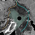
2007 Envisat mosaic of Arctic Ocean ESA210015.jpg 2,700 × 2,700; 1.69 MB
-
2007 Envisat mosaic of Arctic Ocean ESA210015.tiff 2,700 × 2,700, 2 pages; 20.93 MB
-
A Snapshot of Sea Ice (4989578009).jpg 1,280 × 720; 523 KB
-
A Snapshot of Sea Ice (4989578009)a.jpg 860 × 645; 386 KB
-
Alexandra Land and Prince George Land, Arctic Ocean.jpg 3,508 × 2,540; 1.91 MB
-
Approaching the 2015 Arctic Sea Ice Minimum (21327324915).jpg 1,920 × 1,080; 131 KB
-
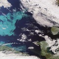
Arctic bloom ESA215884.tiff 2,239 × 2,239; 11.76 MB
-
Arctic bloom.jpg 2,239 × 2,239; 1.54 MB
-
Arctic ice cover June-August 2008.gif 2,650 × 2,650; 17.13 MB
-
Arctic Ocean swirls ESA229045.tiff 2,680 × 2,680; 19.29 MB
-
Arctic Ocean swirls.jpg 2,680 × 2,680; 4.8 MB
-
2015 Arctic Sea Ice Maximum Annual Extent Is Lowest On Record (16678054090).jpg 1,024 × 576; 144 KB
-
Arctic Sea Ice - September 2009 to March 2010 (4497233026).jpg 6,400 × 3,600; 15.76 MB
-
Arctic Sea Ice - September 2009 to March 2010 (HD VIDEO) (4497218048).jpg 1,280 × 720; 479 KB
-
Arctic sea ice loss animation.gif 361 × 252; 850 KB
-
Arctic sea ice on 14 August ESA22194224.jpeg 3,670 × 3,203; 2.86 MB
-
Arctica surface.jpg 978 × 941; 111 KB
-
Beringia copy.png 469 × 241; 167 KB
-
Drifting Ice Plates, Arctic Sea (50095907833).png 10,797 × 5,893; 132.08 MB
-
ESTCube-1 orbiting our colourful planet.jpg 3,000 × 1,688; 3.38 MB
-
Greenland Sea Ice.jpg 2,048 × 1,280; 1.05 MB
-
Monitoring the Arctic during Polar Darkness (8246888979).jpg 3,377 × 3,443; 2.51 MB
-
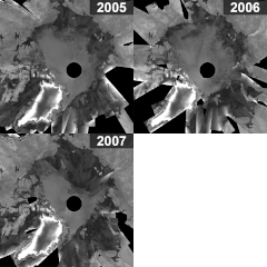
Mosaics of Arctic Ocean for 2005, 2006, 2007 ESA201174.gif 600 × 600; 927 KB
-
NASA Monitoring of Arctic ice 2016.jpg 3,840 × 2,160; 1.85 MB
-
NASA Satellites See Santa's North Pole (5909841424).jpg 6,144 × 6,144; 9.64 MB
-
NASA seaice 1979 lg.jpg 2,560 × 1,920; 2.31 MB
-
NASA seaice 2005 lg.jpg 2,560 × 1,920; 2.29 MB
-
Northpole modis big.jpg 1,423 × 1,391; 1.01 MB
-
Open Northern Sea Route ESA217457.jpg 1,280 × 1,280; 1,017 KB
-
Open Northern Sea Route ESA217457.tiff 2,500 × 2,500; 16.6 MB
-
Open water lead above Canada, Arctic Ocean (8782057685).jpg 8,000 × 6,200; 4.55 MB
-
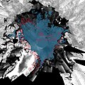
Sea-ice coverage in Aug 2008 and Sept 2007 minimum.jpg 2,000 × 2,000; 1.61 MB
-
Sea-ice coverage in Aug 2008 and Sept 2007 minumum ESA234197.tiff 2,000 × 2,000; 5.69 MB
-
Sunny Skies over the Arctic in Late June 2010 (cropped).jpg 531 × 243; 112 KB
-
Sunny Skies over the Arctic in Late June 2010.jpg 3,072 × 3,072; 4.35 MB
-
The Top of the World (MODIS 2019-04-22).jpg 7,355 × 5,621; 7.28 MB
-
Three views of The Top of the World (MODIS 2020-05-06).jpg 7,810 × 5,986; 6.87 MB
-
Top of the World (MODIS 2019-08-05).jpg 6,639 × 5,376; 12.13 MB


