Category:Satellite pictures of lakes of Japan
Jump to navigation
Jump to search
Media in category "Satellite pictures of lakes of Japan"
The following 15 files are in this category, out of 15 total.
-
Hachirogata Akita Japan SRTM outlined.jpg 681 × 672; 364 KB
-
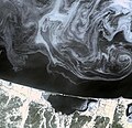
Ice floes of Hokkaido PIA12056.jpg 3,900 × 3,764; 1.69 MB
-
Kasumigaura landsat (cropped).jpg 670 × 456; 74 KB
-
Kasumigaura landsat.jpg 1,024 × 768; 167 KB
-
Lake biwa.jpg 1,024 × 1,399; 176 KB
-
Lake hamana landsat.jpg 903 × 712; 158 KB
-
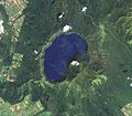
Lake masyu landsat.jpg 644 × 563; 80 KB
-
Lake Shumarinai Landsat 01.jpg 2,326 × 1,745; 2.84 MB
-
Lake syunkusitakara landsat.jpg 1,024 × 1,064; 643 KB
-
Lake towada landsat.jpg 608 × 614; 99 KB
-
Landsat image of Fuji-go-ko.jpg 1,118 × 521; 197 KB
-
LandsatView - Aomori, Goshogawara, Jusan lake april 2014.JPG 859 × 699; 74 KB
-
Oga Peninsula and Hachirogata Akita Japan SRTM.jpg 681 × 672; 103 KB
-
Shiga jpn nasa.jpg 3,032 × 2,007; 1.07 MB
-
Shiga satellite view.jpg 639 × 435; 341 KB


