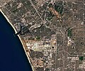
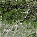
Category:Satellite pictures of Los Angeles
Jump to navigation
Jump to search
English: Satellite pictures of Los Angeles
Español: Imágenes de satélite de Los Ángeles
Media in category "Satellite pictures of Los Angeles"
The following 55 files are in this category, out of 55 total.
-
Los Angeles Basin JPLLandsat.jpg 3,000 × 2,063; 931 KB
-
Los Angeles satellite map.jpg 576 × 854; 87 KB
-
1994 Metromedia Square USGS DOQQ outline.jpg 1,104 × 736; 243 KB
-
1994 Metromedia Square USGS DOQQ.jpg 1,104 × 736; 242 KB
-
430 Megapixels of L A as seen from the ISS (51169641003).jpg 19,279 × 22,403; 198.03 MB
-
Aftermath of Griffith Park Fire.jpg 489 × 489; 439 KB
-
California in flames ESA387826.jpg 4,351 × 3,036; 4.54 MB
-
Catalina Eddy 2013-02-17.jpg 2,625 × 3,112; 3.01 MB
-
Crypto Arena (2023-05-06-18-06-17 UMBRA-05, Los).tiff 10,028 × 10,028, 6 pages; 134.76 MB
-
Crypto Arena (2023-05-08-04-55-48 UMBRA-04, Los).tiff 6,991 × 6,990, 5 pages; 66.51 MB
-
ELA COMPLEX.jpg 658 × 646; 538 KB
-
Forum Arena satellite view.png 992 × 653; 997 KB
-
Hollywood Bowl 22Aug2017 SkySat (cropped).jpg 220 × 294; 26 KB
-
Hollywood Bowl 22Aug2017 SkySat.jpg 822 × 647; 196 KB
-
ISS-40 Los Angeles basin.jpg 4,288 × 2,848; 2.13 MB
-
ISS-61 Los Angeles, California at night.jpg 5,568 × 3,712; 3.69 MB
-
ISS-65 Marina Del Rey, Los Angeles, California.jpg 5,568 × 3,712; 4.43 MB
-
ISS-65 Terminal Island and Long Beach, Los Angeles, California.jpg 5,568 × 3,712; 4.41 MB
-
ISS027-E-7971 - View of Los Angeles.jpg 4,288 × 2,929; 1.12 MB
-
ISS060-E-3679 - View of Mexico.jpg 5,568 × 3,712; 3.84 MB
-
Iss069e032998.jpg 5,568 × 3,712; 5.87 MB
-
Iss070e103326.jpg 5,568 × 3,712; 4.16 MB
-
LA und San Diego 2 NASA World Wind Globe.jpg 1,600 × 1,050; 1.38 MB
-
LA und San Diego NASA World Wind Globe.jpg 1,600 × 1,050; 1.12 MB
-
Los Angeles (ASTER).jpg 4,376 × 4,820; 5.82 MB
-
Los Angeles - Long Beach Harbors, CA (ASTER).jpg 2,490 × 1,120; 327 KB
-
Los Angeles by Sentinel-2, 2019-03-30.jpg 6,104 × 8,088; 53.84 MB
-
Los Angeles from Earth orbit, New Years Day.jpeg 1,020 × 676; 319 KB
-
Los Angeles International Airport satellite view.png 992 × 653; 1.35 MB
-
Los Angeles JPLLandsat.jpg 4,475 × 1,896; 1.82 MB
-
Los Angeles Metropolitan Area by Sentinel-2, 2019-03-30 (big version).jpg 19,483 × 24,238; 477.11 MB
-
Los Angeles Metropolitan Area by Sentinel-2, 2019-03-30 (small version).jpg 9,743 × 12,123; 116.99 MB
-
Los Angeles S2A MSI 432 crop 10 (27885524742).jpg 5,597 × 7,120; 33.75 MB
-
Los Angeles tiny eddy.jpg 420 × 420; 56 KB
-
Los Angeles, United States (7651359516).jpg 946 × 710; 84 KB
-
Losangeles oli2 2022038 annotated.jpg 720 × 600; 383 KB
-
Losangeles oli2 2022038 lrg.jpg 1,161 × 968; 883 KB
-
LosAngeles WFI AMZ1 20210702 051 009 L2 BAND321.png 1,463 × 975; 2.47 MB
-
LosAngeles WFI AMZ1 20210702 051 009 L2 BAND4321.tiff 6,045 × 4,021; 185.47 MB
-
Nasawinds geocover scf.png 1,024 × 702; 837 KB
-
PIA24902 - Backup at Ports of LA and Long Beach.jpg 1,702 × 1,525; 352 KB
-
PIA24902 - Backup at Ports of LA and Long Beach.tif 1,702 × 1,525; 6.25 MB
-
San Bernardino by Sentinel-2, 2019-03-30.jpg 3,489 × 2,797; 13.37 MB
-
San Clemente Island by Sentinel-2, 2019-03-30.jpg 2,901 × 3,049; 8.92 MB
-
San Gabriel Complex Fires, California by Planet Labs.jpg 2,711 × 2,033; 1.32 MB
-
San Pedro by satellite.png 1,024 × 688; 931 KB
-
SanGabrielRiverCA ASTER 2005jan23.jpg 540 × 540; 132 KB
-
Santa Ana winds - satellite image.jpg 1,470 × 1,701; 327 KB
-
Santa Catalina Island (California) by Sentinel-2, 2019-03-30.jpg 3,390 × 2,441; 5.55 MB
-
Santa Catalina with Santa Clemente by Sentinel-2, 2019-03-30.jpg 5,747 × 9,598; 38.65 MB
-
Santa Monica Bay Map.jpg 468 × 597; 283 KB
-
Santa Monica Mtns web.jpg 721 × 418; 279 KB
-
Santacatalinaisland.jpg 654 × 552; 326 KB
-
Satellite Image of Los Angeles from Sentinel-2 2021-08-03.jpg 1,377 × 780; 515 KB
-
Marina-del-rey.jpg 1,213 × 826; 266 KB


