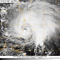
Category:Satellite pictures of Hurricane Tomas
Jump to navigation
Jump to search
Media in category "Satellite pictures of Hurricane Tomas"
The following 18 files are in this category, out of 18 total.
-
05 November 2010 Hurricane Tomas 2010.jpg 1,800 × 2,363; 1.45 MB
-
21L TOMAS 10 30 10 1715 UTC.jpg 1,024 × 1,024; 184 KB
-
Aqua Terra satellite image of Hurricane Tomas. October 30, 2010.jpg 677 × 1,015; 191 KB
-
Hurricane Tomas 2010-10-30 1429Z.jpg 7,200 × 5,600; 6.11 MB
-
Hurricane Tomas carib 10-30.jpg 1,599 × 924; 769 KB
-
Invest91L october29.jpg 494 × 374; 54 KB
-
Tomas 2010-10-30 1735Z.jpg 5,600 × 7,200; 22.64 MB
-
Tomas 2010-10-31 0545Z.png 1,964 × 2,064; 4.38 MB
-
Hurricane Tomas 2010-11-05 1530Z.jpg 6,400 × 8,400; 6.3 MB
-
Tomas nov 2 2010 1445Z.jpg 1,920 × 1,080; 2.06 MB
-
Tomas nov 4 2010 1445Z.jpg 1,920 × 1,080; 2.25 MB
-
Tomas nov 5 2010.jpg 2,000 × 1,500; 725 KB
-
Tomas nov 6 2010.jpg 4,377 × 7,369; 3.6 MB
-
Tomas oct 29 2010 1445Z.jpg 1,500 × 1,500; 2.28 MB
-
Tomas Oct 30 2010.png 1,460 × 1,798; 4.08 MB
-
Tomas Visible pic.jpg 720 × 480; 69 KB
-
Tomas-hurricane.jpg 600 × 337; 94 KB
-
Tomas11052010.ogv 2.4 s, 320 × 240; 345 KB


