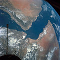
Category:Satellite pictures of Bab-el-Mandeb
Jump to navigation
Jump to search
Media in category "Satellite pictures of Bab-el-Mandeb"
The following 19 files are in this category, out of 19 total.
-
Bab al-Mandab Strait.jpg 4,491 × 2,520; 4.78 MB
-
Bab el Mandeb NAS-AR description.png 1,024 × 702; 1.26 MB
-
Bab el Mandeb NASA with description-ar.jpg 1,024 × 702; 172 KB
-
Bab el Mandeb NASA with description.jpg 1,024 × 702; 257 KB
-
Bab el Mandeb NASA.jpg 1,024 × 702; 164 KB
-
Bab-el-Mandeb Strait, Africa-Arabia (ASTER).jpg 3,778 × 4,408; 1.22 MB
-
Bab-el-Mandeb Strait, Red Sea.jpg 2,757 × 2,757; 1.38 MB
-
Ethiopia hornafrica.jpg 1,280 × 672; 109 KB
-
ISS-59 Storm clouds on the southwestern coast of Yemen.jpg 5,568 × 3,712; 2.09 MB
-
ISS022-E-9108 - View of Yemen.jpg 4,288 × 2,848; 685 KB
-
ISS022-E-9110 - View of Yemen.jpg 4,288 × 2,848; 705 KB
-
ISS022-E-96465 - View of Djibouti (cropped to Ras Siyyan).jpg 1,200 × 900; 189 KB
-
ISS022-E-96465 - View of Djibouti.jpg 4,288 × 2,848; 1.1 MB
-
ISS022-E-96466 - View of Djibouti.jpg 4,288 × 2,848; 1.28 MB
-
ISS022-E-96467 - View of Yemen.jpg 4,288 × 2,848; 1.18 MB
-
MVRubymar Call991 vap-991-1 CBERS4A MUX 20240219 098 097.pdf 2,000 × 1,125, 11 pages; 2.91 MB
-
Perim and entire Shaikh Said Peninsula.jpg 1,186 × 1,193; 312 KB
-
Perim and Shaikh Said Peninsula.jpg 4,288 × 2,848; 4.99 MB
-
S66-54536.jpg 3,276 × 3,275; 1.31 MB


