Category:Satellite pictures of Argentina
Jump to navigation
Jump to search
Subcategories
This category has the following 18 subcategories, out of 18 total.
Media in category "Satellite pictures of Argentina"
The following 161 files are in this category, out of 161 total.
-
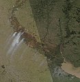
14 JUN 2020 Delta del parana Wildfires.jpg 6,768 × 6,928; 1.25 MB
-
A Gateway to Antarctica.jpg 6,000 × 6,000; 9.6 MB
-
Above Average Rains Turns Argentina Green (MODIS 2024-02-18).jpg 1,359 × 1,076; 383 KB
-
Alto Paraná Atlantic forest.jpg 2,276 × 2,964; 3.15 MB
-
Amana, Argentina.jpg 2,048 × 1,280; 983 KB
-
Aracar.jpg 640 × 457; 43 KB
-
Argentina (4437745771).jpg 2,048 × 2,046; 1.11 MB
-
Argentina (4691434734).jpg 1,965 × 1,347; 821 KB
-
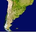
Argentina Blue Marble.png 1,584 × 2,903; 6.55 MB
-
Argentina Forest (ASTER).jpg 861 × 720; 96 KB
-
Argentina from space.png 1,527 × 970; 1.24 MB
-
Argentina on March 13, 2017.jpg 7,200 × 9,400; 10.39 MB
-
Argentina TMO 2007191 lrg.jpg 3,600 × 4,600; 4.17 MB
-
Argentina – MERIS – 24 March 2002 ESA198001.jpg 1,000 × 1,000; 242 KB
-
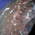
AS07-04-1593.jpg 4,134 × 4,134; 3.3 MB
-
As07-07-1826.jpg 4,128 × 4,128; 3.33 MB
-
Atlantic Forest WWF.jpg 2,877 × 2,897; 1.78 MB
-
Bahía Engaño Scan Nasa.jpg 639 × 435; 43 KB
-
Calbuco Ash on the Move, May 3, 2015.jpg 2,600 × 2,000; 2.91 MB
-
Calbuco Ash on the Move. May 3, 2015.jpg 720 × 480; 351 KB
-
Calbuco Volcano Eruption 2015-04-23 1420Z.jpg 3,600 × 4,800; 2.37 MB
-
Calbuco Volcano Eruption 2015-04-23 1835Z.jpg 5,600 × 4,400; 3.93 MB
-
Calbuco volcano eruption 2015-05-07 1435Z.jpg 2,000 × 1,600; 660 KB
-
Calbuco Volcano Erupts April 23, 2015.jpg 720 × 480; 175 KB
-
Caldera del Atuel.jpg 640 × 417; 58 KB
-
Capitán Bermúdez NASA.jpg 540 × 415; 327 KB
-
Cerro Aconcagua.jpg 4,500 × 4,500; 4.84 MB
-
Cerros colorados res.jpg 5,237 × 5,237; 8.8 MB
-
Chile battles raging wildfires ESA24708112.jpeg 1,920 × 1,440; 2.85 MB
-
Chile satellit.jpg 997 × 895; 105 KB
-
Chili satelliet.jpg 1,800 × 2,400; 777 KB
-
Confluence and Humaitá.jpg 1,579 × 1,600; 1,002 KB
-
Corrientes, Argentina.jpg 2,008 × 3,032; 2.09 MB
-
Cuencia del Río San Juan visto por el SAOCOM 1A.png 810 × 600; 1.12 MB
-
Córdoba countryside as seen by SAOCOM 1A.jpg 1,920 × 960; 1.38 MB
-
Dawson Island.jpg 2,000 × 2,600; 1.31 MB
-
Detalle del Lago San Martín por SAOCOM 1A.jpg 3,216 × 3,012; 2.95 MB
-
Detalle-del-lago-san-martin-.jpg 3,684 × 3,288; 3.79 MB
-
Detalle-del-lago-san-martin-3.jpg 3,708 × 3,768; 4.68 MB
-
Detalle-entre-el-lago-san-martin-y-el-lago-viedma.jpg 4,608 × 5,016; 3.37 MB
-
Dust storms off southern Argentina, 05-20-2015.jpg 2,400 × 3,200; 1.22 MB
-
ElChoconDamReservoir.jpg 1,000 × 700; 87 KB
-
Envisat image of Patagonia ESA217987.jpg 2,086 × 2,086; 970 KB
-
Envisat image of Patagonia ESA217987.tiff 2,086 × 2,086; 10.52 MB
-
Eruption of Calbuco volcano, Chile 04-25-2015.jpg 5,460 × 9,104; 6.62 MB
-
Eruption of Copahue volcano, Chile (morning overpass).PNG 1,238 × 751; 1.84 MB
-
Eruption of Puyehue-Cordón Caulle volcano, Chile, 07-05-2011.jpg 2,400 × 1,800; 542 KB
-
Eruption of Puyehue-Cordón Caulle volcano, Chile, 08-05-2011.png 1,003 × 746; 1.59 MB
-
Eruption of Puyehue-Cordón Caulle volcano, Chile, 08-12-2011.png 1,005 × 749; 1.68 MB
-
Eruption of Puyehue-Cordón Caulle volcano, Chile, 08-13-2011.png 1,005 × 741; 1.58 MB
-
Estados.png 593 × 230; 401 KB
-
Esteros del Iberá.jpg 2,183 × 1,445; 1 MB
-
Fires in and around Iberá National Park (MODIS).jpg 2,814 × 2,198; 809 KB
-
Florescer fitoplâncton.jpg 946 × 710; 93 KB
-
Foz do Iguaçu (satellite view).jpg 2,048 × 1,280; 993 KB
-
Gran San Miguel de Tucumán tomada desde la Estación Espacial en el 2015.jpg 4,928 × 3,280; 4.46 MB
-
Gualeguaychú as seen by SAOCOM 1A.jpg 1,493 × 745; 708 KB
-
Inundaciones en Argentina Argentina.A2003128.1420.250m.jpg 4,000 × 5,200; 3.12 MB
-
Inundaciones en Argentina Argentina.A2003128.1420.721.250m.jpg 4,000 × 5,200; 4.47 MB
-
Inundación de 2003 en Santa Fe vista por SPOT-4 01.tif 3,000 × 3,000; 34.33 MB
-
Inundación de 2003 en Santa Fe vista por SPOT-4 02.jpg 1,000 × 1,000; 889 KB
-
Inundación de 2003 en Santa Fe vista por SPOT-4 03 (cropped).jpg 1,814 × 2,010; 1.39 MB
-
Inundación de 2003 en Santa Fe vista por SPOT-4 03.jpg 3,000 × 3,000; 3.1 MB
-
Isla de los Estados NWW.png 1,016 × 691; 835 KB
-
Isla Del Cerrito, Argentina.jpg 2,048 × 1,280; 814 KB
-
Isla Martin Garcia NWW.png 1,024 × 768; 385 KB
-
ISS016-E-17161 - View of Earth.jpg 3,032 × 2,008; 1.45 MB
-
ISS029-E-17353 - View of Chile.jpg 4,288 × 2,848; 1.16 MB
-
Iss069e030032.jpg 5,568 × 3,712; 5.03 MB
-
JuncalNASA.png 373 × 419; 81 KB
-
Lago Represa Salto Grande2.jpg 3,032 × 2,008; 2.53 MB
-
Lago Tar (SAOCOM).jpg 2,629 × 1,479; 535 KB
-
Lago Viedma NASA 1994.jpg 640 × 512; 153 KB
-
Laguna del Viedma.jpg 95 × 90; 3 KB
-
Lithium mine, Salar del Hombre Muerto, Argentina.jpg 720 × 480; 220 KB
-
Maipo Volcano Mendoza Argentina and Chile.JPG 639 × 423; 221 KB
-
Mendoza, Argentina.jpg 2,048 × 1,280; 1.07 MB
-
Monte Fitz Roy 19Mar2018 SkySat.jpg 2,050 × 2,050; 1.02 MB
-
Médanos Grandes, Argentina.jpg 4,044 × 2,275; 5.56 MB
-
Neuquén Basin.jpg 720 × 480; 529 KB
-
Paraguay (4690804595).jpg 5,321 × 5,321; 8.93 MB
-
PascuaLamaPlanMap.png 448 × 463; 228 KB
-
Patagones ArgentinaA20011521440250m.png 523 × 488; 489 KB
-
Patagonia ESA24337506.jpeg 3,280 × 4,374; 1.91 MB
-
Patagonia ESA24337506.tiff 4,686 × 6,248; 41.44 MB
-
Patagonia Mountain Range.png 433 × 1,065; 772 KB
-
Patagonia Snow.jpg 850 × 1,100; 903 KB
-
Patagonia tmo 2011050 lrg.jpg 4,200 × 5,200; 3.05 MB
-
Patagonian desert (viewed from orbit).jpg 513 × 512; 41 KB
-
Payun Volcanoes, Argentina (ASTER).jpg 3,537 × 3,114; 1.6 MB
-
Payún Matru Volcanic Field, Argentina - NASA Earth Observatory.jpg 720 × 480; 142 KB
-
Peninsula Valdés STS-68.jpg 432 × 341; 12 KB
-
Phytoplankton bloom off Argentina - November 9, 2013.jpg 1,600 × 2,000; 264 KB
-
Phytoplankton Factory in the Argentine Sea.jpeg 5,644 × 5,487; 3.18 MB
-
Phytoplankton SoAtlantic 20060215.jpg 2,000 × 2,600; 301 KB
-
Plume and ash from Calbuco volcano, Chile 04-25-2015.jpg 5,600 × 4,400; 3.42 MB
-
Plume from Calbuco volcano, Chile (afternoon overpass) 04-24-2015.jpg 1,600 × 1,200; 306 KB
-
Primera imagen SAOCOM 1A.jpg 5,188 × 20,520; 3.58 MB
-
Provinz Buenos Aires Rio de la Plata Argentinien NASA.jpg 1,300 × 1,000; 282 KB
-
Puerto y Ciudad de La Plata vista por SAOCOM 1A.jpg 1,920 × 1,080; 973 KB
-
Pyrocumulonimbus Argentina 2018.png 1,076 × 720; 1.89 MB
-
Rio Cuarto - Landsat TM 229.jpg 944 × 1,350; 80 KB
-
Rio de la Plata Cuenca.png 600 × 780; 1.09 MB
-
Rio de la Plata NASA image.jpg 2,852 × 2,192; 3.92 MB
-
Rio Negro Floodplain, Patagonia, Argentina 2010-01-04 lrg.jpg 1,440 × 960; 833 KB
-
Rio Negro Floodplain, Patagonia, Argentina 2010-01-04.jpg 720 × 480; 162 KB
-
Rosario, Argentina.jpg 2,048 × 1,365; 1.67 MB
-
Río Sauce Grande y Sierra de la Ventana.JPG 746 × 741; 88 KB
-
Salar de Arizaro 2013.jpg 720 × 720; 173 KB
-
Salar de Olaroz Lithium Mine, Argentina by Planet Labs.jpg 2,400 × 1,800; 520 KB
-
Salinas Grandes as seen by SAOCOM 1B.jpg 900 × 659; 143 KB
-
Salta as seen by SAOCOM 1B.jpg 900 × 659; 209 KB
-
Salta Province, Argentina (ASTER).jpg 1,542 × 1,825; 418 KB
-
Samerica vir 2012202 lrg (large).jpg 2,628 × 2,628; 3.68 MB
-
San Jorge.jpg 784 × 477; 426 KB
-
SAOCOM 1A San Nicolás de los Arroyos 01.jpg 7,316 × 4,344; 5.18 MB
-
SAOCOM 1A San Nicolás de los Arroyos 02.jpg 3,597 × 2,745; 4.54 MB
-
SAOCOM 1A San Nicolás de los Arroyos 03.jpg 7,316 × 13,470; 7.86 MB
-
Sargentina amo 2008058 lrg.jpg 4,000 × 4,000; 3.14 MB
-
Sat-MDQ.jpg 638 × 425; 44 KB
-
Satellietfoto van Argentinië.jpg 1,750 × 2,500; 1.08 MB
-
Scanned highres STS031 STS031-76-39 copy.jpg 5,266 × 5,266; 16.54 MB
-
Sediment in the Río de La Plata - NASA Earth Observatory.jpg 720 × 480; 89 KB
-
Sierradesangra tm5 1986014 lrg.jpg 2,000 × 3,000; 4.06 MB
-
South Sandwich Islands 2017 02 16 (32816026361).jpg 2,236 × 2,213; 902 KB
-
Southern Argentina and Chile ESA203271.tiff 3,268 × 2,408; 45.2 MB
-
Southern Argentina and Chile.jpg 3,268 × 2,408; 8.77 MB
-
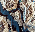
Southern Patagonian Ice Field.jpg 3,032 × 2,008; 995 KB
-
Southern South America - November 13, 2013.jpg 7,200 × 9,400; 13.42 MB
-
Talampaya National Park and Ischigualasto Provincial Park (MODIS).jpg 1,812 × 1,476; 1.04 MB
-
Talampaya National Park SPOT 1197.jpg 500 × 500; 94 KB
-
Talampaya Natural Park.jpg 720 × 900; 826 KB
-
The Geologic Wonder of the Neuquén Basin.jpeg 2,712 × 1,808; 5.8 MB
-
The province of Corrientes ESA232169.tiff 1,892 × 1,892; 10.44 MB
-
The province of Corrientes.jpg 1,892 × 1,892; 1.14 MB
-
Tierra del Fuego as seen by SAOCOM 1B.jpg 900 × 659; 181 KB
-
Upsala glacier change from 1985 to 2021 ESA23321845.jpeg 1,920 × 1,080; 2.71 MB
-
Upsala Glacier ESA23321595.jpeg 1,920 × 1,080; 2.13 MB
-
Upsala Glacier ESA364438.jpg 4,127 × 4,776; 36.3 MB
-
Upsala Glacier ESA364438.tiff 4,127 × 4,776; 48.07 MB
-
Uruguay (4690803887).jpg 3,600 × 4,600; 2.44 MB
-
Uruguay River wetlands ESA415084.jpg 8,000 × 6,000; 8.67 MB
-
UruguayA200436614001km.jpg 1,100 × 850; 314 KB
-
Ushuaia SPOT 1264.jpg 500 × 500; 72 KB
-
Valdes Peninsula as seen by SAOCOM 1B.jpg 5,017 × 3,672; 2.09 MB
-
Valdes Peninsula SPOT 1200.jpg 500 × 500; 87 KB
-
Valdes Satellitenfoto.jpg 1,112 × 712; 247 KB
-
Valle de la Luna, Argentina by Planet Labs.jpg 4,539 × 3,404; 6.05 MB
-
Viedma Glacier lake, Chile-Argentina (disappeared) by Planet Labs.jpg 2,400 × 1,800; 1.44 MB
-
Viedma Glacier lake, Chile-Argentina by Planet Labs.jpg 2,400 × 1,800; 1.51 MB
-
Viedma Lake & Argentino Lake as seen by SAOCOM 1A.jpg 10,120 × 5,071; 3.32 MB
-
Vista satelital santa fe.jpg 2,980 × 1,982; 3.54 MB
-
Volcanic Plateaus in Argentina.jpeg 4,723 × 7,389; 8.69 MB
-
Volcán Maipo NASA.jpg 540 × 334; 95 KB
-
Wildfires Ravage Corrientes as seen by Landsat 9.jpg 7,875 × 7,657; 5.72 MB
-
아르헨티나 산타쿠르즈 (아리랑 2호) (528).jpeg 3,000 × 3,100; 4.33 MB
-
아르헨티나 산타쿠르즈(아리랑 2호) (527).jpeg 3,000 × 3,100; 5.05 MB
-
아르헨티나 산타페(아리랑 2호) (389).jpeg 3,000 × 3,100; 4.72 MB
-
아르헨티나 코르도바(아리랑 2호) (404).jpeg 3,000 × 3,100; 5.62 MB
