Category:San Carlos Apache Indian Reservation
Jump to navigation
Jump to search
Indian reservation | |||||
| Upload media | |||||
| Instance of | |||||
|---|---|---|---|---|---|
| Location | Arizona | ||||
| Different from | |||||
 | |||||
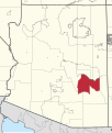
- English: The San Carlos Apache Indian Reservation — of the federally recognized San Carlos Nation in Gila, Graham, and Pinal Counties of southeastern Arizona, U.S.
- Established in 1872 as a reservation for the Chiricahua Apache tribe in the Arizona Territory, who were deported to Florida in 1886. It then became the reservation for various other relocated Apachean−speaking groups.
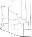
- Its largest communities are Peridot and San Carlos.
- Català: La Reserva índia de San Carlos — una reserva índia del sud-est de l'estat d'Arizona (Estats Units).
- Establerta el 9 de novembre de 1871 per tal de reallotjar diverses tribus Apatxe, Mohave i Yuma d'Arizona i de Nou Mèxic, encara que posteriorment es van crear reserves específiques per aquestes últimes. Es va crear finalment el 1872 com una reserva per als chiricahua. Va ser esmentat per alguns com a "L'infern dels Quaranta Acres," a causa les depriments condicions de salut i ambientals. (→)
Subcategories
This category has the following 12 subcategories, out of 12 total.
Media in category "San Carlos Apache Indian Reservation"
The following 30 files are in this category, out of 30 total.
-
3355R San Carlos Reservation Locator Map.svg 1,150 × 1,357; 4.05 MB
-
A Gentle Rain of Autumn - panoramio.jpg 4,608 × 3,440; 4.15 MB
-
A lonely road - panoramio.jpg 1,600 × 1,200; 392 KB
-
Apacheria, San Carlos, AZ, Antelope Flat view NW to Nantes Rim, 2011 - panoramio.jpg 1,504 × 1,000; 1.25 MB
-
Bylas.jpg 2,313 × 2,697; 1.7 MB
-
Graham County, AZ, USA - panoramio (4).jpg 4,608 × 3,440; 4.11 MB
-
Juniper in Grassland - panoramio.jpg 3,072 × 2,304; 1.23 MB
-
Looking NW - panoramio.jpg 1,600 × 1,200; 390 KB
-
M Cutler Pt of Pines 1957.jpg 1,879 × 1,521; 953 KB
-
Moonrise (4490465646).jpg 3,412 × 2,584; 5.66 MB
-
Point of Pines Sites.jpg 178 × 148; 15 KB
-
Salt River Canyon 1 (5545866222).jpg 5,151 × 3,077; 6.94 MB
-
Salt River Canyon 3 (5545286761).jpg 8,741 × 4,555; 12.14 MB
-
Salt River Canyon at Night (8183714726).jpg 4,051 × 1,584; 2.1 MB
-
San Carlos Apache Reservation - panoramio.jpg 4,000 × 3,000; 4.84 MB
-
San Carlos Apache Reservation Jojoba Seed Purchase(2008).JPG 864 × 616; 100 KB
-
San Carlos wildflowers, 2010.jpg 1,030 × 900; 1.18 MB
-
Spring flowers at sunset near Peridot, AZ.jpg 4,310 × 2,868; 3.56 MB
-
Tonto National Forest, AZ, View E to the San Carlos Apache Reservation, 2011 - panoramio.jpg 4,000 × 3,000; 4.66 MB
-
U.S. Route 60 San Carlos, AZ (24697257225).jpg 6,051 × 2,532; 17.59 MB
-
Walking shadows - panoramio.jpg 1,600 × 1,200; 254 KB
-
Westward View - panoramio.jpg 4,608 × 3,072; 3.28 MB
-
AZMap-doton-Peridot.png 260 × 300; 22 KB


