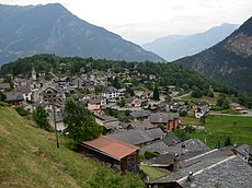
Category:Salvan
Jump to navigation
Jump to search
municipality in the canton of Valais, Switzerland | |||||
| Upload media | |||||
| Instance of | |||||
|---|---|---|---|---|---|
| Location | Saint-Maurice District, Valais, Switzerland | ||||
| Located in or next to body of water | |||||
| Official language | |||||
| Population |
| ||||
| Area |
| ||||
| Elevation above sea level |
| ||||
| official website | |||||
 | |||||
Subcategories
This category has the following 9 subcategories, out of 9 total.
Media in category "Salvan"
The following 71 files are in this category, out of 71 total.
-
1324 Barberine.jpg 14,000 × 9,600; 130.01 MB
-
20151016-Salvan-Fontaine750e-d.jpg 1,944 × 2,592; 2.17 MB
-
20151016-Salvan-Fontaine750e.jpg 1,944 × 2,592; 2.43 MB
-
20151016-Salvan-Ruelle-Eglise.jpg 1,944 × 2,592; 2.24 MB
-
20151016-SalvanVillage.jpg 2,592 × 1,944; 2.66 MB
-
20151018-SalvanVillage.jpg 2,592 × 1,944; 3.25 MB
-
Branta leucopsis DSCF1970.JPG 3,072 × 2,304; 1.68 MB
-
Branta leucopsis DSCF1971.JPG 3,072 × 2,304; 1.66 MB
-
Camping, Van d'En-Haut - panoramio.jpg 966 × 384; 262 KB
-
CHE Salvan Flag.svg 920 × 920; 10.95 MB
-
Chemin-LesGranges-TêteDesCrêtes.jpg 2,592 × 1,944; 3.71 MB
-
Col de Fenestral's sight toward "Mt Blanc" - panoramio.jpg 4,000 × 3,000; 5.06 MB
-
DentsMidi20160807.jpg 2,592 × 1,936; 1.87 MB
-
Emaney's Valley - panoramio.jpg 4,000 × 3,000; 4.91 MB
-
Flag of Salvan.gif 216 × 216; 6 KB
-
Fresh snow - panoramio.jpg 768 × 1,024; 420 KB
-
Heodes virgaurea Morgenrood DSCF1670.JPG 3,072 × 2,304; 1.44 MB
-
Ibex - panoramio.jpg 768 × 1,024; 569 KB
-
Karte Gemeinde Salvan 2007.png 1,476 × 1,675; 546 KB
-
Karte Gemeinde Salvan.png 826 × 937; 165 KB
-
La Creuzas uranium prospect gate.jpg 1,600 × 1,200; 452 KB
-
Lac D Emosson Hydroelectric Power Station (172443247).jpeg 2,048 × 1,365; 451 KB
-
Lac de Blantsin's sight toward "Fontanabran" - panoramio.jpg 3,000 × 4,000; 5.3 MB
-
Lac de Blantsin's sight toward "Le Luisin" - panoramio.jpg 4,000 × 3,000; 5.24 MB
-
Lasiommata maera DSCF1818-kl.JPG 1,076 × 807; 109 KB
-
LesGranges-ColMatze-1.jpg 1,944 × 2,592; 2.78 MB
-
LesGranges-ColMatze-2.jpg 1,944 × 2,592; 4.18 MB
-
LesGranges-ColMatze-3.jpg 1,944 × 2,592; 3.6 MB
-
LesGranges-ColMatze-4.jpg 1,944 × 2,592; 4.05 MB
-
Matterhorn - panoramio (5).jpg 2,272 × 1,704; 682 KB
-
Mont Blanc massif from the Col de Fenestral (22779246487).jpg 5,184 × 3,456; 4.46 MB
-
Neversex's sight to "Glacie du Trient" on summer - panoramio.jpg 3,672 × 4,896; 10.53 MB
-
Neversex's sight to "Tour Sallière" on summer - panoramio.jpg 4,896 × 2,754; 7.29 MB
-
Panoramic view at the Col de Fenestral (15186995452).jpg 15,827 × 3,923; 58.23 MB
-
Panoramic view at the Col de Fenestral (22867877784).jpg 16,820 × 4,041; 62.21 MB
-
Panoramic view at the Col de Fenestral - panoramio.jpg 12,903 × 3,099; 8.23 MB
-
Panoramic view from the Col de la Golette - panoramio.jpg 2,707 × 1,170; 3.16 MB
-
Pierre Bergère in Salvan, Wallis, Schweiz.jpg 5,237 × 3,491; 3.76 MB
-
Pont-Salanfe.jpg 2,592 × 1,944; 3.59 MB
-
Rainbow in swiss forest.jpg 2,656 × 2,759; 1.35 MB
-
Road to salvan.jpg 3,264 × 2,448; 2.98 MB
-
Rocks seen at Le Vélard - panoramio (1).jpg 2,272 × 1,704; 1.33 MB
-
Rocks seen at Le Vélard - panoramio (2).jpg 2,272 × 1,704; 1.46 MB
-
Rocks seen at Le Vélard - panoramio (3).jpg 2,272 × 1,704; 1.53 MB
-
Rocks seen at Le Vélard - panoramio (4).jpg 2,272 × 1,704; 1.73 MB
-
Rocks seen at Le Vélard - panoramio (5).jpg 1,704 × 2,272; 1.41 MB
-
Rocks seen at Le Vélard - panoramio.jpg 2,272 × 1,704; 1.62 MB
-
Route Salvan.jpg 1,114 × 888; 398 KB
-
Salanfe DSCF1671.JPG 3,072 × 2,304; 1.6 MB
-
CHE Salvan COA.svg 500 × 600; 6 KB
-
Salvan Triège Brücken 1908.png 666 × 938; 825 KB
-
Salvan Tête-des-Crêtes.jpg 786 × 656; 340 KB
-
Salvan vue.jpg 3,072 × 2,304; 1.33 MB
-
Salvan's area on fall - panoramio.jpg 4,896 × 2,754; 7.66 MB
-
Salvan-blazon.svg 209 × 245; 14 KB
-
Salvan-ruelle.jpg 3,072 × 2,304; 3.1 MB
-
Salvan.jpg 3,072 × 2,304; 3.65 MB
-
Salvan.png 362 × 446; 43 KB
-
Station de ski suisse.jpg 1,232 × 2,496; 636 KB
-
Tretien's area sight toward "Gueuroz" on summer - panoramio.jpg 3,033 × 4,325; 4.95 MB
-
Valley of Emaney's sight toward "Dent d'Emaney" - panoramio.jpg 4,000 × 3,000; 5.23 MB
-
View from the Col de la Golette - panoramio (1).jpg 2,272 × 1,704; 932 KB
-
View from the Col de la Golette - panoramio (2).jpg 2,272 × 1,704; 1.02 MB
-
View from the Col de la Golette - panoramio (3).jpg 2,272 × 1,704; 1.01 MB
-
View from the Col de la Golette - panoramio (4).jpg 2,272 × 1,704; 1.1 MB
-
View from the Col de la Golette - panoramio.jpg 2,272 × 1,704; 1.04 MB
-
View on La Frête du Parc - panoramio.jpg 2,272 × 1,704; 1.44 MB
-
View onto Martigny from Col de la Golette - panoramio.jpg 1,704 × 2,272; 1.01 MB
-
View onto Martigny from Pts Perrons - panoramio.jpg 1,704 × 2,272; 699 KB
-
Winter night - panoramio.jpg 1,536 × 1,024; 544 KB
-
You have to try the cream meringue - panoramio.jpg 683 × 1,024; 340 KB


