Category:Salfords and Sidlow
Jump to navigation
Jump to search
English: Salfords and Sidlow is a civil parish in the Reigate and Banstead borough of Surrey, England. It has a population of 3,069. The parish includes the villages of Salfords and Sidlow.
civil parish in Surrey, UK | |||||
| Upload media | |||||
| Instance of | |||||
|---|---|---|---|---|---|
| Location | Reigate and Banstead, Surrey, South East England, England | ||||
| Population |
| ||||
 | |||||
Subcategories
This category has the following 2 subcategories, out of 2 total.
Media in category "Salfords and Sidlow"
The following 200 files are in this category, out of 238 total.
(previous page) (next page)-

-
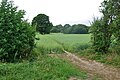
 A view north - geograph.org.uk - 3248231.jpg 2,304 × 1,728; 1.83 MB
-
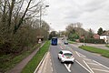
 A23 Bonehurst Road - geograph.org.uk - 6099743.jpg 1,024 × 768; 242 KB
-
 A23 Bonehurst Road - geograph.org.uk - 6100883.jpg 1,024 × 768; 253 KB
-
 A23 Bonehurst Road - geograph.org.uk - 6100927.jpg 1,024 × 684; 187 KB
-
 A23 Brighton Road - geograph.org.uk - 6101031.jpg 1,024 × 684; 253 KB
-
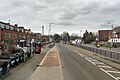 A23 Brighton Road, Salfords - geograph.org.uk - 6100950.jpg 1,024 × 684; 206 KB
-
 Axes Lane, Salfords - geograph.org.uk - 4406496.jpg 2,560 × 1,920; 2.04 MB
-
 Behind the A217 hedge - geograph.org.uk - 1968484.jpg 640 × 428; 134 KB
-
 Being watched - geograph.org.uk - 1281122.jpg 640 × 426; 144 KB
-

-
 Bridge over Salfords Stream - geograph.org.uk - 5758898.jpg 640 × 428; 157 KB
-

-
 Brighton Hill at the junction of Woodhatch Road - geograph.org.uk - 4405268.jpg 2,560 × 1,920; 2.05 MB
-
 Brighton Main Line - geograph.org.uk - 6549671.jpg 1,200 × 802; 1.1 MB
-
 Brooklyn Cottage - geograph.org.uk - 2918432.jpg 640 × 425; 489 KB
-
 Bungalow on Lonesome Lane, Salfords - geograph.org.uk - 4811155.jpg 2,048 × 1,536; 1.47 MB
-
 Bures Manor Lodge - geograph.org.uk - 3615385.jpg 800 × 530; 699 KB
-
 Butler's Shaw - geograph.org.uk - 1270473.jpg 640 × 426; 88 KB
-
 Canada Road - geograph.org.uk - 5759938.jpg 640 × 428; 166 KB
-
 Canada Road - geograph.org.uk - 5760427.jpg 640 × 428; 157 KB
-
 Cattle path by Salfords Stream - geograph.org.uk - 5758865.jpg 640 × 428; 152 KB
-
 Cattle trough by Salfords Stream - geograph.org.uk - 5759085.jpg 640 × 428; 156 KB
-
 Chewing the cud - geograph.org.uk - 5758671.jpg 640 × 428; 119 KB
-

-
 Christmas Farm Kennels - geograph.org.uk - 3248211.jpg 2,304 × 1,728; 1.83 MB
-
 Collendean Lane - geograph.org.uk - 2543525.jpg 640 × 480; 179 KB
-
 Corner of Honeycrock Lane - geograph.org.uk - 3248145.jpg 2,304 × 1,728; 1.86 MB
-
 Cottage near Stumblehole - geograph.org.uk - 5566383.jpg 640 × 428; 165 KB
-
 Cottage opposite Lower Duxhurst Farm - geograph.org.uk - 4811683.jpg 2,048 × 1,536; 1.47 MB
-
 Cross Oak - geograph.org.uk - 2918430.jpg 640 × 425; 475 KB
-
 Cross Oak Lane near Horley - geograph.org.uk - 6525767.jpg 3,648 × 2,736; 2.84 MB
-
 Cross Oak Lane, Horley - geograph.org.uk - 5275706.jpg 2,286 × 1,704; 1.22 MB
-
 Cross Oak Lane, Salfords - geograph.org.uk - 5275598.jpg 2,304 × 1,728; 812 KB
-
 Cross Roads - geograph.org.uk - 3248174.jpg 2,304 × 1,728; 1.86 MB
-
 Crutchfield Road, Wrays - geograph.org.uk - 5265142.jpg 2,304 × 1,728; 798 KB
-
 Dead tree - geograph.org.uk - 6504843.jpg 1,024 × 685; 121 KB
-
 Drainage ditch by Cross Oak Lane - geograph.org.uk - 5275604.jpg 2,304 × 1,728; 817 KB
-
 Drive to Nutley Dean Business Park - geograph.org.uk - 4543171.jpg 4,608 × 3,456; 6.1 MB
-
 Drummer at "Front Room on the Farm" - geograph.org.uk - 4161074.jpg 3,872 × 2,592; 3.6 MB
-
 Dunraven Avenue - geograph.org.uk - 3248159.jpg 2,304 × 1,274; 680 KB
-
 Duxhurst - geograph.org.uk - 1968436.jpg 640 × 428; 105 KB
-

-

-

-

-
 Entrance on Ironsbottom - geograph.org.uk - 5265143.jpg 2,304 × 1,728; 804 KB
-
 Entrance to field on Mason's Bridge Road - geograph.org.uk - 4406517.jpg 2,560 × 1,920; 1.99 MB
-
 Entrance to house on Axes Lane, Salfords - geograph.org.uk - 4406479.jpg 2,560 × 1,920; 2.02 MB
-
 Entrance to houses off Reigate Road - geograph.org.uk - 4811662.jpg 2,048 × 1,536; 1.58 MB
-
 Festival crowd - geograph.org.uk - 4160991.jpg 3,872 × 2,592; 3.26 MB
-
 Field by Brighton Main line - geograph.org.uk - 5419909.jpg 640 × 426; 44 KB
-
 Field edge by Salfords Stream - geograph.org.uk - 5758847.jpg 640 × 428; 139 KB
-

-
 Field gate onto Bridge Road - geograph.org.uk - 5759107.jpg 640 × 428; 131 KB
-
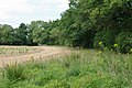
 Field of barley - geograph.org.uk - 5758705.jpg 640 × 428; 145 KB
-
 Field south of Salfords Stream - geograph.org.uk - 5758914.jpg 640 × 428; 119 KB
-
 Five trees - geograph.org.uk - 4955636.jpg 640 × 426; 35 KB
-
 Fixings Center, Salfords - geograph.org.uk - 4405760.jpg 2,560 × 1,920; 1.98 MB
-
 Football pitch, Salfords - geograph.org.uk - 4955590.jpg 640 × 426; 45 KB
-
 Football pitch, Salfords - geograph.org.uk - 6514126.jpg 1,024 × 684; 176 KB
-
 Footbridge over the River Mole - geograph.org.uk - 1965155.jpg 640 × 480; 161 KB
-
 Footpath along edge of barley field - geograph.org.uk - 5758494.jpg 640 × 428; 147 KB
-
 Footpath gently uphill - geograph.org.uk - 5759972.jpg 640 × 428; 137 KB
-
 Footpath meets Picketts Lane - geograph.org.uk - 5758722.jpg 640 × 428; 137 KB
-
 Footpath off Horse Hill - geograph.org.uk - 2543516.jpg 640 × 480; 177 KB
-
 Footpath south from Canada Road - geograph.org.uk - 5759946.jpg 640 × 428; 157 KB
-
 Footpath through the woods - geograph.org.uk - 1965069.jpg 640 × 480; 170 KB
-
 Footpath to New House Lane - geograph.org.uk - 1961557.jpg 640 × 428; 114 KB
-
 Footpath to Picketts Lane - geograph.org.uk - 1961653.jpg 640 × 428; 103 KB
-
 Footpath towards Canada Road - geograph.org.uk - 5759959.jpg 640 × 428; 154 KB
-
 Footpath towards Canada Road - geograph.org.uk - 5759988.jpg 640 × 428; 129 KB
-
 Footpath towards Horse Hill - geograph.org.uk - 1968275.jpg 640 × 428; 148 KB
-
 FP403 towards Salfords - geograph.org.uk - 1968662.jpg 640 × 428; 140 KB
-
 Gabby Young at "Front Room on the Farm" - geograph.org.uk - 4161046.jpg 3,872 × 2,592; 4.78 MB
-
 Garden on Reigate Road, Sidlow - geograph.org.uk - 4812223.jpg 2,048 × 1,536; 1.56 MB
-
 Georgian Post Box - geograph.org.uk - 3248154.jpg 2,304 × 1,728; 1.9 MB
-
 Hathersham Lane - geograph.org.uk - 4016427.jpg 640 × 427; 89 KB
-
 Hedge in blossom - geograph.org.uk - 2937656.jpg 640 × 430; 43 KB
-
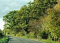
 Hedgerow trees - geograph.org.uk - 5566492.jpg 640 × 428; 160 KB
-
 High Trees - geograph.org.uk - 1853122.jpg 640 × 427; 89 KB
-
 Honeycrock Lane - geograph.org.uk - 3678546.jpg 640 × 430; 55 KB
-
 Horley North West - geograph.org.uk - 4691744.jpg 800 × 530; 445 KB
-
 Horley North West access road - geograph.org.uk - 4829728.jpg 800 × 453; 299 KB
-
 Horley North West access road - geograph.org.uk - 4829733.jpg 800 × 530; 355 KB
-
 Horley Road at the junction of Woodhatch Road - geograph.org.uk - 4405279.jpg 2,560 × 1,920; 2.03 MB
-
 Horse Hill - geograph.org.uk - 2543519.jpg 640 × 480; 167 KB
-
 Horse Hill - geograph.org.uk - 5949810.jpg 2,776 × 2,011; 1.18 MB
-
 Horse Hill - geograph.org.uk - 5949874.jpg 3,589 × 2,005; 1.18 MB
-
 Horse Hill - geograph.org.uk - 5949891.jpg 4,143 × 2,361; 2.44 MB
-
 Horse Hill near Horley - geograph.org.uk - 6445829.jpg 3,648 × 2,736; 4.03 MB
-
 Horse Hill, Hookwood - geograph.org.uk - 5262832.jpg 2,304 × 1,728; 794 KB
-
 Horse Hill, Hookwood - geograph.org.uk - 5262833.jpg 2,304 × 1,728; 798 KB
-
 Horse Hill, Hookwood - geograph.org.uk - 5262834.jpg 2,304 × 1,728; 793 KB
-
 Horse Hill, Wrays - geograph.org.uk - 5261507.jpg 2,304 × 1,728; 831 KB
-
 Horse pasture by Picketts Lane, Salfords - geograph.org.uk - 5277940.jpg 2,304 × 1,728; 843 KB
-
 Horses in the shade - geograph.org.uk - 1968391.jpg 640 × 428; 128 KB
-
 House and tree by Irons Bottom - geograph.org.uk - 5262767.jpg 2,304 × 1,728; 823 KB
-
 House at Christmas Farm - geograph.org.uk - 5758634.jpg 640 × 428; 115 KB
-
 House in Irons Bottom - geograph.org.uk - 5260883.jpg 2,304 × 1,728; 823 KB
-
 Houses at Salfords - geograph.org.uk - 4786377.jpg 3,072 × 1,191; 717 KB
-
 Houses on Honeycrock Lane - geograph.org.uk - 2379019.jpg 1,024 × 768; 228 KB
-
 Houses on Honeycrock Lane - geograph.org.uk - 3248201.jpg 2,304 × 1,728; 1.86 MB
-
 Houses on Honeycrock Lane - geograph.org.uk - 3248216.jpg 2,304 × 1,728; 1.81 MB
-
 Houses on Ironsbottom - geograph.org.uk - 1965111.jpg 640 × 480; 128 KB
-
 Houses on Meath Green Lane - geograph.org.uk - 4812476.jpg 2,048 × 1,536; 1.58 MB
-
 Irons Bottom - geograph.org.uk - 5260936.jpg 2,304 × 1,728; 866 KB
-
 Irons Bottom - geograph.org.uk - 5262765.jpg 2,304 × 1,728; 806 KB
-
 Irons Bottom Road - geograph.org.uk - 3615036.jpg 800 × 530; 623 KB
-
 Ironsbottom - geograph.org.uk - 5262762.jpg 2,304 × 1,728; 1.17 MB
-
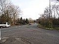
 Ironsbottom at the junction of Crutchfield Lane - geograph.org.uk - 5260959.jpg 2,304 × 1,728; 823 KB
-
 Ironsbottom Road, Sidlow - geograph.org.uk - 4811197.jpg 2,048 × 1,536; 889 KB
-
 Ironsbottom Road, Sidlow - geograph.org.uk - 5260868.jpg 2,304 × 1,728; 791 KB
-
 Is this a stile^ - geograph.org.uk - 1961749.jpg 640 × 428; 123 KB
-
 Junction of Collendean Lane and Horse Hill - geograph.org.uk - 4581510.jpg 4,608 × 3,456; 6.09 MB
-
 Junction of Collendean Lane and Horse Hill - geograph.org.uk - 5260963.jpg 2,304 × 1,728; 1.56 MB
-
 Junction of Collendean Lane with Horse Hill - geograph.org.uk - 2149747.jpg 3,072 × 2,304; 3.88 MB
-
 Kings Mill Lane - geograph.org.uk - 2100638.jpg 640 × 480; 126 KB
-
 Ladyland Farm - geograph.org.uk - 919004.jpg 640 × 481; 66 KB
-
 Layland's Cottages, Salfords - geograph.org.uk - 4811172.jpg 2,048 × 1,536; 1.49 MB
-
 Little Mynthurst Farm - geograph.org.uk - 1854232.jpg 640 × 426; 134 KB
-
 Lodge Lane - geograph.org.uk - 1924378.jpg 640 × 426; 81 KB
-
 Lodge Road at the junction of Meath Green Road - geograph.org.uk - 4810866.jpg 2,048 × 1,536; 1.47 MB
-
 Lonesome Farm, Salfords - geograph.org.uk - 4811825.jpg 2,048 × 1,536; 1.52 MB
-
 Lonesome Farm, Salfords - geograph.org.uk - 4811829.jpg 2,048 × 1,536; 1.51 MB
-
 Lonesome Lane - geograph.org.uk - 1281562.jpg 640 × 426; 95 KB
-
 Lonesome Lane, Salfords - geograph.org.uk - 4811157.jpg 2,048 × 1,536; 951 KB
-
 Lonesome Lane, Salfords - geograph.org.uk - 4812797.jpg 2,048 × 1,536; 1.08 MB
-
 Lonesome Lane, Surrey - geograph.org.uk - 6516594.jpg 3,648 × 2,736; 3.49 MB
-
 Looking north-northwest - geograph.org.uk - 3248224.jpg 2,304 × 1,728; 1.83 MB
-
 Mason's Bridge Road - geograph.org.uk - 2969543.jpg 1,024 × 768; 186 KB
-
 Mason's Bridge Road, Salfords - geograph.org.uk - 4406505.jpg 2,560 × 1,920; 2.38 MB
-
 Mason's Bridge Road, Whitebushes - geograph.org.uk - 4406512.jpg 2,560 × 1,920; 1.66 MB
-
 Meath Green Lane - geograph.org.uk - 4812473.jpg 2,048 × 1,536; 1.42 MB
-
 Meath Green Road at the junction of Lodge Road - geograph.org.uk - 4810859.jpg 2,048 × 1,536; 1.48 MB
-
 Mile Post - geograph.org.uk - 3248279.jpg 2,304 × 1,728; 1.88 MB
-
 Milepost, Horley Road - geograph.org.uk - 3313670.jpg 425 × 640; 441 KB
-
 Milepost, Pear Tree Hill - geograph.org.uk - 2710720.jpg 425 × 640; 124 KB
-
 Milestone, Sidlow Bridge - geograph.org.uk - 3447475.jpg 424 × 640; 407 KB
-
 Mixing desk and stage - geograph.org.uk - 4160998.jpg 3,872 × 2,592; 4.42 MB
-
 Montfort Rise - geograph.org.uk - 2277528.jpg 640 × 426; 72 KB
-
 Near Picketts Lane - geograph.org.uk - 2123997.jpg 640 × 426; 110 KB
-
 New House Lane - geograph.org.uk - 4016429.jpg 427 × 640; 88 KB
-
 New House Lane at the junction of Axes Lane - geograph.org.uk - 5275613.jpg 2,304 × 1,728; 1.1 MB
-
 Newsagents in Honeycrock Lane - geograph.org.uk - 4774840.jpg 640 × 480; 53 KB
-
 Nutley Dean Farm - geograph.org.uk - 1854272.jpg 640 × 426; 89 KB
-

-

-
 Old Milestone, A217, Reigate Road, South of Sidlow Bridge (geograph 6970349).jpg 800 × 1,200; 196 KB
-
 Ordnance Survey Trig Pillar S3280 - geograph.org.uk - 2895372.jpg 3,264 × 2,448; 3.46 MB
-

-
 Over the barley to Honeycrock Lane - geograph.org.uk - 1961631.jpg 640 × 428; 104 KB
-
 Pastureland south of Lodge Lane - geograph.org.uk - 1976894.jpg 640 × 426; 91 KB
-
 Path from Southern Avenue by Salfords station - geograph.org.uk - 2234939.jpg 1,600 × 1,200; 604 KB
-
 Path junction near Bures Manor - geograph.org.uk - 5566486.jpg 640 × 428; 186 KB
-
 Path through the unnamed wood - geograph.org.uk - 1968345.jpg 640 × 428; 184 KB
-
 Path through tree belt along Canada Road - geograph.org.uk - 5759848.jpg 640 × 428; 200 KB
-
 Pear Tree Hill - geograph.org.uk - 2710684.jpg 640 × 425; 112 KB
-
 Perrywood Sports Ground - geograph.org.uk - 3248315.jpg 2,304 × 1,728; 1.8 MB
-
 Phoenix Lodge - geograph.org.uk - 4581514.jpg 4,608 × 3,456; 6.6 MB
-
 Picketts - panoramio.jpg 1,614 × 729; 1,009 KB
-
 Picketts Farmhouse - geograph.org.uk - 1924341.jpg 640 × 426; 128 KB
-
 Picketts Lane - geograph.org.uk - 2123981.jpg 640 × 426; 98 KB
-
 Picketts Lane - geograph.org.uk - 2123990.jpg 640 × 426; 112 KB
-
 Picketts Lane, Salford - geograph.org.uk - 5277941.jpg 2,304 × 1,728; 831 KB
-
 Picketts Lane, Salfords - geograph.org.uk - 5275685.jpg 2,304 × 1,728; 1.11 MB
-

-
 Pillboxes at Sidlow Bridge - geograph.org.uk - 1363517.jpg 640 × 426; 106 KB
-
 Post Box - geograph.org.uk - 3248274.jpg 2,304 × 1,728; 1.89 MB
-
 Private keep out at Tamworth Farm - geograph.org.uk - 5566472.jpg 640 × 428; 148 KB
-
 Private road towards Burys Court - geograph.org.uk - 5566533.jpg 640 × 428; 170 KB
-
 Public Footpath FP403 - geograph.org.uk - 3248128.jpg 2,304 × 1,728; 1.87 MB
-
 Public Footpath FP403 - geograph.org.uk - 3248135.jpg 2,304 × 1,728; 1.88 MB
-
 Public Footpath FP403 - geograph.org.uk - 3248247.jpg 2,304 × 1,728; 1.88 MB
-
 Public Footpath FP403 - geograph.org.uk - 3248253.jpg 2,304 × 1,728; 1.83 MB
-
 Public Footpath FP404 - geograph.org.uk - 3248184.jpg 2,304 × 1,728; 1.86 MB
-
 Railway bridge on Cross Lane, Salfords - geograph.org.uk - 4405325.jpg 2,560 × 1,920; 1.93 MB
-
 Railway bridge over Honeycrock Lane - geograph.org.uk - 2379011.jpg 1,024 × 768; 254 KB
-
 Reigate Motor Company - geograph.org.uk - 2599775.jpg 640 × 425; 52 KB
-
 Reigate Motor Company, Sidlow - geograph.org.uk - 4811195.jpg 2,048 × 1,536; 966 KB
-
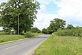
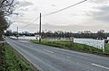
 Reigate Road - geograph.org.uk - 3447467.jpg 640 × 424; 304 KB
-
 Reigate Road - geograph.org.uk - 6364876.jpg 5,184 × 3,888; 7.79 MB
-

-
 Reigate Road, Sidlow - geograph.org.uk - 4811668.jpg 2,048 × 1,536; 1.46 MB
-
 Reigate Road, Sidlow - geograph.org.uk - 4811671.jpg 2,048 × 1,536; 1.51 MB
-
 Remains of Christ Church - geograph.org.uk - 2379081.jpg 640 × 480; 194 KB
-
 Renault Lifestyle on the A23, Salfords - geograph.org.uk - 4405313.jpg 2,560 × 1,920; 1.98 MB
-
 River Mole - geograph.org.uk - 2423533.jpg 640 × 425; 156 KB
-
 River Mole, looking downstream - geograph.org.uk - 1965174.jpg 640 × 480; 159 KB
-
 Rose Cottages - geograph.org.uk - 1924315.jpg 640 × 426; 104 KB
-

-
 Rowgardenswood - geograph.org.uk - 1968297.jpg 640 × 428; 100 KB
-
 Salfords Byway - geograph.org.uk - 6549700.jpg 1,200 × 810; 1.22 MB
-
 Salfords Station - geograph.org.uk - 4955646.jpg 640 × 442; 84 KB
-
 Salfords Stream - geograph.org.uk - 1281121.jpg 640 × 426; 118 KB
-
 Salfords Stream - geograph.org.uk - 1961701.jpg 640 × 428; 158 KB
-
 Salfords Stream - geograph.org.uk - 5758750.jpg 428 × 640; 193 KB
-
 Salfords Stream - geograph.org.uk - 5758855.jpg 640 × 428; 161 KB
-
 Salfords Stream - geograph.org.uk - 5758880.jpg 640 × 428; 166 KB
-
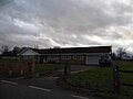
 Salfords Village Hall - geograph.org.uk - 4774838.jpg 640 × 480; 50 KB


_-_geograph.org.uk_-_4771744.jpg)
_-_geograph.org.uk_-_4771745.jpg)
_-_geograph.org.uk_-_4771746.jpg)


.jpg)


