Category:Saaldorf-Surheim
Jump to navigation
Jump to search
municipality of Germany | |||||
| Upload media | |||||
| Instance of |
| ||||
|---|---|---|---|---|---|
| Part of |
| ||||
| Location | Berchtesgadener Land, Upper Bavaria, Bavaria, Germany | ||||
| Head of government |
| ||||
| Population |
| ||||
| Area |
| ||||
| Elevation above sea level |
| ||||
| official website | |||||
 | |||||
Subcategories
This category has the following 4 subcategories, out of 4 total.
!
A
B
D
Pages in category "Saaldorf-Surheim"
This category contains only the following page.
Media in category "Saaldorf-Surheim"
The following 10 files are in this category, out of 10 total.
-
DEU Saaldorf-Surheim COA.svg 512 × 537; 17 KB
-
Farb-Wappen Saaldorf-Surheim.jpg 1,177 × 1,216; 98 KB
-
Wappen der Gemeinde Saaldorf-Surheim.jpg 458 × 474; 42 KB
-
Wappen von Saaldorf-Surheim.png 315 × 317; 110 KB
-
Blau Stunde im Haarmoos Dietmar Sekanina.jpg 3,008 × 2,000; 2.89 MB
-
Kurz vor Saaldorf - geo.hlipp.de - 13007.jpg 640 × 480; 87 KB
-
Saaldorf-Surheim - Abtsdorf westl - Fischer Ri SW - Haarmoos 01.jpg 4,000 × 2,248; 2.45 MB
-
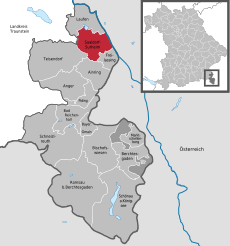
Saaldorf-Surheim in BGL.png 293 × 419; 8 KB
-
Scheune im Haarmoos.jpg 3,008 × 2,000; 3.51 MB
-
Von Abtsdorf zum Abtsdorfer See - geo.hlipp.de - 13004.jpg 640 × 480; 101 KB


