Category:S Line (Utah Transit Authority)
Jump to navigation
Jump to search
streetcar line in Salt Lake County, Utah, United States  | |||||
| Upload media | |||||
| Instance of | |||||
|---|---|---|---|---|---|
| Location |
| ||||
| Transport network | |||||
| Connects with | |||||
| Owned by | |||||
| Operator | |||||
| Maintained by | |||||
| Date of official opening |
| ||||
| Length |
| ||||
| Terminus | |||||
| |||||
English: Media related to the S Line (Utah Transit Authority), a 2.74-metre (0.00274 km) Utah Transit Authority (UTA) streetcar line in Salt Lake County, Utah, United States, that connects South Salt Lake with the Sugar House neighborhood in southeast Salt Lake City, connecting with UTA's TRAX lines (Blue, Green, and Red) at streetcar lines western terminus (Central Pointe station).
Subcategories
This category has the following 7 subcategories, out of 7 total.
3
- 300 East station (1 F)
5
- 500 East station (11 F)
7
- 700 East station (7 F)
C
- Central Pointe station (21 F)
F
- Fairmont station (10 F)
S
- South Salt Lake City station (11 F)
- Sugarmont station (8 F)
Media in category "S Line (Utah Transit Authority)"
The following 10 files are in this category, out of 10 total.
-
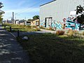 Northeast at graffiti on Parley's Trail, Salt Lake City, Utah, Oct 16.jpg 2,592 × 1,944; 2.37 MB
-
 Northwest at graffiti on Parley's Trail, Salt Lake City, Utah, Oct 16.jpg 2,592 × 1,944; 2.34 MB
-
 Parley's Trail speed limit sign, Sugar House, Salt Lake City, Utah, Oct 16.jpg 1,944 × 2,592; 1.53 MB
-
 S Line crossing sign, Sugar House, Salt Lake City, Utah, Oct 16.jpg 1,944 × 2,592; 1.53 MB
-
 S Line hours sign, Sugar House, Salt Lake City, Utah, Oct 16.jpg 1,944 × 2,592; 1.46 MB
-
 S Line Siemens S70 at Jordan River Rail Serivce Center, Aug 17.jpg 2,592 × 1,944; 2.34 MB
-
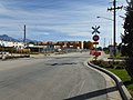 S-Line S 400 E level crossing, South Salt Lake, Utah, Oct 16.jpg 2,592 × 1,944; 2.32 MB
-
 Southeast level crossing on SR-71, Salt Lake City, Utah Oct 16.jpg 2,592 × 1,944; 2.39 MB
-
 Sugar House Branch rail tracks along Parley's Trail, Salt Lake City, Utah Oct 16.jpg 2,592 × 1,944; 2.25 MB
-
 UTA S-Line logo.svg 126 × 97; 10 KB


