Category:SVG transport maps of Brazil
Jump to navigation
Jump to search
Media in category "SVG transport maps of Brazil"
The following 12 files are in this category, out of 12 total.
-
Anhembi.svg 627 × 283; 65 KB
-
Areas da sp trans.svg 1,052 × 744; 1.07 MB
-
Belo horizonte1.svg 782 × 651; 32 KB
-
Brasilia Metro Map.svg 871 × 649; 357 KB
-
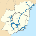
Ferrovia Centro Atlântica network map.svg 299 × 298; 1.57 MB
-
Ferrovias da Bahia.svg 886 × 918; 244 KB
-
Fortaleza 2014.svg 800 × 803; 25 KB
-
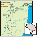
Mapa caminhos da Bahia.svg 650 × 647; 248 KB
-
Mapa dos sistemas ferroviários urbanos do Brasil.svg 780 × 687; 592 KB
-
Metro rio geographical network 2015 .svg 1,024 × 1,008; 23 KB
-
Railway network Brazil.svg 702 × 687; 4.1 MB
-
Transnordestina Logistica network map.svg 614 × 687; 445 KB


