Category:SVG topographic maps of the United States
Jump to navigation
Jump to search
Countries of the Americas: Argentina · Barbados · Belize · Bolivia · Brazil · Canada · Chile · Colombia · Costa Rica · Cuba · Dominica · Ecuador · Guatemala · Guyana · Haiti · Honduras · Jamaica · Mexico · Nicaragua · Panama · Paraguay · Peru · Saint Kitts and Nevis · Saint Lucia · Suriname · Trinidad and Tobago · United States of America · Uruguay · Venezuela
Media in category "SVG topographic maps of the United States"
The following 37 files are in this category, out of 37 total.
-
Acadia 1610-1613 topographic map-fr.svg 546 × 403; 553 KB
-
Acadia 1610-1613 topographic map-ru.svg 546 × 403; 547 KB
-
Braddock Expedition - ru.svg 1,367 × 1,011; 2.13 MB
-
Carte topographique des Provinces Maritimes du Canada.svg 2,928 × 2,106; 973 KB
-
Cascade Range major volcanoes topographic map-fr.svg 403 × 693; 15.91 MB
-
Cascade Range major volcanoes topographic map-it.svg 403 × 693; 5.46 MB
-
Cascade Range subdivisions map-es.svg 403 × 693; 2.99 MB
-
Cascade Range subdivisions map-fr.svg 403 × 693; 3.07 MB
-
Cascade Range subdivisions map-it.svg 403 × 693; 2.49 MB
-
Cascade Range topographic map-fr.svg 403 × 693; 3.15 MB
-
Cascade Range topographic map-it.svg 403 × 693; 2.5 MB
-
Columbia drainage basin map-fr.svg 808 × 790; 3.86 MB
-
Columbia gorge topographic map-fr.svg 682 × 359; 2.84 MB
-
Columbia tributaries drainage basin map-fr.svg 808 × 790; 3.89 MB
-
Columbia tributaries drainage basin map-it.svg 808 × 790; 3.24 MB
-
Guam topographic map.svg 802 × 903; 125 KB
-
Hawaii Island topographic map-fr.svg 3,110 × 2,563; 2.11 MB
-
Holyoke Range map-fr.svg 1,360 × 372; 142 KB
-
King williams war.svg 638 × 455; 1.71 MB
-
Metacomet Ridge map-fr.svg 1,631 × 2,922; 2.27 MB
-
Mississippi Embayment relief map 1.svg 474 × 914; 8.95 MB
-
Mississippi Embayment relief map 2.svg 474 × 914; 8.97 MB
-
Mississippi Embayment relief map mk.svg 474 × 914; 8.97 MB
-
Mount Tom Range map-fr.svg 462 × 616; 205 KB
-
New England and South-East of Canada topographic map-blank.svg 1,455 × 1,040; 528 KB
-
Rainier Adams Hood Saint Helens Comparison-fr.svg 2,356 × 588; 13.21 MB
-
Rainier Shasta Adams Hood Saint Helens Comparison.svg 2,957 × 588; 10.66 MB
-
Snake River drainage basin map-fr.svg 808 × 790; 3.92 MB
-
Three Sisters Range topographic map-en.svg 3,305 × 4,351; 2.87 MB
-
Three Sisters Range topographic map-fr.svg 3,305 × 4,351; 3.73 MB
-
Three Sisters topographic map-fr.svg 2,835 × 3,300; 4.72 MB
-
United States in North America (relief) (+territories) (-mini map).svg 1,181 × 1,185; 4.76 MB
-
United States in North America (relief) (+territories).svg 1,181 × 1,185; 12.5 MB
-
Usa edcp (+HI +AK) relief location map.svg 1,181 × 731; 7 MB
-
Washington topographic map-fr.svg 1,031 × 675; 6.52 MB
-
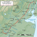
Washington's retreat across New Jersey 1776 - en.svg 1,393 × 1,393; 1.27 MB
-
Washington's retreat across New Jersey 1776 - ru.svg 1,393 × 1,393; 1.27 MB


