Category:SVG topographic maps of Europe
Jump to navigation
Jump to search
Subcategories
This category has the following 3 subcategories, out of 3 total.
Media in category "SVG topographic maps of Europe"
The following 33 files are in this category, out of 33 total.
-
Abházia térképe.svg 1,008 × 786; 1.6 MB
-
Abkhazia ab.svg 251 × 224; 3.9 MB
-
Abkhazia map-ab.svg 945 × 737; 810 KB
-
Abkhazia map-de.svg 945 × 737; 2.14 MB
-
Abkhazia map-en.svg 948 × 743; 1.24 MB
-
Abkhazia map-es.svg 1,008 × 786; 3.35 MB
-
Abkhazia map-fr.svg 945 × 737; 813 KB
-
Abkhazia map-mk.svg 945 × 737; 786 KB
-
Abkhazia map-ru.svg 945 × 737; 809 KB
-
Abkhazia map-sv.svg 945 × 737; 780 KB
-
Balkan mk.svg 1,400 × 1,278; 470 KB
-
Balkan topo fr.svg 1,400 × 1,278; 466 KB
-
Balkan topo hr.svg 1,400 × 1,278; 470 KB
-
Balkan topo la.svg 1,400 × 1,278; 472 KB
-
Balkan topo sr.svg 1,400 × 1,278; 466 KB
-
Balkan hu.svg 1,400 × 1,278; 507 KB
-
Europe eo.svg 504 × 668; 447 KB
-
Europe laea topography.svg 1,302 × 1,085; 3 MB
-
Europe topography map EU highlighted.svg 1,255 × 1,190; 2.28 MB
-
Europe-da.svg 506 × 670; 757 KB
-
Europe-hu.svg 506 × 670; 538 KB
-
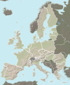
European Union color topographic map.svg 377 × 454; 906 KB
-
European Union map heightfield.svg 377 × 454; 635 KB
-
European Union relief laea location map.svg 1,401 × 1,198; 1,018 KB
-
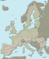
European Union topographic map.svg 377 × 454; 615 KB
-
Fond de carte Tour de France-blank.svg 2,110 × 2,525; 1.79 MB
-
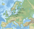
German destroyer Z39 map.svg 1,839 × 1,573; 4.62 MB
-
Hainault and the surrounding area.svg 316 × 499; 1.48 MB
-
MassifGreseuxDeLElbe.svg 2,110 × 2,525; 1.89 MB
-
North Italy relief location map 1905.svg 1,603 × 1,004; 11.85 MB
-
Saint Kea assumed travels.svg 590 × 783; 1.79 MB
-
West Mediterranean sea topographic map.svg 812 × 408; 1.11 MB
-
Western Europe DEMIS topographic map.svg 1,090 × 778; 2.08 MB


