Category:SVG road signs of Ontario
Jump to navigation
Jump to search
Provinces and territories of Canada: British Columbia · Manitoba · Nova Scotia · Ontario · Prince Edward Island · Quebec ·
Subcategories
This category has the following 4 subcategories, out of 4 total.
S
Media in category "SVG road signs of Ontario"
The following 200 files are in this category, out of 203 total.
(previous page) (next page)-
North Dumfries Township Road 8.svg 450 × 450; 5 KB
-
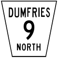
North Dumfries Township Road 9.svg 450 × 450; 4 KB
-
Central Frontenac Township Road 38.svg 450 × 450; 8 KB
-
Central Frontenac Township Road 509.svg 450 × 450; 7 KB
-
CA-ON road sign M-511.svg 512 × 512; 7 KB
-
Cornwall City Road 2.svg 450 × 450; 3 KB
-
Durham Regional Highway 12.svg 450 × 450; 3 KB
-
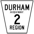
Durham Regional Highway 2.svg 450 × 450; 3 KB
-
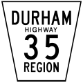
Durham Regional Highway 35.svg 450 × 450; 5 KB
-
Durham Regional Highway 47.svg 450 × 450; 3 KB
-
Durham Regional Highway 48.svg 450 × 450; 5 KB
-
Durham Regional Highway 7.svg 450 × 450; 3 KB
-
Durham Regional Highway 7A.svg 450 × 450; 3 KB
-
Durham Regional Road 2A.svg 450 × 450; 3 KB
-
Kingston City Road 1.svg 450 × 450; 3 KB
-
Kingston City Road 10.svg 450 × 450; 3 KB
-
Kingston City Road 11.svg 450 × 450; 3 KB
-
Kingston City Road 12.svg 450 × 450; 3 KB
-
Kingston City Road 13.svg 450 × 450; 4 KB
-
Kingston City Road 15.svg 450 × 450; 4 KB
-
Kingston City Road 16.svg 450 × 450; 4 KB
-
Kingston City Road 17.svg 450 × 450; 3 KB
-
Kingston City Road 19.svg 450 × 450; 4 KB
-
Kingston City Road 2.svg 450 × 450; 3 KB
-
Kingston City Road 20.svg 450 × 450; 3 KB
-
Kingston City Road 21.svg 450 × 450; 3 KB
-
Kingston City Road 22.svg 450 × 450; 3 KB
-
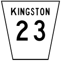
Kingston City Road 23.svg 450 × 450; 4 KB
-
Kingston City Road 24.svg 450 × 450; 3 KB
-
Kingston City Road 25.svg 450 × 450; 4 KB
-
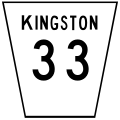
Kingston City Road 33.svg 450 × 450; 4 KB
-
Kingston City Road 38.svg 450 × 450; 6 KB
-
Kingston City Road 4.svg 450 × 450; 3 KB
-
Kingston City Road 6.svg 450 × 450; 4 KB
-
Kingston City Road 9.svg 450 × 450; 4 KB
-
North Dumfries Township Road 1.svg 450 × 450; 3 KB
-
North Dumfries Township Road 10.svg 450 × 450; 3 KB
-
North Dumfries Township Road 11.svg 450 × 450; 3 KB
-
North Dumfries Township Road 12.svg 450 × 450; 3 KB
-
North Dumfries Township Road 13.svg 450 × 450; 4 KB
-
North Dumfries Township Road 14.svg 450 × 450; 3 KB
-
North Dumfries Township Road 15.svg 450 × 450; 4 KB
-
North Dumfries Township Road 16.svg 450 × 450; 4 KB
-
North Dumfries Township Road 17.svg 450 × 450; 3 KB
-
North Dumfries Township Road 18.svg 450 × 450; 5 KB
-
North Dumfries Township Road 19.svg 450 × 450; 4 KB
-
North Dumfries Township Road 1E.svg 450 × 450; 3 KB
-
North Dumfries Township Road 2.svg 450 × 450; 3 KB
-
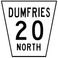
North Dumfries Township Road 20.svg 450 × 450; 4 KB
-
North Dumfries Township Road 21.svg 450 × 450; 3 KB
-
North Dumfries Township Road 22.svg 450 × 450; 3 KB
-
North Dumfries Township Road 23.svg 450 × 450; 5 KB
-
North Dumfries Township Road 24.svg 450 × 450; 4 KB
-
North Dumfries Township Road 27A.svg 450 × 450; 4 KB
-
North Dumfries Township Road 2E.svg 450 × 450; 4 KB
-
North Dumfries Township Road 3.svg 450 × 450; 4 KB
-
North Dumfries Township Road 3E.svg 450 × 450; 4 KB
-
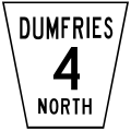
North Dumfries Township Road 4.svg 450 × 450; 3 KB
-
North Dumfries Township Road 44.svg 450 × 450; 3 KB
-
North Dumfries Township Road 4E.svg 450 × 450; 3 KB
-
North Dumfries Township Road 5.svg 450 × 450; 4 KB
-
North Dumfries Township Road 5E.svg 450 × 450; 4 KB
-
North Dumfries Township Road 6.svg 450 × 450; 4 KB
-
North Dumfries Township Road 6E.svg 450 × 450; 4 KB
-
Ontario 11 EDR.svg 450 × 600; 8 KB
-
Ontario 115 EDR.svg 450 × 600; 9 KB
-
Ontario 12 EDR.svg 450 × 600; 9 KB
-
Ontario 137 EDR.svg 450 × 600; 10 KB
-
Ontario 17 EDR.svg 450 × 600; 9 KB
-
Ontario 27 EDR.svg 450 × 600; 10 KB
-
Ontario 400 EDR.svg 450 × 600; 9 KB
-
Ontario 400A EDR.svg 450 × 600; 9 KB
-
Ontario 401 EDR.svg 450 × 600; 9 KB
-
Ontario 402 EDR.svg 450 × 600; 10 KB
-
Ontario 403 EDR.svg 450 × 600; 10 KB
-
Ontario 404 EDR.svg 450 × 600; 9 KB
-
Ontario 405 EDR.svg 450 × 600; 10 KB
-
Ontario 406 EDR.svg 450 × 600; 10 KB
-
Ontario 407 Toll.svg 458 × 953; 56 KB
-
Ontario 409 EDR.svg 450 × 600; 10 KB
-
Ontario 410 EDR.svg 450 × 600; 9 KB
-
Ontario 412 Toll.svg 458 × 953; 56 KB
-
Ontario 416 EDR.svg 450 × 600; 10 KB
-
Ontario 417 EDR.svg 450 × 600; 9 KB
-
Ontario 418 Toll.svg 458 × 953; 57 KB
-
Ontario 420 EDR.svg 450 × 600; 10 KB
-
Ontario 427 EDR.svg 450 × 600; 9 KB
-
Ontario 58 EDR.svg 450 × 600; 11 KB
-
Ontario 6 EDR.svg 450 × 600; 9 KB
-
Ontario 69 EDR.svg 450 × 600; 9 KB
-
Ontario 7 EDR.svg 450 × 600; 9 KB
-
Ontario 8 EDR.svg 450 × 600; 10 KB
-
Ontario 85 EDR.svg 450 × 600; 11 KB
-
Ontario Blank EDR.svg 450 × 600; 8 KB
-
Ontario Parking Sign.svg 512 × 512; 3 KB
-
Ontario QEW EDR.svg 450 × 600; 10 KB
-
Ontario Template-00 EDR.svg 450 × 600; 8 KB
-
Ontario Template-000 EDR.svg 450 × 600; 8 KB
-
Ottawa Regional Road 174 EDR.svg 450 × 600; 4 KB
-
Perth County Line 20.svg 450 × 450; 3 KB
-
Perth County Line 24.svg 450 × 450; 3 KB
-
Perth County Line 26.svg 450 × 450; 4 KB
-
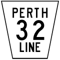
Perth County Line 32.svg 450 × 450; 4 KB
-
Perth County Line 33.svg 450 × 450; 3 KB
-
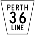
Perth County Line 36.svg 450 × 450; 5 KB
-
Perth County Line 37.svg 450 × 450; 4 KB
-
Perth County Line 43.svg 450 × 450; 3 KB
-
Perth County Line 44.svg 450 × 450; 2 KB
-
Perth County Line 55.svg 450 × 450; 3 KB
-
Perth County Line 56.svg 450 × 450; 4 KB
-
Perth County Line 72.svg 450 × 450; 3 KB
-
Perth County Line 8.svg 450 × 450; 4 KB
-
Perth County Line 86.svg 450 × 450; 5 KB
-
Perth County Line 88.svg 450 × 450; 4 KB
-
Perth County Line 9.svg 450 × 450; 3 KB
-
Perth County Line 91.svg 450 × 450; 3 KB
-
Perth County Line 93.svg 450 × 450; 5 KB
-
Perth County Road 101.svg 450 × 450; 3 KB
-
Perth County Road 107.svg 450 × 450; 3 KB
-
Perth County Road 112.svg 450 × 450; 3 KB
-
Perth County Road 113.svg 450 × 450; 4 KB
-
Perth County Road 118.svg 450 × 450; 4 KB
-
Perth County Road 119.svg 450 × 450; 4 KB
-
Perth County Road 120A.svg 450 × 450; 4 KB
-
Perth County Road 121.svg 450 × 450; 3 KB
-
Perth County Road 122.svg 450 × 450; 3 KB
-
Perth County Road 123.svg 450 × 450; 4 KB
-
Perth County Road 130.svg 450 × 450; 4 KB
-
Perth County Road 131.svg 450 × 450; 4 KB
-
Perth County Road 135.svg 450 × 450; 5 KB
-
Perth County Road 139.svg 450 × 450; 5 KB
-
Perth County Road 140.svg 450 × 450; 3 KB
-
Perth County Road 147.svg 450 × 450; 3 KB
-
Perth County Road 151.svg 450 × 450; 3 KB
-
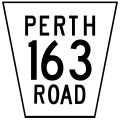
Perth County Road 163.svg 450 × 450; 5 KB
-
Perth County Road 178.svg 450 × 450; 4 KB
-
Perth County Road 180.svg 450 × 450; 5 KB
-
Quinte West City Road 1.svg 450 × 450; 4 KB
-
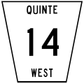
Quinte West City Road 14.svg 450 × 450; 4 KB
-
Quinte West City Road 2.svg 450 × 450; 4 KB
-
Quinte West City Road 21.svg 450 × 450; 4 KB
-
Quinte West City Road 22.svg 450 × 450; 4 KB
-
Quinte West City Road 28.svg 450 × 450; 6 KB
-
Quinte West City Road 30.svg 450 × 450; 5 KB
-
Quinte West City Road 31.svg 450 × 450; 5 KB
-
Quinte West City Road 33.svg 450 × 450; 5 KB
-
Quinte West City Road 34.svg 450 × 450; 5 KB
-
Quinte West City Road 4.svg 450 × 450; 4 KB
-
Quinte West City Road 40.svg 450 × 450; 4 KB
-
Quinte West City Road 42.svg 450 × 450; 4 KB
-
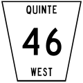
Quinte West City Road 46.svg 450 × 450; 5 KB
-
Quinte West City Road 5.svg 450 × 450; 4 KB
-
Quinte West City Road 64.svg 450 × 450; 5 KB
-
Quinte West City Road 8.svg 450 × 450; 5 KB
-
South Frontenac Township Road 10.svg 450 × 450; 7 KB
-
South Frontenac Township Road 11.svg 450 × 450; 7 KB
-
South Frontenac Township Road 12.svg 450 × 450; 7 KB
-
South Frontenac Township Road 18.svg 450 × 450; 9 KB
-
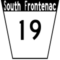
South Frontenac Township Road 19.svg 450 × 450; 8 KB
-
South Frontenac Township Road 38.svg 450 × 450; 10 KB
-
South Frontenac Township Road 4.svg 450 × 450; 7 KB
-
South Frontenac Township Road 5.svg 450 × 450; 7 KB
-
South Frontenac Township Road 7.svg 450 × 450; 7 KB
-
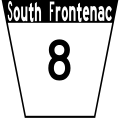
South Frontenac Township Road 8.svg 450 × 450; 8 KB
-
South Frontenac Township Road 9.svg 450 × 450; 8 KB
-
TCH-COR.svg 446 × 600; 22 KB
-
TCH-GBR.svg 446 × 600; 21 KB
-
TCH-LSR.svg 446 × 600; 22 KB
-
TCH-NOR.svg 446 × 600; 22 KB
-
TCH-OVR.svg 446 × 600; 19 KB
-
Toronto Seniors Safety Zone sign.svg 2,133 × 2,842; 17 KB
-
Toronto Watercourse Locator Sign.svg 512 × 224; 8 KB
-
Waterloo Regional Road 97.svg 450 × 450; 4 KB
-
Waterloo Township Road 16N.svg 36 × 36; 3 KB
-
Waterloo Township Road 2C.svg 36 × 36; 2 KB
-
Waterloo Township Road 66.svg 36 × 36; 2 KB
-
Waterloo Township Road 72.svg 36 × 36; 2 KB
-
Waterloo Township Road 78.svg 36 × 36; 3 KB
-
Wilmot Township Road 1.svg 450 × 450; 2 KB
-
Wilmot Township Road 10.svg 450 × 450; 3 KB
-
Wilmot Township Road 11.svg 450 × 450; 2 KB
-
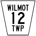
Wilmot Township Road 12.svg 450 × 450; 3 KB
-
Wilmot Township Road 13.svg 450 × 450; 4 KB
-
Wilmot Township Road 14.svg 450 × 450; 3 KB
-
Wilmot Township Road 15.svg 450 × 450; 3 KB
-
Wilmot Township Road 16.svg 450 × 450; 4 KB
-
Wilmot Township Road 17.svg 450 × 450; 3 KB
-
Wilmot Township Road 18.svg 450 × 450; 4 KB
-
Wilmot Township Road 19.svg 450 × 450; 4 KB
-
Wilmot Township Road 2.svg 450 × 450; 3 KB
-
Wilmot Township Road 20.svg 450 × 450; 3 KB
-
Wilmot Township Road 21.svg 450 × 450; 3 KB
-
Wilmot Township Road 22.svg 450 × 450; 3 KB
-
Wilmot Township Road 23.svg 450 × 450; 4 KB
-
Wilmot Township Road 24.svg 450 × 450; 3 KB
-
Wilmot Township Road 3.svg 450 × 450; 4 KB
-
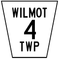
Wilmot Township Road 4.svg 450 × 450; 2 KB
-
Wilmot Township Road 5.svg 450 × 450; 3 KB
-
Wilmot Township Road 6.svg 450 × 450; 3 KB
-
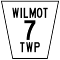
Wilmot Township Road 7.svg 450 × 450; 2 KB

