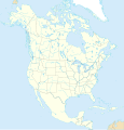
Category:SVG political maps of North America
Jump to navigation
Jump to search
Temperate regions: North America · South America · Africa · Europe · Asia · – Polar regions: – Other regions: Afro-Eurasia ·
| NO WIKIDATA ID FOUND! Search for SVG political maps of North America on Wikidata | |
| Upload media |
Countries of North America: Antigua and Barbuda · the Bahamas ≈ Bahamas · Barbados · Belize · Canada · Costa Rica · Cuba · Dominica · the Dominican Republic ≈ Dominican Republic · El Salvador · Grenada · Guatemala · Haiti · Honduras · Jamaica · Mexico · Nicaragua · Panama · Saint Kitts and Nevis · Saint Lucia · Saint Vincent and the Grenadines · Trinidad and Tobago‡ · the United States‡ ≈ United States‡
Other territories: Anguilla · Bermuda · the British Virgin Islands ≈ British Virgin Islands · the Cayman Islands ≈ Cayman Islands · the Florida Keys ≈ Florida Keys · Greenland · Guadeloupe · Martinique · Montserrat · Puerto Rico · Saint-Barthélemy · Saint Martin (France) · Saint-Pierre and Miquelon · the Turks and Caicos Islands ≈ Turks and Caicos Islands · the United States Virgin Islands ≈ United States Virgin Islands
‡: partly located in North America
Subcategories
This category has only the following subcategory.
Media in category "SVG political maps of North America"
The following 14 files are in this category, out of 14 total.
-
2016 United States presidential election results map by county.svg 542 × 334; 13.32 MB
-
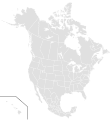
BlankMap-North America-Subdivisions.svg 1,677 × 1,789; 1.18 MB
-
Map of list of active separatist movements in north america.svg 1,168 × 1,065; 6.37 MB
-
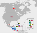
Map of North America with flags.svg 560 × 500; 1.68 MB
-
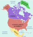
Mapa america do norte.svg 350 × 396; 118 KB
-
N. America separatism.svg 2,642 × 3,902; 1.18 MB
-
North America - First level political divisions.svg 350 × 396; 65 KB
-
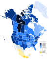
North America first level political divisions by income.svg 1,789 × 2,154; 537 KB
-
North America map coloured.svg 1,634 × 1,992; 345 KB
-
North America map with states and provinces.svg 1,300 × 1,353; 674 KB
-
North America states and provinces.svg 495 × 465; 1.18 MB
-
North america.svg 506 × 669; 960 KB
-
Northeast and Midwest America map with states and provinces.svg 638 × 638; 403 KB

