Category:SVG maps showing history
Jump to navigation
Jump to search
Subcategories
This category has the following 3 subcategories, out of 3 total.
E
Media in category "SVG maps showing history"
The following 33 files are in this category, out of 33 total.
-
Abbasid Caliphate (greatest extent).svg 553 × 553; 296 KB
-
Archaic globalization.svg 1,417 × 1,063; 430 KB
-
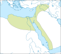
Ayubíes1189.svg 591 × 521; 846 KB
-
Blank map of Europe in 1920.svg 841 × 732; 541 KB
-
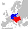
Dual Alliance in 1914.svg 450 × 456; 468 KB
-
Ganedigezh, Marv ha Bezioù Ried Breizh.svg 2,000 × 1,922; 1.25 MB
-
Germanic tribes settlements 750BC-1AD.svg 527 × 390; 201 KB
-
Hippie trail az.svg 1,514 × 800; 520 KB
-
Hippie trail.svg 1,514 × 800; 428 KB
-
K-524 Arctic voyage map.svg 1,173 × 869; 1,000 KB
-
Kurilen und Sachalin 1875-1945.svg 868 × 478; 64 KB
-
Map Iberian Peninsula 1000-be.svg 827 × 574; 236 KB
-
Partition of India-ms.svg 718 × 838; 53 KB
-
Political map of England 1140.svg 1,396 × 1,137; 191 KB
-
Political map of England 1153.svg 1,396 × 1,644; 106 KB
-
Punjab 1951-66 as.svg 1,055 × 427; 50 KB
-
Punjab 1951-66-gu.svg 1,055 × 427; 51 KB
-
Punjab 1951-66-hi.svg 1,055 × 427; 53 KB
-
Punjab 1951-66-kn.svg 1,055 × 427; 62 KB
-
Punjab 1951-66-ml.svg 1,055 × 427; 76 KB
-
Punjab 1951-66-mr.svg 1,055 × 427; 54 KB
-
Punjab 1951-66-pa.svg 1,055 × 427; 52 KB
-
Punjab 1951-66-te.svg 1,055 × 427; 54 KB
-
Punjab 1951-66.od.svg 1,055 × 427; 52 KB
-
Romania wwII.svg 471 × 371; 26 KB
-
Scandinavia 1645-es.svg 1,191 × 1,799; 166 KB
-
Scandinavia 1814-es.svg 1,191 × 1,799; 163 KB
-
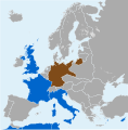
Stresa-Front 1935.svg 676 × 685; 368 KB
-
The height of Swedish territories in 1658.svg 1,191 × 1,799; 161 KB
-
TratadoDeBrestLitovsk NO.svg 512 × 708; 392 KB
-
Voting res 2758.svg 1,700 × 766; 1.08 MB
-
Voting res 3379.svg 1,700 × 766; 678 KB
-
公元500年的萨珊王朝.svg 1,000 × 980; 792 KB


