Category:SVG maps of the history of Venezuela
Jump to navigation
Jump to search
Subcategories
This category has the following 4 subcategories, out of 4 total.
Media in category "SVG maps of the history of Venezuela"
The following 14 files are in this category, out of 14 total.
-
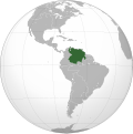 Captaincy General of Venezuela, 1777 (ortographic projection).svg 550 × 550; 331 KB
-
 Map of Venezuela (1813).svg 1,793 × 1,303; 1.47 MB
-
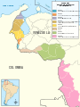
 Mapa de la crisis 2015 entre Colombia y Venezuela (deportados-retornados).svg 972 × 1,296; 258 KB
-
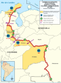
 Mapa de la crisis 2015 entre Colombia y Venezuela (municipios).svg 972 × 1,296; 921 KB
-
-
 Mapa de Venezuela 1817-1819.svg 1,664 × 1,483; 1.9 MB
-
 Mapa de Venezuela, 1817-1819.svg 1,879 × 1,483; 1.21 MB
-
 Mapa FR de la crisis 2015 entre Colombia y Venezuela (deportados-retornados).svg 972 × 1,296; 258 KB
-
 Mapa FR de la crisis 2015 entre Colombia y Venezuela (municipios).svg 972 × 1,296; 921 KB
-

-
 Venezuela (1810).svg 2,050 × 1,479; 657 KB
-
 Venezuela (1840).svg 2,050 × 1,479; 729 KB
-
 Venezuela (1856).svg 2,050 × 1,479; 795 KB
-
 Venezuela (1990).svg 2,050 × 1,479; 859 KB
.svg)
.svg)
.svg)
.svg)
.svg)


.svg)
.svg)
.svg)
.svg)
.svg)
.svg)
.svg)