Category:SVG maps of the history of Santander Department
Jump to navigation
Jump to search
Media in category "SVG maps of the history of Santander Department"
The following 22 files are in this category, out of 22 total.
-
 Bolívar-Landázuri in United States of Colombia.svg 2,085 × 2,260; 1.68 MB
-
 Boyacá in Gran Colombia (1824).svg 2,843 × 2,461; 1.19 MB
-
 Bucaramanga in Colombia (1908).svg 2,029 × 2,241; 447 KB
-
 Galán in Colombia (1905).svg 2,029 × 2,242; 408 KB
-
 García Rovira in New Granada (1855).svg 2,029 × 2,242; 836 KB
-
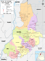
 Mapa de Santander (1810).svg 940 × 1,258; 292 KB
-
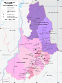
 Mapa de Santander (1832).svg 940 × 1,258; 335 KB
-
 Mapa de Santander (1855).svg 940 × 1,258; 367 KB
-
 Mapa de Santander (1859).svg 911 × 1,231; 415 KB
-
 Mapa de Santander (1870).svg 911 × 1,231; 437 KB
-
 Mapa de Santander (1905).svg 940 × 1,258; 334 KB
-
 Mapa de Santander (1908).svg 940 × 1,258; 278 KB
-
 Mapa de Santander (1910).svg 940 × 1,258; 329 KB
-
 Mapa de Santander (2010).svg 940 × 1,258; 677 KB
-
 Pamplona in New Granada (1810).svg 2,029 × 2,241; 1.08 MB
-
 San Gil in Colombia (1908).svg 2,029 × 2,241; 447 KB
-
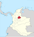
 Santander in Granadine Confederation.svg 2,029 × 2,242; 417 KB
-
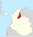
 Santander in United States of Colombia.svg 2,029 × 2,241; 424 KB
-
 Socorro in New Granada (1810).svg 2,029 × 2,241; 1.08 MB
-
 Socorro in New Granada (1855).svg 2,029 × 2,242; 836 KB
-
 Soto in New Granada (1855).svg 2,029 × 2,242; 836 KB
-
 Vélez in New Granada (1855).svg 2,029 × 2,242; 836 KB

.svg)
.svg)
.svg)
.svg)
.svg)
.svg)
.svg)
.svg)
.svg)
.svg)
.svg)
.svg)
.svg)
.svg)
.svg)


.svg)
.svg)
.svg)
.svg)