Category:SVG maps of the history of Brazil
Jump to navigation
Jump to search
Media in category "SVG maps of the history of Brazil"
The following 20 files are in this category, out of 20 total.
-
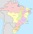
Brazil in 1534.svg 2,008 × 1,985; 1,016 KB
-
Brazil in 1572.svg 2,008 × 1,985; 913 KB
-
Brazil in 1709.svg 2,008 × 1,985; 1.18 MB
-
Brazil in 1750.svg 2,008 × 1,985; 1.29 MB
-
Brazil in 1817.svg 2,008 × 1,985; 1.37 MB
-
Brazil in 1822.svg 2,008 × 2,065; 1.45 MB
-
Brazil in 1889.svg 2,008 × 1,986; 1.43 MB
-
Brazil in 1943.svg 2,008 × 1,987; 1.5 MB
-
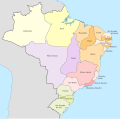
Brazil Provinces 1889.svg 2,008 × 1,984; 1.13 MB
-
Coffee with milk politics map of Brazil.svg 2,008 × 1,984; 1.17 MB
-
Estado do Brasil - 1549.svg 1,883 × 1,861; 840 KB
-
Estado do Brasil - 1815.svg 1,883 × 1,861; 1.07 MB
-
Jundiaí (1763).svg 1,055 × 728; 483 KB
-
Nordeste brasileiro - 1709 (cropped).svg 833 × 1,028; 430 KB
-
Nordeste brasileiro - 1709 map.svg 840 × 1,028; 1.61 MB
-
Pernambuco - 1534.svg 1,883 × 1,861; 840 KB
-
Reducciones.svg 568 × 390; 387 KB
-
Reducciones2.svg 394 × 338; 132 KB
-
Sudamerica-rioplata 1864-1873.svg 1,873 × 2,000; 219 KB
-
Tupiniquim area.svg 744 × 718; 11 KB


