Category:SVG maps of the history of Antioquia Department
Jump to navigation
Jump to search
Media in category "SVG maps of the history of Antioquia Department"
The following 34 files are in this category, out of 34 total.
-
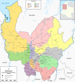
 Antioquia (1580).svg 1,742 × 1,987; 422 KB
-
 Antioquia (1650).svg 1,742 × 1,987; 443 KB
-
 Antioquia (1760).svg 1,742 × 1,987; 589 KB
-
 Antioquia (1800).svg 1,742 × 1,987; 651 KB
-
 Antioquia (1814).svg 2,012 × 2,379; 985 KB
-
 Antioquia (1826).svg 1,742 × 1,987; 756 KB
-
 Antioquia (1835).svg 1,742 × 1,987; 787 KB
-
 Antioquia (1843).svg 1,742 × 1,987; 854 KB
-
 Antioquia (1851).svg 1,742 × 1,987; 924 KB
-
 Antioquia (1859).svg 1,742 × 1,987; 899 KB
-
 Antioquia (1865).svg 1,742 × 1,987; 904 KB
-
 Antioquia (1885).svg 1,742 × 1,987; 980 KB
-
 Antioquia (1905).svg 2,012 × 2,207; 1.23 MB
-
 Antioquia (1908).svg 2,012 × 2,125; 1.19 MB
-
 Antioquia (1910).svg 2,012 × 2,125; 1.23 MB
-
 Antioquia (1930).svg 2,012 × 2,125; 1.26 MB
-
 Antioquia (1960).svg 2,012 × 2,125; 1.27 MB
-
 Antioquia (1977).svg 2,012 × 2,125; 1.34 MB
-
 Antioquia (1982).svg 2,012 × 2,125; 1.38 MB
-
 Antioquia (2010).svg 2,012 × 2,125; 1.42 MB
-
 Antioquia in Colombia (1908).svg 2,029 × 2,241; 447 KB
-
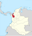
 Antioquia in Granadine Confederation.svg 2,029 × 2,242; 417 KB
-
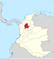
 Antioquia in New Granada (1810).svg 2,029 × 2,241; 1.08 MB
-
 Antioquia in New Granada (1855).svg 2,029 × 2,242; 836 KB
-
 Antioquia in United States of Colombia.svg 2,029 × 2,241; 424 KB
-
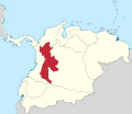 Cundinamarca in Gran Colombia (1824).svg 2,843 × 2,461; 1.19 MB
-
 Córdova in New Granada (1855).svg 2,029 × 2,242; 836 KB
-
 Jericó in Colombia (1908).svg 2,029 × 2,241; 447 KB
-
 Mapa de la colonización antioqueña (expansión poblacional).svg 961 × 1,352; 429 KB
-
 Mapa de la colonización antioqueña (rutas).svg 961 × 1,352; 409 KB
-
 Medellín in Colombia (1908).svg 2,029 × 2,241; 447 KB
-
 Medellín in New Granada (1855).svg 2,029 × 2,242; 836 KB
-
 Sonsón in Colombia (1908).svg 2,029 × 2,241; 447 KB
-
 Urabá in Colombia (1912).svg 2,024 × 2,291; 441 KB
.svg)
.svg)
.svg)
.svg)
.svg)
.svg)
.svg)
.svg)
.svg)
.svg)
.svg)
.svg)
.svg)
.svg)
.svg)
.svg)
.svg)
.svg)
.svg)
.svg)
.svg)

.svg)
.svg)

.svg)
.svg)
.svg)
.svg)
.svg)
.svg)
.svg)
.svg)
.svg)