Category:SVG maps of the Spanish Empire
Jump to navigation
Jump to search
Subcategories
This category has the following 4 subcategories, out of 4 total.
A
N
S
Media in category "SVG maps of the Spanish Empire"
The following 57 files are in this category, out of 57 total.
-
1812SpanishConstitutionMap.svg 863 × 443; 7.5 MB
-
Universidades fundadas por España en América y Filipinas.png 1,000 × 1,000; 258 KB
-
CaminoEspañol-NL.svg 449 × 614; 1.89 MB
-
CaminoEspañol.svg 449 × 614; 1.25 MB
-
Capitanía general de Filipinas.svg 494 × 243; 200 KB
-
Diachronic map of the Spanish Empire 2.svg 863 × 443; 6.05 MB
-
Diachronic map of the Spanish Empire-zh-hans.svg 4,371 × 2,284; 6.42 MB
-
Diachronic map of the Spanish Empire.svg 4,371 × 2,284; 6.47 MB
-
Dominios de Felipe II-hu.svg 927 × 573; 521 KB
-
Dominios de Felipe II-pt.svg 927 × 573; 377 KB
-
Dominios de Felipe II.svg 927 × 573; 719 KB
-
Dutch and Spanish Taiwan es.svg 627 × 720; 197 KB
-
Empresa de China.svg 1,974 × 1,974; 2.34 MB
-
Espacio Constitucional Luso-Hispánico.svg 2,754 × 1,398; 2.19 MB
-
España1890.svg 740 × 931; 1.81 MB
-
Gobernación de la Terra Australis (1539-1555), España.svg 744 × 1,219; 1.67 MB
-
Governorate of Terra Australis (1539-1555), Spain.svg 744 × 1,219; 1.67 MB
-
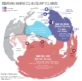
Iberian mare clausum claims.svg 1,600 × 956; 269 KB
-
Iberian Union empires.svg 940 × 415; 1.83 MB
-
IberianMareClausum-es.svg 613 × 608; 835 KB
-
IberianMareClausum.svg 875 × 869; 203 KB
-
Imperio Español Completo de.svg 863 × 443; 6.58 MB
-
Imperio Español Completo-ar.svg 921 × 472; 6.39 MB
-
Imperio español diacrónico (es).svg 2,753 × 1,399; 1.01 MB
-
ImperioDeFelipeII.svg 2,362 × 858; 2.26 MB
-
Imperios Español y Portugués 1790.svg 2,655 × 3,000; 7.7 MB
-
Imperios ibéricos, 1790.svg 2,754 × 1,398; 1.53 MB
-
Largest empires in history including claims.svg 2,214 × 1,582; 8.11 MB
-
Map of the Englightement in Spain.svg 863 × 443; 5.58 MB
-
Map of the Holy League in 1595.svg 1,140 × 990; 525 KB
-
Map WestIndies SpanishTreasureRoutes 1726.svg 737 × 411; 3.39 MB
-
Mayores imperios incluyendo reclamaciones.svg 2,214 × 1,582; 8.26 MB
-
Nación Española 1580.svg 2,754 × 1,398; 2.09 MB
-
Oceanía Española.svg 1,473 × 1,264; 2.92 MB
-
Proyectos geopolíticos inconclusos de la España del siglo XVIII.svg 1,120 × 750; 3.8 MB
-
Segunda Unión Ibérica.svg 2,754 × 1,398; 4.61 MB
-
Size of Empires Spanish VS British.svg 4,607 × 3,292; 6.99 MB
-
Size of Empires.svg 996 × 1,515; 2.57 MB
-
Spanish Australia (Australia del Espíritu Santo).svg 1,797 × 1,214; 2.57 MB
-
Spanish Empire (diachronic).svg 863 × 443; 5.3 MB
-
Spanish Empire Anachronous en IncludingClaims.svg 2,753 × 1,399; 1.17 MB
-
Spanish Empire Anachronous en.svg 2,753 × 1,399; 1.12 MB
-
Spanish Empire and Empire of Charles V.svg 4,371 × 2,284; 6.5 MB
-
Spanish Empire.svg 2,754 × 1,398; 2.85 MB
-
Spanish Moluccas.svg 2,008 × 1,632; 5.57 MB
-
Spanish New Guinea.svg 2,537 × 1,231; 6.76 MB
-
Spanish North America.png 7,949 × 7,944; 25.09 MB
-
Spanish Solomon and Santa Cruz Islands.svg 1,890 × 1,097; 1.22 MB
-
Spanish World Empire.svg 7,185 × 4,073; 10.96 MB
-
SpanishEmpire1606.svg 2,589 × 1,318; 2.07 MB
-
SpanishEmpire1790-ar.svg 921 × 472; 5.7 MB
-
SpanishEmpire1790.svg 4,327 × 2,194; 5.67 MB
-
SpanishEmpireandControlledlands.png 5,762 × 3,038; 1.61 MB
-
SpanishPacific-es.svg 1,250 × 1,075; 4.1 MB
-
SpanishPacific.svg 1,250 × 1,075; 2.04 MB
-
Unión de Armas.svg 1,257 × 840; 412 KB
-
África Ecuatorial Española.svg 2,846 × 1,863; 1.91 MB


