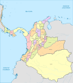
Category:SVG maps of the Republic of New Granada
Jump to navigation
Jump to search
Subcategories
This category has the following 2 subcategories, out of 2 total.
Media in category "SVG maps of the Republic of New Granada"
The following 22 files are in this category, out of 22 total.
-
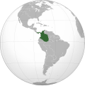
New Granada (orthographic projection).svg 550 × 550; 444 KB
-
Antioquia (1835).svg 1,742 × 1,987; 787 KB
-
Antioquia (1843).svg 1,742 × 1,987; 854 KB
-
Antioquia (1851).svg 1,742 × 1,987; 924 KB
-
Antioquia (1859).svg 1,742 × 1,987; 899 KB
-
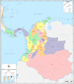
Colombia (1835).svg 2,072 × 2,339; 2.48 MB
-
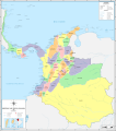
Colombia (1847).svg 2,072 × 2,339; 2.61 MB
-
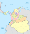
Colombia (1853).svg 2,072 × 2,339; 2.53 MB
-
Colombia in 1835.svg 2,029 × 2,296; 2.02 MB
-
Colombia in 1847.svg 2,029 × 2,296; 2.15 MB
-
Colombia in 1853.svg 2,029 × 2,296; 2.01 MB
-
Guerra de los Supremos (1839-1840).svg 1,287 × 1,351; 782 KB
-
Guerra de los Supremos (1841-1842).svg 1,287 × 1,351; 842 KB
-
Guerra de los Supremos.svg 1,287 × 1,351; 880 KB
-
Mapa de Santander (1832).svg 940 × 1,258; 335 KB
-
Mapa de Santander (1855).svg 940 × 1,258; 367 KB
-
New Granada location map.svg 2,085 × 2,260; 1.57 MB
-
Panama (1847).svg 748 × 438; 211 KB
-
Panama (1853).svg 748 × 438; 196 KB
-
Panama (1856).svg 748 × 438; 243 KB
-
Territorios de Colombia entre 1843 y 1898.svg 2,029 × 2,296; 1.07 MB
-
Viajes Comisión Corográfica.svg 2,237 × 2,362; 3.14 MB
