Category:SVG maps of the Philippines
Jump to navigation
Jump to search
Subcategories
This category has the following 8 subcategories, out of 8 total.
B
L
P
R
Media in category "SVG maps of the Philippines"
The following 41 files are in this category, out of 41 total.
-
2019-21 polio outbreak in the Philippines.svg 4,200 × 6,105; 912 KB
-
Bataan Death March route vector ja.svg 309 × 379; 45 KB
-
Bataan Death March route vector ru.svg 303 × 379; 47 KB
-
Bataan Death March route vector-zhs.svg 315 × 379; 63 KB
-
Bataan Death March route vector-zht.svg 315 × 379; 63 KB
-
Bataan Death March route vector.svg 315 × 379; 47 KB
-
City of Greater Manila in the Philippines.svg 512 × 792; 1.31 MB
-
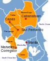
Cordillera and Bangsamoro.svg 1,871 × 2,468; 1.41 MB
-
COVID-19 community quarantine in the Philippines (April 6–30).svg 4,200 × 6,105; 2.61 MB
-
COVID-19 community quarantine in the Philippines (July 16–31).svg 4,200 × 6,105; 2.49 MB
-
COVID-19 pandemic cases in the Philippines (affected primary LGUs).svg 3,545 × 4,343; 1.69 MB
-
COVID-19 pandemic cases in the Philippines (primary LGUs breakdown).svg 4,200 × 6,105; 1.01 MB
-
COVID-19 pandemic cases in the Philippines by region (per capita).svg 4,200 × 6,105; 2.02 MB
-
COVID-19 pandemic cases in the Philippines by region.svg 4,200 × 6,105; 2.02 MB
-
COVID-19 pandemic cases in the Philippines version 2.svg 4,200 × 6,105; 2.63 MB
-
COVID-19 pandemic cases in the Philippines.svg 4,200 × 6,105; 912 KB
-
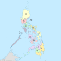
Federal philippines (letter coded) map.svg 1,332 × 1,332; 2.27 MB
-
Federal State of the Visayas in the First Philippine Republic.svg 512 × 826; 1.21 MB
-
Mapa das Filipinas (OCHA).svg 252 × 252; 342 KB
-
Mapa precolonial filipino (~1500).svg 512 × 675; 735 KB
-
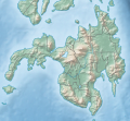
Mindanao relief location map.svg 395 × 362; 2.21 MB
-
Mindaneo location map.svg 395 × 362; 1.49 MB
-
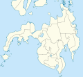
Mindano administrative.svg 1,052 × 1,000; 804 KB
-
Northern Mindanao.svg 2,206 × 1,893; 3.47 MB
-
Ph fil muntinlupa.svg 512 × 1,024; 98 KB
-
Ph general map blank.svg 4,200 × 6,105; 2.24 MB
-
Ph general map.svg 4,200 × 6,105; 2.53 MB
-
Ph locator congress manila 1st.svg 82 × 158; 58 KB
-
Philippine subdivisions with LGBT protections.svg 1,744 × 2,863; 109 KB
-
PhilippineAirForce AirBase map-en.svg 1,148 × 1,756; 298 KB
-
PhilippineAirForce AirBase map-fr.svg 1,148 × 1,756; 297 KB
-
Philippines (orthographic projection).svg 541 × 541; 401 KB
-
Philippines Aurora District locator map-fr.svg 1,148 × 1,756; 260 KB
-
Philippines HDI map.svg 2,000 × 3,120; 672 KB
-
PHL orthographic.svg 550 × 550; 1.23 MB
-
PNR Rail Map.svg 350 × 450; 6.12 MB
-
Sharia District Courts of the Philippines.svg 1,374 × 778; 129 KB
-
Terrorist incidents map of the Philippines 1970-2016.svg 1,052 × 724; 3.28 MB
-
The Philippines and ASEAN (orthographic projection).svg 550 × 551; 449 KB
-
Tiger Cub Philippines.svg 1,100 × 900; 187 KB
-
Turtle Islands Map.svg 1,149 × 753; 28 KB


