Category:SVG maps of the Arabian Peninsula
Jump to navigation
Jump to search
Media in category "SVG maps of the Arabian Peninsula"
The following 13 files are in this category, out of 13 total.
-
Arabian Peninsula Map.svg 1,854 × 1,546; 19 KB
-
Map of the Arabic peninsula - eo.svg 520 × 415; 146 KB
-
Arabian Peninsula blank.svg 392 × 429; 75 KB
-
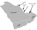
Arabian Peninsula Map-ar.svg 1,854 × 1,546; 63 KB
-
Geographic range of Naja arabica-ru.svg 491 × 358; 44 KB
-
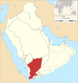
Lower Arabia.svg 512 × 268; 3.75 MB
-
Map of North Yemen in the Arabian Peninsula (1923).svg 1,162 × 1,225; 1.54 MB
-
Map of the Arabic peninsula - en.svg 520 × 415; 56 KB
-
Map of the Arabic peninsula - nl.svg 520 × 415; 48 KB
-
Map of the states of the Arabian Peninsula (1905-1923).svg 1,162 × 1,225; 1.36 MB
-
Piris Reis expedition map-ar.svg 533 × 356; 162 KB
-
Piris Reis expedition map-fr.svg 533 × 356; 75 KB
-
Rub-al-Jali.svg 693 × 567; 403 KB


