Category:SVG maps of Yugoslavia
Jump to navigation
Jump to search
Subcategories
This category has only the following subcategory.
Media in category "SVG maps of Yugoslavia"
The following 79 files are in this category, out of 79 total.
-
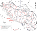
1944 Yugoslavia liberated territories.svg 1,553 × 1,297; 2.28 MB
-
Antiga Iugoslàvia - 2006-es.svg 1,832 × 1,142; 597 KB
-
Antiga Iugoslàvia - 2006.svg 1,832 × 1,142; 110 KB
-
Antiga Iugoslàvia - durant la guerra.svg 1,832 × 1,142; 141 KB
-
Banates and Administrative District of the Kingdom of Yugoslavia (1929-1939).png 2,364 × 2,048; 719 KB
-
Banates and Administrative District of the Kingdom of Yugoslavia (1939-1941).png 2,364 × 2,048; 719 KB
-
BanovinasDe1929.svg 2,760 × 2,000; 566 KB
-
Była Jugosławia 2006 (Former Yugoslavia).svg 1,832 × 1,142; 109 KB
-
Była Jugosławia 2006 ET.svg 1,832 × 1,142; 104 KB
-
Była Jugosławia podczas wojny 0.svg 1,454 × 1,142; 88 KB
-
Była Jugosławia podczas wojny ET.svg 1,832 × 1,142; 131 KB
-
Creation of Yugoslavia (October 29, 1918 - December 1, 1918).png 2,364 × 2,048; 528 KB
-
Former Yugoslavia 1991-1995.svg 1,832 × 1,142; 108 KB
-
Former Yugoslavia 2006.svg 1,832 × 1,142; 617 KB
-
Former Yugoslavia durning war hr.svg 1,832 × 1,142; 142 KB
-
Former Yugoslavia durning war-ES.svg 1,832 × 1,142; 143 KB
-
Former Yugoslavia durning war-PT.svg 1,832 × 1,142; 143 KB
-
Former Yugoslavia durning war.svg 1,832 × 1,142; 143 KB
-
History of Yugoslavia (tall).svg 450 × 1,380; 1.36 MB
-
Iugoslavia na guerra-GL.svg 1,832 × 1,142; 287 KB
-
Jugoslavija republike (1946-1990) location map.svg 1,220 × 1,057; 426 KB
-
Jugosławia podczas wojny 2006.svg 1,832 × 1,142; 142 KB
-
Kingdom of Serbs, Croats and Slovenes (1918-1929); Kingdom of Yugoslavia (1929-1941).png 2,364 × 2,048; 466 KB
-
Kingdom of Serbs, Croats and Slovenes (Yugoslavia) blank location map (1918-1922).png 2,364 × 2,048; 600 KB
-
Kingdom of Serbs, Croats and Slovenes (Yugoslavia) blank location map (1922-1929).png 2,364 × 2,048; 684 KB
-
Kingdom of Yugoslavia banovinas.svg 373 × 267; 1.69 MB
-
Kingdom of Yugoslavia blank location map (1929-1939).png 2,364 × 2,048; 595 KB
-
Kingdom of Yugoslavia blank location map (1939-1941).png 2,364 × 2,048; 598 KB
-
La guerre en Ex-Yougoslavie.svg 1,832 × 1,142; 143 KB
-
Map of Greater Serbia (in Yugoslavia) hr.svg 1,283 × 1,085; 171 KB
-
Map of Greater Serbia (in Yugoslavia) sr.svg 1,283 × 1,085; 171 KB
-
Map of Greater Serbia (in Yugoslavia)-pt.svg 1,283 × 1,085; 265 KB
-
Map of Greater Serbia (in Yugoslavia).svg 1,283 × 1,085; 291 KB
-
Map of Greater Serbia-hu.svg 1,283 × 1,085; 266 KB
-
Map of invasion of Yugoslavia - Northeastern section map.svg 1,420 × 900; 4.57 MB
-
Map of invasion of Yugoslavia - Northwestern section map.svg 1,421 × 900; 5.4 MB
-
Map of invasion of Yugoslavia - Situation map.svg 1,300 × 1,136; 4.52 MB
-
Map of invasion of Yugoslavia - Southeastern section map.svg 1,421 × 1,141; 5.11 MB
-
Map of invasion of Yugoslavia - Southwestern section map.svg 1,420 × 1,141; 2.7 MB
-
Map of Vardar Banovina - bg.svg 770 × 650; 65 KB
-
Map of Vardar Banovina - mk.svg 770 × 650; 61 KB
-
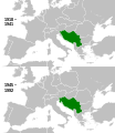
Maps of Yugoslavia and FR Yugoslavia.svg 450 × 780; 1.06 MB
-
Oblasts of the Kingdom of Serbs, Croats and Slovenes - Yugoslavia (1922-1929).png 2,364 × 2,048; 893 KB
-
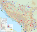
SFR Yugoslavia autoput cs.svg 1,557 × 1,205; 146 KB
-
SFR Yugoslavia autoput de.svg 1,475 × 1,136; 72 KB
-
SFR Yugoslavia autoput it.svg 1,388 × 1,072; 84 KB
-
SFR Yugoslavia autoput pl.svg 1,557 × 1,205; 146 KB
-
SFR Yugoslavia autoput sr.svg 1,557 × 1,205; 53 KB
-
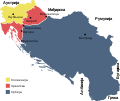
State of Slovenes, Croats and Serbs compared to 1918-1941 Yugoslavia.svg 485 × 406; 424 KB
-
Yugoslav successor states and territory (since 2019; English).png 2,364 × 2,048; 657 KB
-
Yugoslavia (1929-1939) location map.svg 1,220 × 1,057; 407 KB
-
Yugoslavia (1939–41) location map.svg 1,220 × 1,057; 407 KB
-
Yugoslavia (1946-1990) location map (red).svg 1,220 × 1,057; 431 KB
-
Yugoslavia (1946-1990) location map.svg 1,220 × 1,057; 439 KB
-
Yugoslavia 1998 ethnic map es.svg 1,734 × 1,256; 1.42 MB
-
Yugoslavia 1998 ethnic map fr.svg 1,734 × 1,256; 1.03 MB
-
Yugoslavia location map.svg 450 × 521; 762 KB
-
Yugoslavia map es.svg 595 × 431; 321 KB
-
Yugoslavia map he.svg 595 × 431; 385 KB
-
Yugoslavia map mk.svg 595 × 431; 319 KB
-
Yugoslavia map norwegian.svg 595 × 431; 315 KB
-
Yugoslavia map sr.svg 595 × 431; 316 KB
-
Yugoslavia map swedish.svg 512 × 371; 667 KB
-
Yugoslavian banovinas bg.svg 1,065 × 771; 507 KB
-
Yugoslavian banovinas mk.svg 1,065 × 771; 507 KB
-
Yugoslavian banovinas sr.svg 1,065 × 771; 480 KB
-
Yugoslavian banovinas-ES.svg 2,760 × 2,000; 801 KB
-
Yugoslavian banovinas-hu.svg 2,760 × 2,000; 408 KB
-
Yugoslavian banovinas-pt.svg 1,065 × 771; 507 KB
-
Yugoslavian banovinas.svg 1,065 × 771; 506 KB


