Category:SVG maps of World War II France
Jump to navigation
Jump to search
Subcategories
This category has only the following subcategory.
B
Media in category "SVG maps of World War II France"
The following 32 files are in this category, out of 32 total.
-
Bureaux de l'UGIF en 1942.svg 1,504 × 1,460; 672 KB
-
Carte du maquis de Saint-Mards-en-Othe.svg 3,495 × 2,452; 60 KB
-
France map Lambert 93 with regions-hu.svg 2,000 × 1,898; 897 KB
-
France map Lambert-93 topographic-demarcation line.svg 2,000 × 1,898; 1.57 MB
-
France map Lambert-93 with regions and departments-occupation He.svg 1,996 × 1,894; 921 KB
-
France map Lambert-93 with regions and departments-occupation-de.svg 2,000 × 1,898; 902 KB
-
France map Lambert-93 with regions and departments-occupation-el.svg 1,996 × 1,894; 718 KB
-
France map Lambert-93 with regions and departments-occupation-eo.svg 2,000 × 1,898; 900 KB
-
France map Lambert-93 with regions and departments-occupation-es.svg 2,000 × 1,898; 897 KB
-
France map Lambert-93 with regions and departments-occupation-fr.svg 2,000 × 1,898; 902 KB
-
France map Lambert-93 with regions and departments-occupation-hr.svg 1,996 × 1,894; 697 KB
-
France map Lambert-93 with regions and departments-occupation-it.svg 2,000 × 1,898; 881 KB
-
France map Lambert-93 with regions and departments-occupation-nl.svg 1,996 × 1,894; 693 KB
-
France map Lambert-93 with regions and departments-occupation-no.svg 1,996 × 1,894; 708 KB
-
France map Lambert-93 with regions and departments-occupation-pt.svg 1,996 × 1,894; 708 KB
-
France map Lambert-93 with regions and departments-occupation-ru.svg 2,000 × 1,898; 1.54 MB
-
France map Lambert-93 with regions and departments-occupation-sr.svg 1,996 × 1,894; 694 KB
-
France map Lambert-93 with regions and departments-occupation.svg 1,996 × 1,894; 745 KB
-
France May 1940.svg 2,000 × 1,922; 764 KB
-
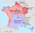
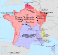
France zona libre es.svg 431 × 413; 281 KB
-
France zona libre no.svg 431 × 413; 281 KB
-
French Indochina subdivisions ww2-es.svg 667 × 1,017; 547 KB
-
French Indochina subdivisions ww2.svg 667 × 1,017; 81 KB
-
Kristian Hamon - carte actions Bezen Perrot.svg 980 × 750; 726 KB
-
Map of the Falaise Pocket.svg 628 × 939; 333 KB
-
Massacre of Oradour-sur-Glane.svg 1,467 × 987; 180 KB
-
Michel Hollard Routen in die Schweiz-hu.svg 2,000 × 1,898; 910 KB
-
Michel Hollards Routen in die Schweiz.svg 2,000 × 1,898; 908 KB
-
Military administration Belgium Northern France-fr.svg 1,560 × 1,040; 226 KB
-
Military administration Belgium Northern France-hu.svg 1,560 × 1,040; 228 KB
-
Offices of UGIF 1942.svg 1,504 × 1,460; 662 KB
-
Simplified map of occupied France 1940-1944 - grayscale-fr.svg 2,000 × 1,898; 869 KB


