Category:SVG maps of Spanish Morocco
Jump to navigation
Jump to search
Media in category "SVG maps of Spanish Morocco"
The following 30 files are in this category, out of 30 total.
-
Territorios de la Segunda República Española-variante.svg 4,950 × 7,500; 1.73 MB
-
Cabilas del Protectorado Español de Marruecos.svg 1,198 × 613; 1.34 MB
-
Chauen territory loc map.svg 1,198 × 613; 106 KB
-
Desastre de Annual.svg 1,529 × 1,205; 512 KB
-
Kert territory loc map.svg 1,198 × 613; 106 KB
-
Lucus territory loc map.svg 1,198 × 613; 106 KB
-
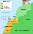
Mapa del Magreb (1956)-ast.svg 1,700 × 1,750; 556 KB
-
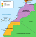
Mapa del Magreb (1956).svg 1,700 × 1,750; 573 KB
-
Mapa del Magreb (1958).svg 1,700 × 1,750; 545 KB
-
Mapa del Magreb (1959).svg 1,700 × 1,750; 553 KB
-
Maroc sans cadre.svg 406 × 388; 249 KB
-
Morocco Protectorate (rus).svg 406 × 388; 667 KB
-
Morocco Protectorate de.svg 731 × 699; 18 KB
-
Morocco Protectorate lt.svg 731 × 699; 21 KB
-
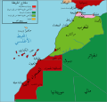
Morocco Protectorate-ar.svg 433 × 414; 943 KB
-
Morocco Protectorate-HE.svg 406 × 388; 663 KB
-
Morocco Protectorate-hu.svg 406 × 388; 708 KB
-
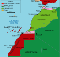
Morocco Protectorate.svg 406 × 388; 815 KB
-
Morocco-spanish-protectorate-1955-a.svg 1,198 × 613; 682 KB
-
Protectorado español en Marruecos c. 1956 (variant).svg 151 × 133; 196 KB
-
Protectorado español en Marruecos.svg 151 × 133; 196 KB
-
República del Rif.svg 1,198 × 613; 1.32 MB
-
Rif territory loc map.svg 1,198 × 613; 106 KB
-
Saharaoccidentales.svg 627 × 599; 149 KB
-
Spanisch-Marokko.svg 1,198 × 613; 470 KB
-
Spanish Morocco (1936).svg 450 × 456; 475 KB
-
Spanish Morocco blank map.svg 1,198 × 613; 106 KB
-
Territorios de la Segunda República Española.svg 4,950 × 7,500; 989 KB
-
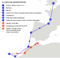
Vuelodragonrapide.svg 512 × 496; 144 KB
-
Yebala territory loc map.svg 1,198 × 613; 106 KB


