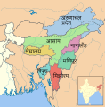
Category:SVG maps of Northeast India
Jump to navigation
Jump to search
Subcategories
This category has the following 8 subcategories, out of 8 total.
A
M
N
S
T
Media in category "SVG maps of Northeast India"
The following 19 files are in this category, out of 19 total.
-
India Panhandle.svg 24 × 17; 8 KB
-
India-locator-map-NE.svg 1,486 × 1,734; 447 KB
-
Land boundary agreement map2-hu.svg 484 × 657; 522 KB
-
Land boundary agreement map2.svg 484 × 657; 504 KB
-
North East India.svg 612 × 696; 174 KB
-
Northeast India.svg 1,574 × 1,792; 274 KB
-
NortheastIndia.svg 744 × 1,052; 7.49 MB
-
SevenSisterStates-bh.svg 606 × 615; 1.05 MB
-
SevenSisterStates-gu.svg 606 × 615; 1 MB
-
SevenSisterStates-hi.svg 606 × 615; 1.05 MB
-
SevenSisterStates-kn.svg 606 × 615; 1.05 MB
-
SevenSisterStates-ml.svg 606 × 615; 1.05 MB
-
SevenSisterStates-mr.svg 606 × 615; 1.05 MB
-
SevenSisterStates-ne.svg 606 × 615; 1.05 MB
-
SevenSisterStates-pa.svg 606 × 615; 1.05 MB
-
SevenSisterStates-te.svg 606 × 615; 1.05 MB
-
SevenSisterStates.svg 606 × 615; 1 MB
-
সাত বোন রাজ্য.svg 606 × 615; 1.52 MB
-
স্থল সীমান্ত চুক্তির মানচিত্র ২.svg 484 × 657; 888 KB


