Category:SVG maps of Nigeria
Jump to navigation
Jump to search
Subcategories
This category has the following 5 subcategories, out of 5 total.
Media in category "SVG maps of Nigeria"
The following 40 files are in this category, out of 40 total.
-
 2019 Nigerian House of Representatives election, seat change.svg 512 × 341; 1.85 MB
-
 2019 Nigerian House of Representatives election, vote share.svg 512 × 341; 1.94 MB
-
 2019 Nigerian Senate election, vote share.svg 512 × 410; 516 KB
-
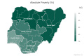
 Absolute poverty by state in Nigeria.svg 600 × 400; 110 KB
-
 Absolute poverty by zone in Nigeria.svg 600 × 400; 94 KB
-
 Abuja Rail Mass Transit.svg 730 × 552; 163 KB
-
 Cross River National Park-pt.svg 369 × 484; 205 KB
-
 Cross River National Park.svg 384 × 514; 209 KB
-
 Cross River Okwangwo-pt.svg 543 × 412; 33 KB
-
 Cross River Okwangwo.svg 543 × 412; 31 KB
-
 Dispersal of the Benue-Congo languages.svg 427 × 330; 445 KB
-
 Dollar per day poverty by state in Nigeria.svg 600 × 400; 110 KB
-
 Dollar per day poverty by zone in Nigeria.svg 600 × 400; 95 KB
-
 Executive control of Nigerian states 01.svg 600 × 400; 110 KB
-
 FCT-Nigeria area councils.svg 1,500 × 1,500; 13 KB
-
 Female literacy rate in Nigeria by state in 2013.svg 954 × 734; 413 KB
-
 Food poverty by state in Nigeria.svg 600 × 400; 110 KB
-
 Food poverty by zone in Nigeria.svg 600 × 400; 94 KB
-
 Geopolitical Zones of Nigeria.svg 954 × 734; 114 KB
-
 Koppen-Geiger Map NGA future.svg 1,265 × 850; 1.17 MB
-
 Koppen-Geiger Map NGA present-ar.svg 1,430 × 850; 1.45 MB
-
 Koppen-Geiger Map NGA present.svg 1,430 × 850; 1.18 MB
-
 Legislative control of Nigerian states.svg 600 × 400; 110 KB
-
 Map of Nigeria's 109 Senatorial districts showing party control.svg 600 × 400; 2.62 MB
-
 Map of Nigeria's 109 Senatorial districts.svg 512 × 410; 426 KB
-
 Map of Wilayah Gharib Ifriqiyah.svg 2,973 × 2,596; 363 KB
-
 Nigeria - Location Map (2013) - NGA - UNOCHA-pt.svg 254 × 254; 325 KB
-
 Nigeria - Location Map (2013) - NGA - UNOCHA.svg 254 × 254; 375 KB
-
 Nigeria blank map.svg 954 × 734; 114 KB
-
 Nigeria location map.svg 954 × 734; 442 KB
-
 Nigeria Primary School Enrolment by state in 2013.svg 954 × 734; 413 KB
-
 Nigerian National Parks-pt.svg 983 × 743; 147 KB
-
 Nigerian National Parks.svg 983 × 743; 148 KB
-
 Nigerian States 2018 HDI.svg 512 × 410; 59 KB
-
 North East region of Nigeria.svg 954 × 734; 291 KB
-
 Political map of Nigeria.svg 919 × 703; 5.19 MB
-
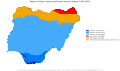
 Relative poverty by state in Nigeria.svg 600 × 400; 110 KB
-
 Relative poverty by zone in Nigeria.svg 600 × 400; 94 KB
-
 Roman Catholic Diocese of Issele-Uku, Nigeria.svg 744 × 1,052; 1.06 MB
-
 SVG-Koort Nigeria.svg 700 × 500; 67 KB


_-_NGA_-_UNOCHA-pt.svg)
_-_NGA_-_UNOCHA.svg)


