Category:SVG maps of Kalimantan
Jump to navigation
Jump to search
| NO WIKIDATA ID FOUND! Search for SVG maps of Kalimantan on Wikidata | |
| Upload media |
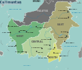
May only include maps that focus on the island of Kalimantan. If other major islands of Indonesia are visible, use other categories, such as Category:SVG maps of western Indonesia / Category:SVG maps of eastern Indonesia. If showing the location of Kalimantan in relation with Indonesia, use Category:SVG locator maps of Kalimantan. If not showing the whole of Kalimantan, use the province level category(/categories).
Subcategories
This category has the following 6 subcategories, out of 6 total.
- SVG maps of East Kalimantan (17 F)
- SVG maps of North Kalimantan (12 F)
- SVG maps of South Kalimantan (20 F)
- SVG maps of West Kalimantan (18 F)
*
Media in category "SVG maps of Kalimantan"
The following 12 files are in this category, out of 12 total.
-
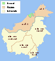
Administrative map of Borneo.svg 1,063 × 1,183; 167 KB
-
Borneo blank map.svg 521 × 580; 238 KB
-
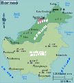
Borneo map.svg 1,063 × 1,183; 687 KB
-
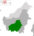
Indonesia Central Kalimantan location.svg 767 × 808; 837 KB
-
Indonesia East Kalimantan location.svg 767 × 808; 834 KB
-
Indonesia Kalimantan location map.svg 1,087 × 926; 368 KB
-
Indonesia North Kalimantan location.svg 767 × 808; 825 KB
-
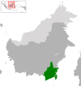
Indonesia South Kalimantan location.svg 767 × 808; 826 KB
-
Indonesia West Kalimantan location.svg 767 × 808; 832 KB
-
Kalimantan.svg 1,087 × 926; 520 KB
-
KalimantanRTPO.svg 473 × 460; 187 KB
-
Map of Banjar Sultanate under Sultan Sulaiman.png 1,600 × 1,310; 424 KB

