
Category:SVG maps of Ireland
Subcategories
This category has the following 6 subcategories, out of 6 total.
*
L
T
Media in category "SVG maps of Ireland"
The following 116 files are in this category, out of 116 total.
-
 Blank Ireland.svg 908 × 1,159; 81 KB
-
 Blankireland.svg 908 × 1,160; 27 KB
-
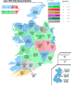
 1923 Irish general election.svg 1,000 × 1,200; 4.17 MB
-
 1932 Irish general election.svg 1,000 × 1,200; 4.17 MB
-
 1933 Irish general election.svg 1,000 × 1,200; 4.16 MB
-
 1981 Irish general election, seats per constituency.svg 512 × 512; 3.8 MB
-
 1981 Irish general election.svg 512 × 512; 727 KB
-
 1987 Irish general election, seats per constituency.svg 512 × 341; 3.82 MB
-
 1987 Irish general election.svg 512 × 512; 696 KB
-
 1989 Irish general election, seats per constituency.svg 512 × 341; 3.83 MB
-
 1989 Irish general election.svg 512 × 512; 665 KB
-
 1992 Irish general election, seats per constituency.svg 512 × 341; 3.81 MB
-
 1992 Irish general election.svg 512 × 512; 660 KB
-
 1997 Irish general election, seats per constituency.svg 512 × 341; 4.06 MB
-
 1997 Irish general election.svg 512 × 512; 703 KB
-
 2002 Irish general election, seats per constituency.svg 512 × 341; 4.13 MB
-
 2002 Irish general election.svg 512 × 512; 713 KB
-
 2007 Irish general election, seats per constituency.svg 512 × 341; 4.48 MB
-
 2007 Irish general election.svg 512 × 512; 783 KB
-
 2011 Irish general election, seats per constituency.svg 512 × 341; 4.48 MB
-
 2011 Irish general election.svg 512 × 512; 777 KB
-
 2016 Irish general election, seats per constituency.svg 512 × 341; 4.19 MB
-
 2016 Irish general election.svg 512 × 512; 731 KB
-
 2020 Irish general election, delegations composition.svg 512 × 512; 777 KB
-
 2020 Irish general election, seats per constituency.svg 512 × 512; 6.54 MB
-
 2020 Irish general election.svg 512 × 512; 755 KB
-
 2024 Irish general election, seats per constituency.svg 512 × 512; 9.31 MB
-
 2024 Irish general election.svg 512 × 512; 1.42 MB
-
 Airgialla-900.svg 633 × 825; 686 KB
-
 Blank Ireland OpenStreetMap.svg 235 × 303; 4 MB
-
 British Isles map showing UK, Republic of Ireland, and historic counties.svg 1,250 × 1,835; 1,024 KB
-
 British–European Union frontier in Ireland.svg 1,450 × 1,807; 681 KB
-
 Capitales iles britanniques et Irlande du Nord.svg 1,343 × 1,587; 650 KB
-
 Capitals de les Illes Birtàniques i d'Irlanda del Nord.svg 1,343 × 1,587; 681 KB
-
 Celtic countries.svg 547 × 979; 242 KB
-
 Clew Bay.svg 1,927 × 2,271; 148 KB
-
 Counties of Ireland.svg 1,450 × 1,807; 697 KB
-
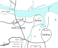 Dublin900.svg 3,526 × 2,906; 246 KB
-
 Dáilcheantair 2020.svg 638 × 529; 976 KB
-
 Ei-map (Lithuanian).svg 649 × 754; 214 KB
-
 Ei-map He.svg 652 × 756; 210 KB
-
 Ei-map rus.svg 652 × 756; 105 KB
-
 Ei-map sr.svg 652 × 756; 101 KB
-
 Ei-map-fr.svg 652 × 756; 102 KB
-
 Ei-map-ga.svg 652 × 756; 122 KB
-
 Ei-map-it.svg 652 × 756; 109 KB
-
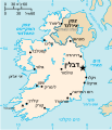
 Ei-map.svg 652 × 756; 115 KB
-
 European Union internal frontier in Ireland (pre-Brexit).svg 1,450 × 1,807; 683 KB
-
 February 1982 Irish general election, seats per constituency.svg 512 × 512; 2.92 MB
-
 February 1982 Irish general election.svg 512 × 512; 692 KB
-
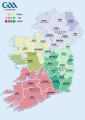 Gaelic Games County Map.svg 744 × 1,052; 1.08 MB
-
 Gaeltacht.svg 906 × 1,163; 72 KB
-
 InishtrahullRevised.svg 1,490 × 1,470; 131 KB
-
 Inner Irish Border.svg 2,200 × 2,800; 204 KB
-
 Ireland complete-mk.svg 800 × 1,000; 645 KB
-
 Ireland complete.svg 800 × 1,000; 581 KB
-
 Ireland Constituency Map 2016.svg 1,257 × 1,000; 612 KB
-
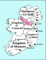
 Ireland early peoples and politics.svg 908 × 1,160; 44 KB
-
 Ireland medieval location map-es.svg 1,450 × 1,807; 667 KB
-
 Ireland medieval location map.svg 1,450 × 1,807; 666 KB
-
 Ireland regions.svg 2,450 × 3,000; 3.68 MB
-
 Ireland smaller.svg 21 × 26; 65 KB
-
 Ireland stub, noflag.svg 563 × 800; 67 KB
-
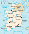
 Ireland transport map.svg 1,450 × 1,807; 720 KB
-
 Ireland-Dublin-European-Parliament-Constituency-1979-2004.svg 710 × 910; 81 KB
-
 Ireland-Dublin-European-Parliament-Constituency-2019.svg 710 × 910; 74 KB
-
 Ireland-East-European-Parliament-Constituency-2004-2009.svg 710 × 910; 80 KB
-
 Ireland-European-Parliament-Constituencies-1979-2004.svg 710 × 910; 84 KB
-
 Ireland-European-Parliament-Constituencies-2004-2009.svg 710 × 910; 82 KB
-
 Ireland-European-Parliament-Constituencies-2014-2019.svg 740 × 910; 62 KB
-
 Ireland-European-Parliament-Constituencies-2019.svg 728 × 910; 75 KB
-
 Ireland-Leinster-European-Parliament-Constituency-1979-2004.svg 710 × 910; 82 KB
-
-
 Ireland-Munster-European-Parliament-Constituency-1979-2004.svg 710 × 910; 81 KB
-
 Ireland-North-West-European-Parliament-Constituency-2004-2009.svg 710 × 910; 80 KB
-
 Ireland-outline-detailed.svg 1,213 × 1,507; 118 KB
-
 Ireland-South-European-Parliament-Constituency-2004-2009.svg 710 × 910; 80 KB
-
 Ireland-South-European-Parliament-Constituency-2019.svg 710 × 910; 74 KB
-
 Ireland.svg 2,200 × 2,800; 204 KB
-
 Ireland900.svg 633 × 825; 1,009 KB
-
 IrelandUlster.svg 200 × 250; 520 KB
-
 Irlande.svg 580 × 720; 74 KB
-
 Island of Ireland location map.svg 1,450 × 1,807; 1.96 MB
-
 Island of Ireland.svg 675 × 1,180; 168 KB
-
 ITM map of Ireland.svg 548 × 684; 162 KB
-
 June 1927 Irish general election.svg 1,000 × 1,200; 4.17 MB
-
 Kingdom of Breifne-900.svg 633 × 825; 687 KB
-
 Kingdom of Connacht-900.svg 633 × 825; 701 KB
-
 Kingdom of Leinster-900.svg 633 × 825; 691 KB
-
 Kingdom of Mide-900-nb.svg 633 × 824; 538 KB
-
 Kingdom of Mide-900.svg 633 × 824; 542 KB
-
 Kingdom of Munster-900-ar.svg 633 × 825; 666 KB
-
 Kingdom of Munster-900.svg 633 × 825; 707 KB
-
 Kingdom of Osraige-900.svg 633 × 825; 685 KB
-
 Map of Celtic Nations (alternate).svg 675 × 1,300; 90 KB
-
 Map of Celtic Nations.svg 675 × 1,300; 97 KB
-
 Map of Ireland's capitals zh-hant.svg 2,200 × 2,800; 134 KB
-
 November 1982 Irish general election, seats per constituency.svg 512 × 512; 2.55 MB
-
 November 1982 Irish general election.svg 512 × 512; 682 KB
-
 Population density of Ireland map2002 RU.svg 800 × 1,000; 507 KB
-
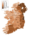 Population density of Ireland map2002.svg 800 × 1,000; 621 KB
-
 Provinces d'Irlande sans noms.svg 800 × 1,000; 23 KB
-
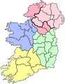 Provinces of Ireland (light colors) simple.svg 280 × 361; 58 KB
-
 Provinces of Ireland location map.svg 1,450 × 1,807; 1.95 MB
-

-
 Republic of Ireland without counties.svg 2,200 × 2,800; 236 KB
-
 ROI and NI counties (SVG).svg 512 × 638; 220 KB
-
 Ríocht Uí Failge.svg 984 × 696; 1.3 MB
-
 September 1927 Irish general election.svg 1,000 × 1,200; 4.16 MB
-
 Skellig Michael monastery map-fr.svg 975 × 1,125; 207 KB
-
 Tectonic map of Ireland-IT.svg 1,450 × 1,807; 1.21 MB
-
 Tectonic map of Ireland.svg 1,450 × 1,807; 1.21 MB
-
 The Kingdom of Uí Failge.svg 984 × 696; 1.3 MB
-
 Tory Island OpenStreetMaps.svg 2,963 × 1,958; 3.13 MB
-
 Tutorial mapas 1.svg 280 × 361; 21 KB
-
 Ulster locator map.svg 1,450 × 1,807; 699 KB


.svg)


.svg)


.svg)


_simple.svg)


.svg)


