Category:SVG maps of Equatorial Guinea
Jump to navigation
Jump to search
Subcategories
This category has the following 4 subcategories, out of 4 total.
Media in category "SVG maps of Equatorial Guinea"
The following 6 files are in this category, out of 6 total.
-
 Corsico Bay with borders (labelled).svg 743 × 574; 180 KB
-
 Equatorial Guinea adm location map.svg 1,091 × 1,042; 117 KB
-
 Equatorial Guinea Dystrykt Baney map.svg 340 × 259; 12 KB
-
 Equatorial Guinea Dystrykt Malabo map.svg 340 × 259; 12 KB
-
 Prowincja Bioko Północne adm.svg 340 × 259; 14 KB
-
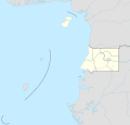
 SVG-Koort Äquatorialguinea.svg 400 × 350; 21 KB
.svg)


