Category:SVG maps of Central America
Jump to navigation
Jump to search
Subcategories
This category has the following 8 subcategories, out of 8 total.
+
C
G
H
N
P
Media in category "SVG maps of Central America"
The following 50 files are in this category, out of 50 total.
-
 Age of consent - Central America.svg 512 × 419; 10 KB
-
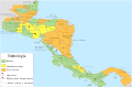
 America Central-color.svg 1,041 × 739; 78 KB
-
 Centroamerica prehispanica siglo XVI.svg 250,980 × 165,770; 499 KB
-
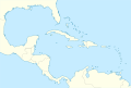
 Caribbean location map.svg 3,690 × 2,323; 1.02 MB
-
 Caribbean maritime boundaries map zh.svg 3,561 × 2,221; 2.87 MB
-
 Caribbean maritime boundaries map.svg 3,561 × 2,221; 2.78 MB
-
 Caribbean maritime boundaries map mk.svg 3,561 × 2,221; 5.52 MB
-
 Mapa das Caraíbas (fronteiras marítimas).svg 3,561 × 2,221; 2.86 MB
-
 Mapa del Caribe (límites marinos).svg 5,340 × 3,660; 3.02 MB
-
 Mapa del Mar Caribe (límites marinos)-fr.svg 3,587 × 2,221; 1.91 MB
-
 Mapa del Mar Caribe (límites marinos).svg 3,587 × 2,221; 1.98 MB
-
 Caxcania map.svg 1,139 × 703; 159 KB
-
 Central America (configurable orthographic projection).svg 600 × 600; 519 KB
-
 Central America (orthographic projection) blank.svg 550 × 550; 47 KB
-
 Central America (orthographic projection).svg 550 × 550; 354 KB
-
 Central America-4 Border Control Agreement map.svg 300 × 300; 1.11 MB
-
 Central American Integration System.svg 940 × 477; 272 KB
-
 CentralAmericaCountriesHe.svg 423 × 330; 171 KB
-
 CentralAmericaLocatio1n.svg 559 × 543; 173 KB
-
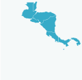
 CentralAmericaLocation.svg 559 × 543; 545 KB
-
 Centroamérica y el Caribe en Wikiviajes.svg 497 × 286; 1,016 KB
-
 Eublaberus-posticus-range.svg 1,725 × 1,239; 1.17 MB
-
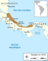
 European Union San Jose dialogue Locator.svg 638 × 328; 1.5 MB
-
 Extended Central America.svg 150 × 105; 97 KB
-
 Federal Republic of Central America location map (Costa Rica).svg 2,400 × 1,900; 1.24 MB
-
 Federal Republic of Central America location map (El Salvador and Federal District).svg 2,400 × 1,900; 1.24 MB
-
 Federal Republic of Central America location map (El Salvador).svg 2,400 × 1,900; 1.24 MB
-
 Federal Republic of Central America location map (Federal District).svg 2,400 × 1,900; 1.24 MB
-
 Federal Republic of Central America location map (Guatemala and Belize).svg 2,400 × 1,900; 1.24 MB
-
 Federal Republic of Central America location map (Guatemala).svg 2,400 × 1,900; 1.24 MB
-
 Federal Republic of Central America location map (Honduras and the Mosquito Coast).svg 2,400 × 1,900; 1.24 MB
-
 Federal Republic of Central America location map (Honduras).svg 2,400 × 1,900; 1.24 MB
-
 Federal Republic of Central America location map (Nicaragua and the Mosquito Coast).svg 2,400 × 1,900; 1.24 MB
-
 Federal Republic of Central America location map (Nicaragua).svg 2,400 × 1,900; 1.24 MB
-
 Federal Republic of Central America location map.svg 2,400 × 1,900; 1.24 MB
-
 Lenguas nativas americanas en Centroamérica.svg 512 × 400; 351 KB
-
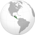
 LocationCentralAmerica.svg 1,000 × 500; 2.76 MB
-
 LocationSICA.svg 1,000 × 500; 768 KB
-
 Map Bastimentos PortoBello Panama.svg 744 × 422; 544 KB
-
 Map of Central America and Mexico.svg 2,914 × 1,976; 2.57 MB
-
 Map WestIndies SpanishTreasureRoutes 1726.svg 737 × 411; 3.39 MB
-
 Mapa america central caribe.svg 1,172 × 707; 284 KB
-
 Mapa del Mar de Balboa (límites marinos).svg 2,177 × 2,006; 530 KB
-
 Mapa Mesoamérica Aridoamérica Oasisamérica.svg 1,024 × 768; 201 KB
-
 Mayapan 1200.svg 1,800 × 1,500; 496 KB
-
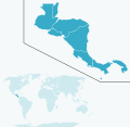
 Middle America location map.svg 1,053 × 707; 179 KB
-
 Phyllobates lugubris map-fr.svg 600 × 750; 980 KB
-
 Phyllobates map-fr.svg 793 × 802; 1,010 KB
-
 Phyllobates vittatus map-fr.svg 600 × 750; 973 KB
-
 Provincias tributarias de la Triple Alianza (s. XVI).svg 949 × 731; 858 KB


.svg)
.svg)
-fr.svg)
.svg)

.svg)
.svg)


.svg)
.svg)
.svg)
.svg)
.svg)
.svg)
.svg)
.svg)
.svg)
.svg)


.svg)


.svg)
_blank.svg)