Category:SVG maps of Algeria
Jump to navigation
Jump to search
Subcategories
This category has the following 10 subcategories, out of 10 total.
*
C
D
T
Media in category "SVG maps of Algeria"
The following 18 files are in this category, out of 18 total.
-
Aires linguistiques du nord-est algérien AR.svg 1,461 × 881; 114 KB
-
Algeria alternative.svg 286 × 298; 60 KB
-
Algeria Oran Area Wilayas.png 2,000 × 1,969; 478 KB
-
Algeria regions map.svg 575 × 587; 1.68 MB
-
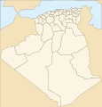
Algeria Wilayas-blank 2020.svg 508 × 500; 75 KB
-
Algeria Wilayas-blank.svg 508 × 500; 70 KB
-
Algeria-Military-Region.svg 2,105 × 1,488; 55 KB
-
Camps de réfugiés Tindouf.svg 703 × 589; 76 KB
-
COVID-19 Outbreak Cases in Algeria.svg 4,853 × 4,739; 58 KB
-
COVID-19 Pandemic Deaths in Algeria.svg 4,853 × 4,739; 58 KB
-
Ghardaïa territory 1934-1955 map-fr.svg 1,287 × 1,278; 1.79 MB
-
Mapa da Argélia (OCHA).svg 254 × 254; 403 KB
-
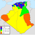
Population growth rate Algeria 2008.svg 508 × 500; 73 KB
-
Population map of Algeria in 2008.svg 508 × 500; 76 KB
-
اللغات المنطوقة في الشمال الشرقي الجزائري.svg 1,461 × 881; 114 KB
-
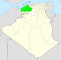
الهضاب العليا.svg 1,000 × 1,001; 64 KB


